Agua Negra (Upper)
Jump to navigation
Jump to search
Also known as: Canyon de Agua Negra.
| Rating: | ||||||||||||||||
|---|---|---|---|---|---|---|---|---|---|---|---|---|---|---|---|---|
|
| ||||||||||||||||
| | Difficulty:4B III (v4a2 III) Raps:max ↨213ft
Red Tape: Shuttle:Required | |||||||||||||||
| Location: | ||||||||||||||||
| Condition Reports: | ||||||||||||||||
| Best season: | ||||||||||||||||
| Regions: | ||||||||||||||||
_Banner.jpg)
GPS data automatically extracted from descente-canyon.com, please visit their site for more detailed information.
Introduction
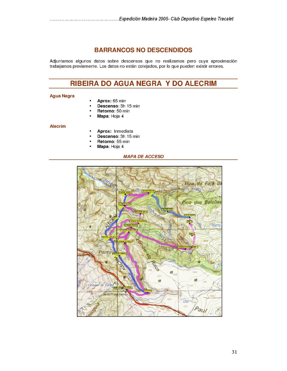
Approach
Descent
Exit
Red tape
Beta sites
 Descente-Canyon.com : Agua Negra (supérieur)
Trip reports and media
 Wikiloc.com : Track Acceso aguas negras sup