Arzino 0
| Rating: | |||||||||||||||||||||||||||||||
|---|---|---|---|---|---|---|---|---|---|---|---|---|---|---|---|---|---|---|---|---|---|---|---|---|---|---|---|---|---|---|---|
| | Raps:max ↨92ft
Red Tape: Shuttle:None | ||||||||||||||||||||||||||||||
| Location: | |||||||||||||||||||||||||||||||
| Condition Reports: | |||||||||||||||||||||||||||||||
| Best season: | Aug - Nov;AVOID in After
|
||||||||||||||||||||||||||||||
| Regions: | |||||||||||||||||||||||||||||||
Introduction[edit]
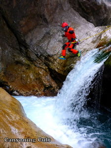
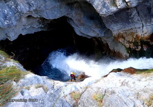
Arzino 0 is a short but intensive canyon with a large amount of water throughout the whole year, located in the Val d'Arzino. In this canyon you can find some really nice but difficult rappels, delicate jumps, deep green pools, some swimming passages with a strong current. The canyon is very technical but with proper water flow it provides a lot of satisfaction and intense feelings. River Arzino is very well known for its beautiful emerald color and it is probably the most beautiful river in Friuli region. The canyon is named Arzino 0, because this river has already 4 canyons in its lower reaches, named Arzino 1,2,3 and 4 which are more suitable for whitewater kayaks.
Canyon is not suitable for
beginners!
Zone: Italy – Friuli – Val d'Arzino
Dimensions: Entrance: 570 m Exit: 460 m Height: 110 m Length: 900 m
Period August - November (Avoid it after rain.)
Times: Approach: 10 min (with 1 car or 1 min with 2 cars) Progression: 1,5 - 2 h Return: 15 min (with 1 car or 5 min with 2 cars)
Shuttle: No (Shuttle is not necessary)
Equipment: Expedition (with 10mm bolts with maillons and slings)
Rope: 1 x 50m
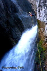
Highest waterfall: 23 m
Possible exit Yes (many, on the left side)
Maps: Carta Tabacco 13
Attraction: Regional
Difficulty: V5 a5-a6 II
Approach[edit]
From Tolmezzo (near Centro sportivo) take the road to Verzegnis and Chialcis, cross the bridge over Tagliamento river and drive to village Chialcis. In Chialcis take the road to Sella Chianzuran, cross the saddle and drive downhill into Val d'Arzino. On your right you will see the turning (sign) for Pozzis, drive onward through 2 very sharp bends and approximately 500 meters further on you will arrive at a small parking lot on the right side. On the left side there is a very small chapel and iron cross. From the direction of Udine is better to use the road to Spilimbergo – Flagogna – Sequalins – San Francesco.
Checkpoint: The checkpoint is on the entrance of the canyon or 70 m lower from the small metal bridge, which is accessible from the large parking before the sharp road bend.
Do not enter the canyon, if the water flow is higher than 0.5m on the webpage:
Protezione Civile.fvg.it, better is 0.4m.
From the parking lot follow the road uphill to the first sharp bend. On the left side of this bend take the sand (dirt) road which leads to the bridge over the Arzino (20 m from the main road). Here is the entrance for the canyon.
Descent[edit]
C 3m: 1 bolt with maillon (R) D 1.5m: (L) - exposed
MC 1m : 1 bolt (L) – hard to reach
C 11m: 1 bolt with maillon (L) – into the flow
T 1.5m
T 3m: On the right side of the flow into the very turbulent pool (white water), it is advisable to secure the first canyoneer down with rope.
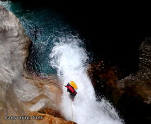
C 18m: 1 bolt with maillon (L) – Don't jump into the first pool on the right (no exit), the rappeling point (bolt) is far on the left on a small rock covered with grass (it is very difficult to find). On the bottom of the fall you need to cross the stream to the right side (on the rope).
J 1,5m: (turbulent pool)
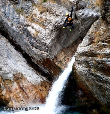
J 10m: Down climb 1 meter (exposed) and jump to the middle of the pool in white water (pool is not very deep). (L)
C 23m: sling with maillon on tree (L) – It is difficult to reach but the rappel is out of the water.
T 1m
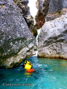
D+W+j 400m: easy
Swim 30m
Exit[edit]
After the last swimming passage you will see remnants of the old concrete coverage (old dam) and a little gully in the wood on the left side (50 m. before the dam). Climb on this gully 20 meters and you will reach a good path which leads uphill to the parking lot.
Red tape[edit]
Beta sites[edit]
 Canyon.Carto.net : Arzino %220%22
Trip reports and media[edit]
Background[edit]
First descent by Hannes Holzer and Gerhard Berger on 23 th of August 2015. First repetition: Canyoning Cult on 8 th of January 2016
