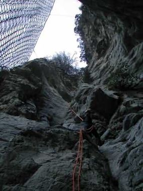
Bataillere
Jump to navigation
Jump to search
Also known as: Vallon de Bataillère; Vallon de Bataillere.
| Rating: | |||||||||||||||||||||||||||||||
|---|---|---|---|---|---|---|---|---|---|---|---|---|---|---|---|---|---|---|---|---|---|---|---|---|---|---|---|---|---|---|---|
| | Difficulty:3A II (v3a1 II) Raps:max ↨98ft
Red Tape:Permit required Shuttle:None Rock type:Limestone | ||||||||||||||||||||||||||||||
| Location: | |||||||||||||||||||||||||||||||
| Condition Reports: | |||||||||||||||||||||||||||||||
| Best season: | Autumn;Winter
|
||||||||||||||||||||||||||||||
| Regions: | |||||||||||||||||||||||||||||||
GPS data automatically extracted from descente-canyon.com, please visit their site for more detailed information.
Introduction[edit]
Village plus proche: Plan du Var
Hauteur du rappel plus long: 30 m
Information sur le débit: Canyon sec ( sauf après une periode de très fortes pluies)
Cordes: 2 X 30 m + corde de secours
Combinaison néoprène: Non
Matériel d'installation: Il est conseillé de porter du matériel d’installation de remplacement
Période conseillée: Toute l’année
Temps d'approche: 50 m
Temps de parcours: 3h30m
Temps de retour: 2 m
Zone ou massif: VALLEE DE LA TINEE
Longueur: 1.500 m
Dénivelle: 360 m
Espèces menacées: Dans tous les habitats vivent des animaux et des plantes qui devons respecter
Approach[edit]
Navette voiture: Oui
Parking aval: environ 4 km après Plan du Var, sur la N202, et juste avant deux petits tunnels ( filet de protection) se garer à droite. Le canyon arrive entre les deux tunnels Parking amont : continuer sur quelques centaines de mètres et se garer à la balise 106 ( même parking que pour le canyon de La Balma), prendre le sentier qui monte jusqu’au hameau de Reveston. A la balise 107 prendre à droite, passer par des ruines. Un peu plus loin le sentier coupe le lit du canyon sec. Point de départ.
Descent[edit]
Succession de rappels sans problème ou tout se passse à la fin
Exit[edit]
Après le dernier rappel passer sous la N 202 et remonter sur la route ou on retrouve la voiture.
Red tape[edit]
Beta sites[edit]
 Descente-Canyon.com : Bataillère
 Barranquismo.net : Bataillere
