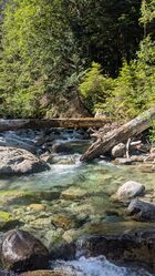
Bear Creek (NF Skykomish River)
| Rating: | |||||||||||||||||||||||||||||||
|---|---|---|---|---|---|---|---|---|---|---|---|---|---|---|---|---|---|---|---|---|---|---|---|---|---|---|---|---|---|---|---|
| | Raps:7, max ↨80ft
Red Tape: Shuttle: | ||||||||||||||||||||||||||||||
| Start: | |||||||||||||||||||||||||||||||
| Parking: | |||||||||||||||||||||||||||||||
| Condition Reports: | 5 Oct 2025
"Great day. The water was quite cold, but otherwise a lovely sunny day. The webbing on R7 is frayed, we didnt use it and rapped from another log inste |
||||||||||||||||||||||||||||||
| Best season: | Aug-Sept
|
||||||||||||||||||||||||||||||
| Regions: | |||||||||||||||||||||||||||||||
Introduction[edit]
Bear Creek is a charming canyon off of the North Fork Skykomish River. The canyon features shimmering blue pools and some optional jump platforms to scramble to for those who want to add a bit more excitement to their day. The day starts and ends at the beautiful Bear Creek Falls (ironically not on Bear Creek at all, at the confluence with the Skykomish Rver). The falls is a unique geologic feature of its own. If you time your trip right in mid to late September, you may see salmon swimming up the falls!
Bear Creek is split into an upper and lower section by an easy 0.6 mile creek walk. While the creek itself is not very narrow, the walls of the canyon are quite steep, and escape from the canyon above the lower section would be difficult.
Approach[edit]
Getting There
The Index-Galena Rd was re-opened in November, 2023. The drive is paved the entire way. From Monroe drive east on Route 2 for 20 miles. Turn left onto Index-Galena Road and drive for 11 miles. Park at a small pull out on the right with an obvious trail leading down to Bear Creek Falls. A MAXIMUM OF 3 VEHICLES CAN FIT IN THIS PARKING AREA. There are no other pull outs for quite a distance.
Approach
The off trail approach is about 1.1 miles total and takes an average of 1.5-2hrs.
From the road, find a use trail down to Bear Creek Falls. If you have time, it’s worth taking a few minutes to drop your packs and scramble over the polished rock above the falls to have a look at the unique canyon and plunge pools that the river flows through.
Cross the river in the shallow gravels below the falls to the Bear Creek confluence. The river is typically no more than knee deep. Cross Bear Creek and begin bushwhacking up the east side of the creek, topping out onto flatter ground after 10-15 minutes. From here, wind your way around the many fallen logs and trees through mostly open forest for about 1 hour, paralleling the creek and getting the occasional glimpse of the canyon below. A few hundred yards before the drop-in, there is a vine maple thicket that must be pushed through, although it is relatively short. Once through the thicket, you will reach 2,000 feet elevation briefly before traversing down the hillside towards the creek to the drop-in. There is an easy walk in.
Descent[edit]
Special Notes
DCL = Down Canyon Left
DCR = Down Canyon Right
Check all pools for depth/hazards prior to jumping!
Please do not add webbing to unlinked bolts. Debris can catch on these anchors during flood events and damage the anchor and/or the rock. Groups should be familiar with safe rigging for unlinked anchors.
Upper Section
The upper section is made up of 3 back to back rappels.
R1: 40’ from unlinked bolts DCL into a pool. There is a flake on the bottom of the pool the rope can get stuck on. To avoid the rope getting stuck pull it across the pool before it sinks to the bottom. This drop has been jumped from a ledge about 15’ from the anchor.
R2: 35’ from unlinked bolts DCR. After this rappel, traverse behind the falls or on the ledge on the downstream side and scramble over canyon left to access the R3 anchor.
R3: 80’ from unlinked bolts DCL. THIS IS THE HIGHLIGHT PF THE CANYON. This rappel is mostly in the flow and is very slippery. As of 2023 one of the bolts here had sustained impact damage from rockfall, but still seemed strong and was not loose. The pool below R3 is very deep! This pool has been jumped by scrambling up the rock DCR of the pool and jumping from a ledge.
Creekwalk: 0.6mi, approximately 30-45 minutes, a pleasant open creek not terribly slippery
Lower Section
R4: 25’ from a single bolt DCL. You must swim across a deep pool to access this anchor. Space is limited to two people.
After R4, you’ll immediately come to a logjam 25’ above a pool. To access R5, scramble up DCR over the mossy rockface and around back towards the falls and look for the single bolt in the rock just over the edge.
R5a: 80’ from a single bolt DCR. This is a dry rappel that goes into a brief overhang. R5b: 70' from bolts, in the flow. To access the R5b anchor, rappel 10' from R5a to the lip of the falls.
R6: 70’ from unlinked bolts DCL. The bottom section of this rappel cannot be seen from the anchor.
R7: 10’ nuisance rappel from a logjam, or downclimb in the crack center right to a boulder you can stand upon. Once the first person is down, easy to partner assist from below. BEWARE THE ENTIRE AREA IS ON A FALSE FLOOR.
Exit[edit]
Hike/swim the last few hundred feet to confluence with the NF Skykomish River. If you have time, it’s fun to check out Bear Creek Falls while still in your wetsuits, and do some jumps into the deep pool below.
Red tape[edit]
Beta sites[edit]
The falls along this creek have been given a variety of names:
- Medved Falls
- Karhut Falls
- Spire Mountain Falls
- Ursa Falls
Trip reports and media[edit]
Background[edit]
This canyon was first descended on 9/25/2021 by Jake Huddleston, Madeline Hwang, Joe Cruikshank, Tiffanie Lin, Haruka-James Clay Lipscomb, Kevin Steffa, Michelle Nilles, and Michael Peterson.


