Boulder Creek (Three Sisters)
| Rating: | ||||||||||||
|---|---|---|---|---|---|---|---|---|---|---|---|---|
| | Difficulty:3B II (v3a2 II) Raps:5, max ↨200ft
Red Tape:Permit required Shuttle:None | |||||||||||
| Location: | ||||||||||||
| Condition Reports: | ||||||||||||
| Best season: | ||||||||||||
| Regions: | ||||||||||||
Introduction[edit]
Boulder Creek is the name of the water course that contains the Three Sisters waterfalls, also labeled Devils Punch Bowl on the topographic map. When flowing strong, this is an excellent canyon that can be descended top-down from Devils Punch Bowl and exited through the Three Sisters waterfalls access trail. All the drops are bypassable, albeit with some exposure, so it makes for a good beginner canyon that will also prove to be fun for experts.
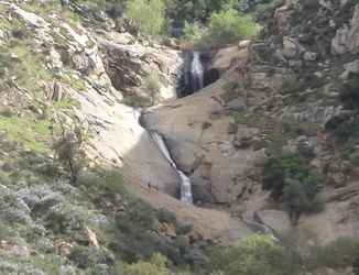
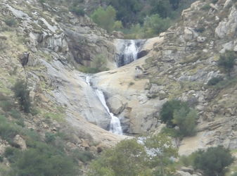
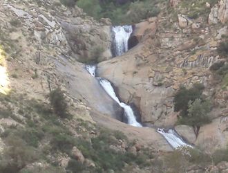
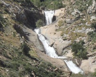
When flowing strong, this canyon is one of the best in SoCal. To check current water flow just google the web or search on Meetup.com for recent hiking trips to Three Sisters and compare recent pictures to the reference below. Note: this is how the Three Sisters look from the official Three Sisters hiking trail (hikers hike it in&out, canyoneers hike it out to exit the canyon).
The road between Mildred Falls and Boulder Creek is CLOSED and blocked off. Combining these canyons now (2024) requires a much longer backtrack and significantly more driving between the canyons.
Approach[edit]
Leave one car at the Three Sisters trailhead and proceed on foot (or with a second car) to the location where Johnson Creek crosses the road. Walk on the private road (permission required, see Red Tape) all the way to the end and at the river change into wetsuits. If want to minimize disturbance to local residents, you may want to drop in the small stream that crosses the road and follow it to the start of the technical section.
If you do not have permission to cross private property you may opt for the far less pleasant 'Bushwack Approach'.
Descent[edit]
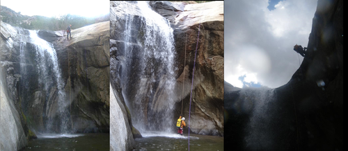
The descent down the river is pretty straightforward. There a 2 waterfalls at the beginning, a river wading stretch and 3 waterfalls (Three Sisters) at the end. All obstacles can be bypassed if needed, mostly through exposed goat trails around the walls of the canyon. But it is much more fun to rappel or slide them.
At 200ft long but only 45% incline, Middle falls is the longest rappel in the canyon. Please do not build permanent anchors with webbing or rappel rings, as these will be taken by hikers that visit the falls. Practice the use of retrievable anchors (Ghosting). If something goes wrong you can always hike back around to retrieve the rope.
Devil's Punchbowl[edit]
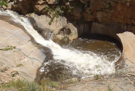
The first waterfall is easily downclimbed or rappeled but some folks will choose to slide the chute instead. Slide can be violent, so be careful.
This is a good checkpoint to get an idea on how difficult (or lame) the canyon is going to be. Use the amount of whitewater in the “Devil’s Punchbowl” pool as reference:
Immediately after the Devil's Punchbowl pool there is a 40ft drop that can be rappeled using metal pipes as anchors.
Big Fall[edit]
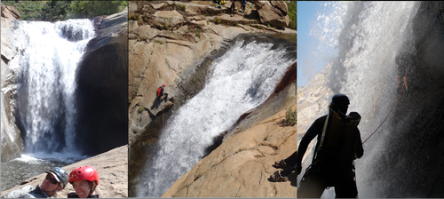
The big waterfall is less than 100ft tall and changes dramatically based on water level. The pool at the bottom is usually waist deep, so it should not present danger of hydraulic even in high water.
The top of this drop is frequently accessed by adventurous hikers, so not expect to find any permanent anchors. Use the pictures below to asses where you want to rappel (left, right or center) according to water flow and experience in your party.
</gallery>
Middle Fall[edit]
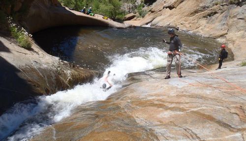
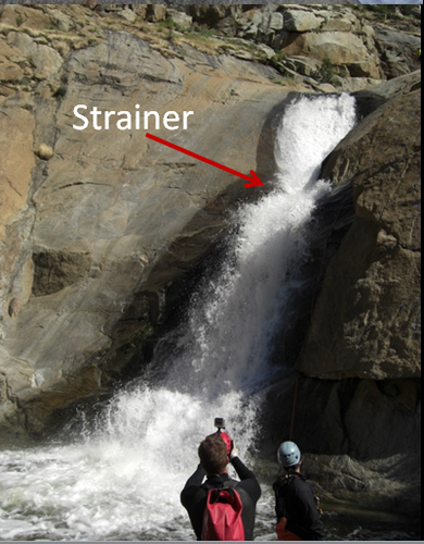
The middle waterfall is a 200ft gentle slope that may not seem like much, but in high water is the most dangerous part of the canyon. All the water flow concentrates at a V shaped strainer in the middle of the falls, which can potentially swipe people off their feet, jam their descender and leave them hanging upside down underwater. From the top anchor the view is blocked, so it’s recommended to station someone in the cracks above the V to keep watch and act in case of emergency. Highly skilled anchor builders may opt to rappel in two stages. In high water beginners should bypass this rappel downclimbing on canyon left.
Big Slide[edit]
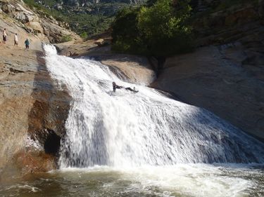
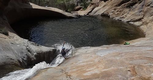
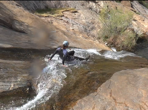
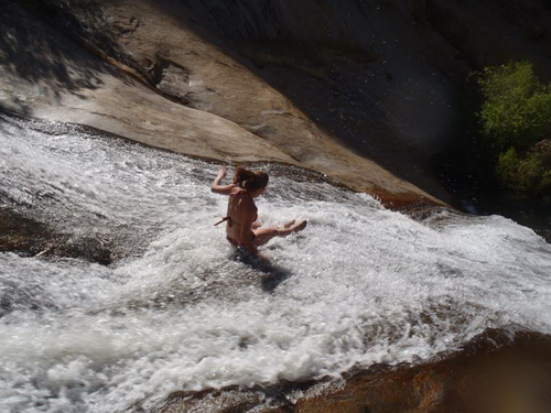
If you choose to do the big slide start in the middle and use your hands to push off and correct trajectory as you slide to make sure you stay in the center. There are submerged rocks on canyon left (which you will not be able to see in high water) that have caused several accidents. In fact it is not uncommon to witness helicopter rescues of injured hikers in this area, sometimes twice a day.
Hiking girls may do the slide in bikinis, canyoneers should stick to wetsuits and keep their cameras handy...
Exit[edit]
Hike down along the stream following a faint train on canyon right and then up the ridge and back to your car following the access trail to Three Sisters. Watch out for poison oak on the side of the trail.
Red tape[edit]
The access the start of the descent requires crossing private land. Frank Brown the main property owner has requested no one trespass on the outlined property line. Access may have been granted before, but that is no longer the case due to recent incidents and other liabilities. Please respect the private land.
Beta sites[edit]
Trip reports and media[edit]
Background[edit]
First documented canyoneering descent was lead in 2011 by Luca Chiarabini, Nivalda Pinguet, Michelle Niles and Dominik Nadolski. However, on the scouting trip there was a group of locals floating down the river in inner tubes coming from the Devil's Punchbowl. So it's obvious that the canyon has been descended many times before by hikers who instead of rappelling it just bypass the waterfalls climbing around them.
