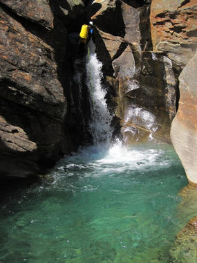
Calancasca
Jump to navigation
Jump to search
| Rating: | |||||||||||||||||||||||||||||||
|---|---|---|---|---|---|---|---|---|---|---|---|---|---|---|---|---|---|---|---|---|---|---|---|---|---|---|---|---|---|---|---|
| | Raps:63, max ↨164ft
Red Tape: Shuttle:Required 1h Rock type:Gneiss | ||||||||||||||||||||||||||||||
| Start: | |||||||||||||||||||||||||||||||
| Parking: | |||||||||||||||||||||||||||||||
| Shuttle: | |||||||||||||||||||||||||||||||
| Condition Reports: | |||||||||||||||||||||||||||||||
| Best season: | Autumn
|
||||||||||||||||||||||||||||||
| Regions: | |||||||||||||||||||||||||||||||
GPS data automatically extracted from www.descente-canyon.com, please visit their site for more detailed information.
Introduction[edit]
A very long canyon, and even longer trip. The start of the canyon is not easy to reach, best option probably being starting in San Bernadino and walking over the Pass dei Omenit (1600m to 2500m) before going down to the start of the canyon at 2170m. If you plan leave out the uppermost section and start at 1920m of altitude, it probably makes more sense to walk up the valley itself.
Last descent has been done a while ago and there are big flood waves in this region, so take a drill with you.
Approach[edit]
Descent[edit]
Exit[edit]
Red tape[edit]
Beta sites[edit]
Trip reports and media[edit]
Picture Credit : Timo Stammwitz
