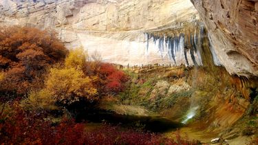
Calf Creek Falls (Upper)
Jump to navigation
Jump to search
Also known as: Calf Creek Canyon; Upper Calf Creek Falls; Upper Calf Creek Hike.
| Rating: | |||||||||||||||||||||||||||||||
|---|---|---|---|---|---|---|---|---|---|---|---|---|---|---|---|---|---|---|---|---|---|---|---|---|---|---|---|---|---|---|---|
| | Difficulty:2A II (v1a1 II) Raps:
Red Tape: Shuttle: | ||||||||||||||||||||||||||||||
| Location: | |||||||||||||||||||||||||||||||
| Condition Reports: | |||||||||||||||||||||||||||||||
| Best season: | Any
|
||||||||||||||||||||||||||||||
| Regions: | |||||||||||||||||||||||||||||||
Automatic GPS data extraction NOT allowed, please visit roadtripryan.com to download GPX.
Introduction[edit]
04/22/18: Calf Creek (the entire drainage, upper and lower) is closed to canyoneering (source BLM office, Escalante, UT).[edit]
Approach[edit]
Descent[edit]
Exit[edit]
Red tape[edit]
Beta sites[edit]
 CanyoneeringUSA.com : Upper Calf Creek Hike
 RoadTripRyan.com : Upper Calf Creek Falls
 Super Amazing Map : Calf Creek Falls (upper)
 SummitPost.org : Calf Creek Canyon
