Canyon Topo Creation
Jump to navigation
Jump to search
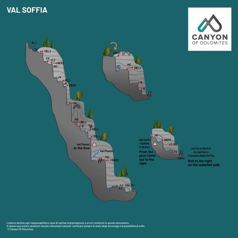
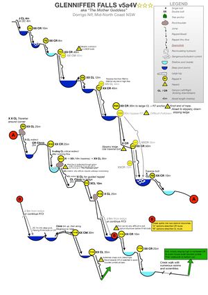
Canyoning Topos, also called Canyon Profile Maps, are a graphical way to represent canyon beta. Instead of using long tedious descriptions or summarized bullet points, a Canyon Topo displays the whole descent in one or more self-explanatory images with minimal use of words. A topo makes it easier to understand and easier to use when running a descent. They are especially useful when traveling internationally - i.e., when you don't speak the local language.
Software
To draw a Canyon Topo one can draw it by hand or use several different type of software, from generic office presentation to professional graphic arts packages, although most people will be best using free sketching software such as InkScape.
- Inkscape Inkscape: free and easy to use sketching software with tutorial on Media:How to Create Canyon Topos Using Inkscape.pdf
- Betaflash (defunct): a now dead java based sketching software to create mountaineering and climbing beta
- Microsoft Powerpoint: generic presentation software, comes with most computers and available free online
- Google Slides: generic presentation software available free online - Canyon Topo Tempate (Brent Roth)
- Adobe Illustrator: advanced Graphic Arts software that is both expensive and difficult to use


