Coomera Canyon
| Rating: | ||||
|---|---|---|---|---|
| | Raps:5, max ↨197ft
Red Tape:Closed to entry Shuttle: | |||
| Location: | ||||
| Condition Reports: | ||||
| Best season: | ||||
| Regions: | ||||
Introduction[edit]
Reproduced from canyoning.org.au which was a reproduction from theverticaladventurer.com
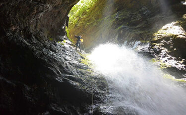
Coomera Canyon, also known as Coomera Crevice. Unlike many other ‘canyons’ in Queensland, this is a proper canyon. It has high walls, is very beautiful, and has decent water running through it most of the time. The anchor status is unknown due to ranger removal of bolts from national parks in SEQ.
Access[edit]
Please note that canyoning in Coomera Gorge is not permitted by Queensland Parks and Forests department. Entering this canyon without a permit is at your own risk of a substantial fine. Refer to Restricted Access Area: Coomera Gorge area of Lamington National Park
Water levels[edit]
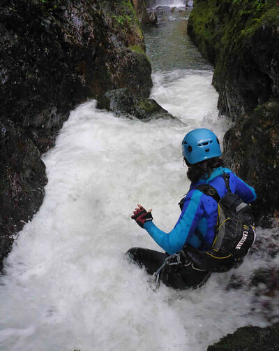
Be aware that this canyon has water hazards that form in very high water levels. When starting, if the first few pools are white with bubbles, as shown in the picture below from one of our trips, you should turn back, especially if the group is large or you have beginners with you. Several waterfalls are added as you progress in the canyon, each adding more volume making it dangerous if you are not prepared.
Large rain events cause this canyon to become extremely dangerous. Give the canyon three or more days after a 50 to 80mm+/12 hr rain event. This canyon is inescapable in the entire lower section. Make sure you have the skills to continue no matter what you find. Bolts can get cut clean from floods through the canyon.
Approach[edit]
To access the canyon, walk along the Coomera river circuit and enter the creek when you cross it. You have a few swims early on and it is reversible up until the large log slide/jump. After this point, it becomes impossible to reverse or escape until the very last 60m abseil.
Descent[edit]
Highest abseil: 60m
Jumps: One of 4m, plus 2 or 3 small ones
Abseils: 5
Wetsuits: Yes
Anchors: All bolted
Topo[edit]
Published with permission of the author.
Exit[edit]
For the exit of the canyon, there are two options:
OPTION 1[edit]
Rock hop 1km downstream, which will take roughly 1 hour for most parties, and start searching the creek side for some tape. There is also an old wooden marker in amongst the trees somewhere as well. This is quite hard to find and will take some time if you are doing it for the first time. Once found, there is an easy scramble up a small 3m cliff with plenty of tree roots to grab. From then on the track often changes direction around bluffs and many people become lost here. Take your time, stop, and go back if you have lost the way. If you know the way, expect it to take 2-3 hours after the 1km rock hop from the base of the falls. This exit is highly recommended to be done with someone who knows the way out.
OPTION 2[edit]
Follow Coomera creek all the way until Gwongoorool Pool and then head up the track. This requires a car shuffle and takes longer (4-5 hours) but is easier in terms of effort and navigation. This way is recommended for those not familiar with the exit route of option 1.
Red tape[edit]
Please note that canyoning in Coomera Canyon is prohibited by Queensland Parks and Forests department. There is a substantial fine for getting caught without a permit and you will not be advancing the interests of our canyoning community.
Refer to Restricted Access Area: Coomera Gorge area of Lamington National Park
Beta sites[edit]
 Wikiloc.com : Coomera Canyon Exit
 Wikiloc.com : Coomera Canyon


