Corbin Creek Canyon
| Rating: | |||||||||||||||||||||||||||||||
|---|---|---|---|---|---|---|---|---|---|---|---|---|---|---|---|---|---|---|---|---|---|---|---|---|---|---|---|---|---|---|---|
| | Raps:10, max ↨100ft
Red Tape: Shuttle:Required | ||||||||||||||||||||||||||||||
| Start: | |||||||||||||||||||||||||||||||
| Parking: | |||||||||||||||||||||||||||||||
| Shuttle: | |||||||||||||||||||||||||||||||
| Condition Reports: | |||||||||||||||||||||||||||||||
| Best season: | Anytime (avg for this region)
|
||||||||||||||||||||||||||||||
| Regions: | |||||||||||||||||||||||||||||||
Introduction[edit]
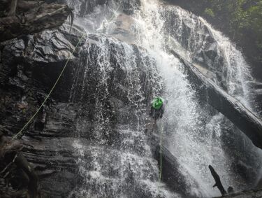
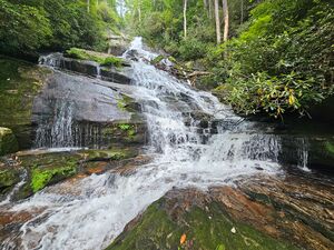
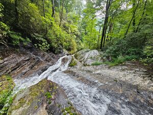
A WNC powerhouse and mega classic featuring fun flow, big cliffs, and technical terrain. Corbin Creek descends an impressive 600’ in just 0.3mi. This route is committing, features numerous rappels through flow in rapid-fire succession, and creative rigging.
Approach[edit]
Drive to the Upper Whitewater Falls Observation Deck and Foothills Trail Parking lot, located on HWY 281 about 8.7 miles south of the junction with HWY 64 in Sapphire. Drop the finishing shuttle car there. Note: This is a $3 parking fee area. Remember to bring cash. Afterwards, drive north on HWY 281 for 1.6mi to a large pull out on the right (east) side of the road. This is the parking for the start and is located here: 35.03908, -83.01307
Suit and/or gear up at the parking. From there, the creek is only 0.1mi below the road. Head down through the open woods following a light path that eventually peters out the last hundred feet or so before reaching the creek. Once there, the first rappel is only 5 or so minutes downstream.
Descent[edit]
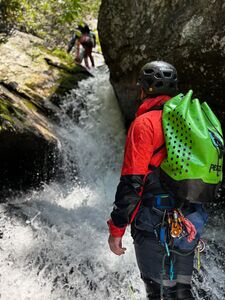
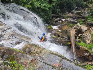
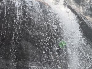
All the rappels come in quick succession after each other, and are in flow with various levels of submersion. A couple anchors require mitigating exposed creek crossings to access. This canyon is not a beginner friendly option, and has committing sections where escape isn’t possible with the typical, heinous NC bushwhack out.
R1: 95ft (29m) off a small, single rhodo DCR. A bit of a walk-out start before hitting the crown, but an excellent first rap through strong flow. Finishes in a waist-to-chest deep pool.
R2: 12ft (4m) DCR off a log jammed between the boulder walls, where the creek pinches through.
R3: 85ft (24m) off a slung boulder DCR, right where the creek begins to make a left-hand turn into the crevice and deepening canyon below. This isn’t as spicy as it looks from above.
Note: If you can safely do it, throw the rope bag/pull line away from the creek and over the large, flat boulder to avoid sticking your rope trying to pull it down through the crevice. Make sure someone is down there to get the bag first. This would be a bad spot to lose it in.
R4: 75ft (23m) off a slung boulder pinch DCR. You’ll need to look under the boulder to see it. Lower angle rappel to get you down a section that is too risky to scramble. Finish at the flat landing in the rhodo tunnel DCR, close to the next drop.
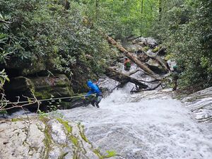
R5: 100ft (30m) off a rhodo DCL close to the drop. Accessing this anchor requires crossing the creek in a place with high penalty points, and doesn’t have a great way to stage more than a couple people at a time. It’s possible to rig traverse lines, and the crossing is only a couple steps in flow.
Note: this waterfall is very big and ledgy. 100ft of rope is not going to get you to the true base, but it gets you to a point where scrambling the rest is feasible.
R6: 12ft (4m) off tree DCR. Just to get you down the awkwardly tall ledge. We ghosted this rap to conserve material.
R7: 100ft (30m) off a boulder pinch on the big flat rock DCL. Lower angle sliding waterfall with a couple features that could stick your rope on the pull.
R8: 95ft (29m) off a rhodo DCR. Long, slabby start before getting into this neat mini channel/slot feature. Water is easier than it looks from above.
R9: 80ft (25m) off a log jam at the top of the drop. Big two-tier waterfall, with a hard overhanginging start.
R10: 80ft (25m) off a tree DCL. Accessing this anchor requires crossing the creek in a place with high penalty points. It’s possible to rig traverse lines. Be mindful of flaking your rope above the boulder after you slide around it at the start of the rap. Excellent flow and ends up being easier than it looks.
Exit[edit]
After the final rappel, pack up the rope and continue scrambling downstream. In about 5-7mins, you’ll reach the Foothills Trail and a well built bridge spanning the creek. We de-geared and took off our suits at a nice flat spot on the trail next to the bridge, before continuing north to the Upper Whitewater Falls Observation Deck and the shuttle car - about 1mi from this junction.
Red tape[edit]
Beta sites[edit]
Trip reports and media[edit]
Background[edit]
First Technical Descent: Ryan Mallon, Trevor Curran, Cat Chambers, Danny Bell, and Ben Wolf August 2025.
