Geyser Warm Spring
| Rating: | |||||||||||||||||||||||||||||||
|---|---|---|---|---|---|---|---|---|---|---|---|---|---|---|---|---|---|---|---|---|---|---|---|---|---|---|---|---|---|---|---|
| | Difficulty:POI Raps:
Red Tape: Shuttle: | ||||||||||||||||||||||||||||||
| Location: | |||||||||||||||||||||||||||||||
| Condition Reports: | |||||||||||||||||||||||||||||||
| Best season: | summer, fall
|
||||||||||||||||||||||||||||||
| Regions: | |||||||||||||||||||||||||||||||
Introduction
Located in a pretty forest glade, a small pool is fed by the only true geyser in Colorado. Natural mineral water fill the pools of this unique Hot Spring.
Approach
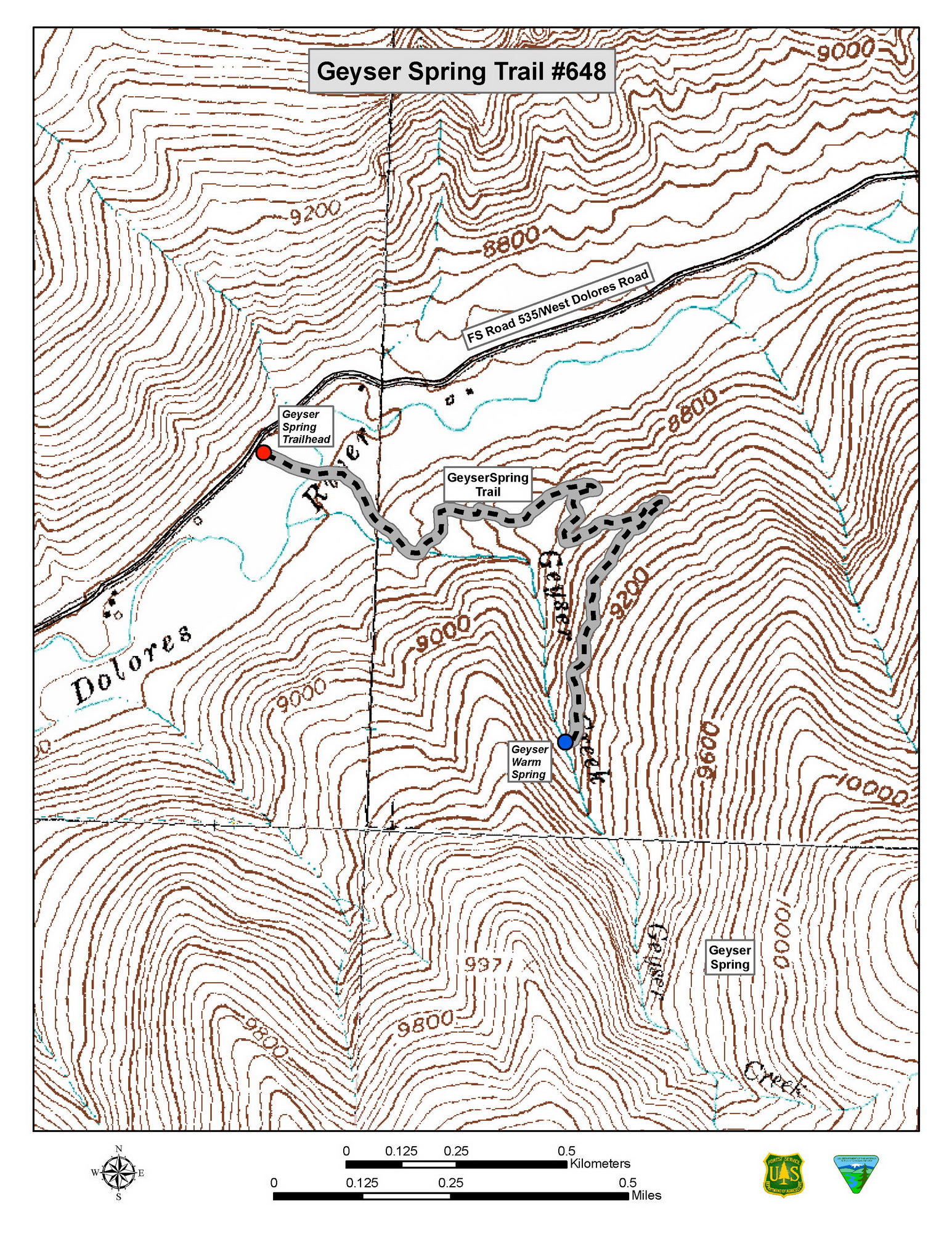
Directions to trailhead: From the town of Dolores, head east on Highway 145 for 12 miles to junction of NFSR (National Forest Service Road) #535. Turn left and travel 23.3 miles. The parking area is on the right side NFSR #535 (this is a new trailhead). The trailhead is 2.2 miles south of the town of Dunton.
Trail Description: Beginning at the newly constructed parking area, the Geyser Spring Trail starts by crossing the West Dolores River. There is currently no foot bridge across the river on Forest Service Land, so it is important you wait for high water levels to drop before attempting to hike this trail. Spring runoff is not a good time to attempt this hike. There are rocks, however, that have been strategically placed for your convenience. Please watch small children carefully. Hikers are encouraged to respect adjacent land owner’s private property and not trespass across their bridge. The trail rises approximately 500 feet in elevation from its beginning to end. There are several relatively gently sloped switchbacks that take you through a series of small meadows and aspen stands. Evidence of mining activity is apparent in the area.
The trail ends up at a small warm pool fed by the only true geyser in the state of Colorado. Although the frequency of the eruptions varies, 30 to 40 minute intervals are most common. The action is slight and boils 12 to 15 minutes emitting strong sulfur gases. The temperature of the spring is 82.4 degrees Fahrenheit which is not the ideal temperature for soaking.