Havasu Canyon
| Rating: | |||||||||||||||||||||||||||||||
|---|---|---|---|---|---|---|---|---|---|---|---|---|---|---|---|---|---|---|---|---|---|---|---|---|---|---|---|---|---|---|---|
| | Raps:0
Red Tape:Access is Restricted Shuttle:None | ||||||||||||||||||||||||||||||
| Location: | |||||||||||||||||||||||||||||||
| Condition Reports: | 22 Apr 2018
"Weather at this time (50-80ºf) was excellent. I did have to wear a hard shell at times for spray and wind, but I never felt like I was melting. Our t |
||||||||||||||||||||||||||||||
| Best season: | Spring, Summer, Fall
|
||||||||||||||||||||||||||||||
| Regions: | |||||||||||||||||||||||||||||||
Introduction[edit]
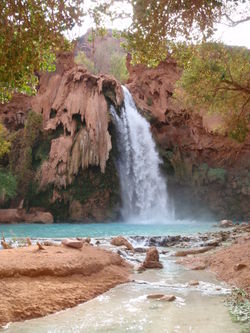
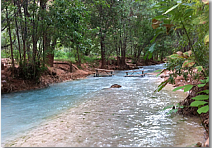
Havasu Creek is a tributary of the Colorado River in Grand Canyon West. The creek is famous for its surreal blue-green water. As the creek descends it produces a set of amazing waterfalls, the most famous being Havasu Falls. This non-technical backpacking adventure will take you onto Indian land, down to the Indian village of Supai and beyond. Many hikers just hike the trail and enjoy the waters without knowing that there are many adventures to be had in this ancient land... if you know its secrets. The information detailed in this beta will help you plan your visit and make you aware of some of the amazing spots that this area has to offer.
DISCLAIMER: Before entering a mine, cave or jumping off a cliff, remember to use your own judgement! Your safety is your own responsibility. If something feels too dangerous or unsafe, don't do it!
Special notes for Colorado River rafters in Red Tape section below
Approach[edit]
Havasu Canyon is best visited over a long weekend, spending a minimum of 3 days and 2 nights down in the canyon. You can camp at the Havasupai campground (near the Havasu Falls) or you can stay at the lodge (in the Supai Village). Either way you will need reservations, preferably reserving 6 months in advance. You may need perseverance calling the Indian Reservation and sometimes the phones don't work at all.
The best season to go is September/October followed by May/June. During these months the weather is not too hot and the days are still long. June is packed with visitors, as most young backbackers are out of college. September is less crowded and easier to find nice campsites. July and August is monsoon season, it may rain a lot or camp may be closed or evacuated due to flash flood danger. In April and November days may be too short or it may be too cold to endure long exposure to the nice cool waters, which flow at constant temperature of 70F all year around.
Plan your trip carefully, as there are limited facilities down at the Village of Supai. If you stay at the lodge you can go with just a day pack and have dinner there. If you stay at the campground you will need full backpacking gear and to carry food for several days. With advanced reservation you can arrange for mules to carry some of your stuff down (or back up) and then backpack with light loads. The hike down to Supai Village is 8 miles downhill (10 miles if going to the campground).
One can also take a Helicopter in or out from Supai Village. It costs $85 each way and it flies only on specific days of the week (best to call them to confirm). It is usually not worth it for the way in, but is a fantastic option for the way out as it saves 6 hours of uphill hiking and you'll be well rested for the drive home.
For more information and reservations go to http://havasupaifalls.net
How To Get There[edit]
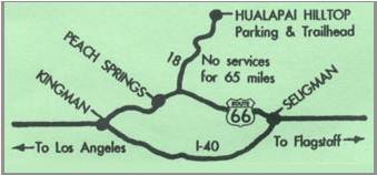
- From Kingman to the Hualapai Hilltop is a 2-3 hour drive (130 miles)
- From Peach Springs to the Hilltop is a 1-1.5h hour drive (70 miles)
It is recommended to drive out the evening before the hike down, spend the night in a motel or camp near the trailhead, and then start the hike the next day at dawn. The first half of the hike is in full sunlight and starting early will avoid the heat. It will also allow you to get to camp earlier than other visitors and claim a better camping spot for your group. The lower end of campground has nicer sites. East side (crossing creek) is usually quieter and fills up later. The south side of the campground is the last to fill up.
Motels[edit]
- Grand Canyon Caverns: 5 miles east of turnoff 18, decent, closer to hilltop, with restaurant. Address: Route 66, Mile Post Marker 115, Peach Springs AZ, (928) 422-3223, (928) 422-3224,gccaverns.com
- Hualapai Lodge: 7 m west from turnoff 18, rude service, expensive, good restaurant. Address: 889 Highway Street, Peach Springs AZ, (928) 769-2230, hualapaitourism.com
- Frontier Motel & Cafe: 16m west from turnoff on 18, cheap $55, basic. Address: 16118 E Highway 66, Truxton, AZ, (928) 769-2238
- Kingman Motel: 60m from turnoff on 18, Cheapest, $35/night for 2 queens, but 2h-3h drive from trailhead (bummer) www.motel6.com
- Orlando Motel: Truxton, AZ
Camping[edit]
- Hualapai Hilltop: N36.159914 W112.709556, At the trailhead. Trailhead for the hike. Noisy, windy, dirty and no services! Can sleep there in the car or camp in parking lot. This is not officially recommended but is tolerated by the Indians. Groups will want to park cars to protect tents.
- Camp on BLM land: N36.103141 W112.690458, 15min from trailhead. Right turnoff 55.7 miles from Rte66/Hwy18. BLM land, camping is legal. Indians may claim it's their land but it's not, sign of "Indian reservation" is 1/4 mile up the road. Tell them you'll be hiking Havasupai and they'll leave you alone.
- Camp on Indian land: N36.13816 W112.66457, 15min from trailhead. Indians may claim you're illegally camping on their land. Tell them you'll be hiking Havasupai and they'll leave you alone Turnoff N36.121741 W112.693159 57miles from Rte66/Hwy18
Descent[edit]
There are several interesting spots along the route that deserve a visit. You can stop by on the way in or on the way back. In order to fully enjoy Havasu Canyon you will need at least 3 days, preferably more. A shorter itinerary might look like this:
- First Day: Hike Down - Start at dawn, briefly stop at Havasu Spring, then bolt for camp to secure a nice site. After that go for a swim in Havasu Falls, explore the Crystal Mine. If you have time check out some of the other mines around camp or hike the Mesa Trail.
- Second Day: Waterfalls - Hike to Beaver Falls but take time to explore the interesting spots along the way. Go for a swim in Mooney Falls, stick to the wet route down to Beaver and try to find the Green and Blue rooms. If you are a small group you may have time to attempt the climb up the Vanadium mine or the hike down to the Colorado River still in daylight. But if you can afford it, it is better to allocate an extra day exclusively for the Colorado River hike.
- Third Day: Fly Back - Take it easy, pack camp and head for Supai Village. If you have time, stop to play at Havasu Falls, Rock Falls and New Navajo Falls along the way. Make sure you get to Supai by noon to catch the helicopter out. Reservations are not needed, but last flight is usually 1pm.
Havasu Springs[edit]
- The source of Havasu Creek is very unique. To get to it you walk upstream about 1/4 mile from where Hualapai Canyon meets Cataract Creek. The easiest way to get there is to make a small detour on your hike in. When you first see Havasu Creek hike upstream for about 1/4 mile rather than following the signs pointing downstream. Small springs cover this area and together they make the large Havasu Creek.
- Around the spring area there is an ancient Indian cliff dwelling, look on the walls on canyon right (right looking downstream). It's not very obvious, but if you look for it you may find it.
- Watch for signs restricting access; this area may be inaccessible
Supai Village[edit]
- You can refill bottles at a faucet on the east side of the Tourist Office building (right before helipad).
- Many opt to send postcards stamped with mules from Post Office (unique in the USA).
- Small Museum next to tourist office, you can ask at the office to give you access
- Be sure to check out the two smaller waterfalls above Havasu Falls proper (Rock Falls and New Navajo Falls), either on the way in or on the way out.
- The helicopter out of Supai only runs 2-4 days a week, make sure you plan accordingly. In my opinion this is the best return option. It costs $85 but allows you to spend an extra 1/2 day and save 6h of hiking time and have a killer helicopter experience too. If too expensive, the next best thing is to hire a mule to lighten your load so you can hike with a day pack. More info www.havasupaitribe.com
Rock Falls[edit]
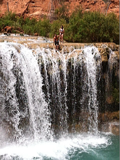
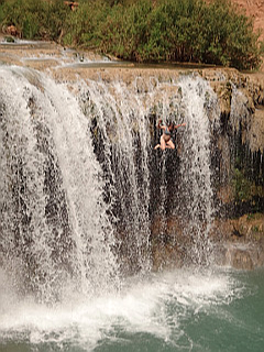
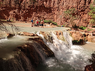
- Rock Falls is the Indian's favorite swimming hole. You can jump 30ft from the top of these falls in the pool below.
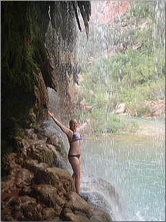
- There's a hidden rope you can grab to get to the very edge and then jump. I'm holding the rope in the picture.
- You can also just skip the rope and take a run and jump. (just make sure you jump in the right spot).
- Summer flash floods change the canyon every year, make sure the falls are still safe to jump when you go
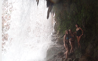
- Once you're done jumping don't forget to sneak into the back of the waterfall
[edit]
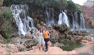
- New Navajo Falls is a beautiful little Travertine grotto, very scenic.
Havasu Falls[edit]
- Some say it's forbidden to rappel the falls, but some people have done it and posted pictures online. The water is so strong that you have to rappel dry, out of the water. If you do so, be discreet and to avoid any confrontation with the Indians.
- Hike on top of the cliffs above the campground and beyond. You can get on top of the cliff by climbing up Ghost Canyon which is just beyond the cemetery as you are walking into the canyon and near the top of Havasu Falls.
- Short distance before the falls the trail branches off to the right to go to Carbonate Mesa Trail. This is a flat hike through nice sky terraces with sweeping views of Havasu Falls, camp and below. THIS IS NOT FOR A MIDDAY HIKE. 30-45min round trip, only do it if want to kill some time some afternoon and it's too cold to go play in the water.
- You can get behind Havasu Falls at the bottom pool, climb the rocks to a grotto 15ft up and jump off into the waterfall, having the falls push you under the water, then out toward the pools.
Campground[edit]
- Lower end of campground has nicer sites. East side (crossing creek) is usually quieter and last to flll up. Fern Spring at north end of camp is reliable (no treatment). South side of campground is the last to fill up.
- If you can't find a site with a table available, ask some other group if you can share one
- Hang food and trash from trees. Squirrels will chew through tents and packs to steal food.
- There are a few abandoned mines that you can explore right around camp. (see notes below)
Crystal Mine[edit]
- This is the largest of the mines in Carbonate Canyon, adjacent to Havasu Falls, where rails and timbers still can be found descending three levels. Lead was mined here for the last time during WWII. Ranger Gale Burack, who worked at Grand Canyon, wrote of her experiences in the miners camp where the campground now resides (Arizona Highways, September, 1984).
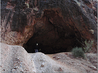
- To get to the mine cross the rim of the Havasu Falls pool and get into Carbonate canyon, head 1/4 miles up canyon and on the right you'll find a big opening with a pipe sticking out, this is the entrance of the mine.
- This a cool 3 level mine. Not trivial to navigate, but not too complicated to explore. Inside the mine there's a big shaft that crosses the 3 levels, but the bottom can be reached by an alternate route climbing down static ropes.
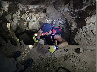
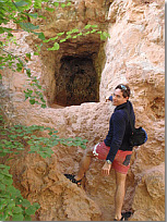
- Watch for a hole at ground level near some wood false floor (see picture), there will be a rope hanging here. Follow the rope down to reach 2nd level of the mine. It's a awkward climb, but not too hard to get out. Check that all of you will be able to climb back up BEFORE you climb down. If you can't, stay out.
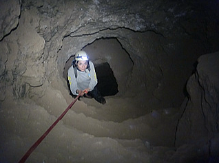
- Bring a 30ft webbing or rope to descend from 2nd to 3rd level, since a rope is not always there. This climb is only for experienced adventurers because if you fall down you will be trapped in a water shaft full of rotten logs. If you happen to fall in and your buddies do not rescue quickly you may die of exhaustion or hypothermia or both. Double wrap webbing or rope around your hands and wear gloves for maximum friction. The climb is not that hard, but it is not for everyone either. Use your own judgment.
Another Mine[edit]
- Next to center of campground and visible from main trail on canyon left .
- Exposed climb required to access the 2 entrances, not very long, just one level, but cool.
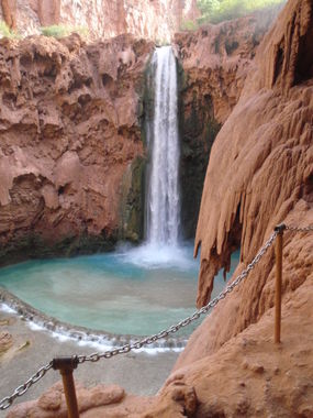
Mooney Falls[edit]
- Some say it's forbidden to rappel the falls, but some people have done it and posted pictures online. The water is so strong that you have to rappel dry, out of the water. If you do so, be discreet and avoid any confrontation with the Indians.
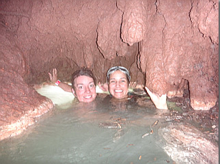
- It is possible to swim to the left of the falls to the rock wall, and then shimmy your way across the rock (while staying in the water) to a small cave that is located just above the water line, approximately 15–20 feet (5 to 6 meters) away from the falls (only attempt if you are a strong swimmer).
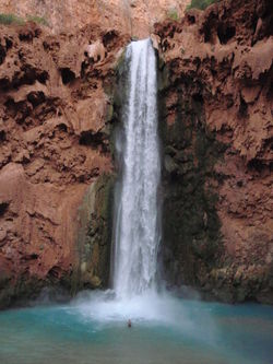
- There is an island located in the middle, which breaks the pool into two streams. Standing on this island allows for very dramatic pictures, as it looks you are engulfed by the waterfall.
Ghost Canyon[edit]
- deep and narrow burial canyon with a warm spring and 300ft walls just below Mooney. Great place to escape midday summer sun. Where Ghost canyon intersects Havasu creek it creates a grotto (set of pretty waterfalls) on the west side of the Havasu creek.
- About 300 yards down from the Mooney Falls pool is a very cool cave on the left filled with ferns and water pouring down over the top. This is a great place to stop for a few pics and to cool off.
- About 1/4 of a mile down, there is a small stream which feeds into the creek, over the side of the cliff, effectively creating a place to shower. Follow the trail off to the right towards the creek, then back towards Mooney Falls a bit and you'll find this mini-waterfall.
Cataract Mine / Vanadium Mine[edit]
- On canyon left down from Mooney Falls, immediately after Ghost Canyon
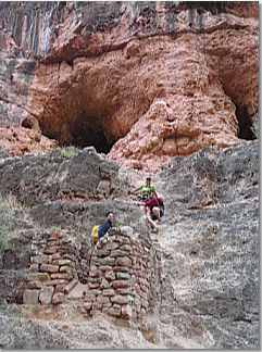
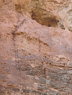
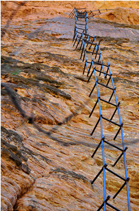
- This mine requires a 256ft climb of a metal ladder to main entrance. The pipe ladder ascends to a vanadium deposit several hundred feet above the canyon floor.
- Near the top, barely visible in this image, are the words "Enter the Dragon," presumably painted by a local tribe member.
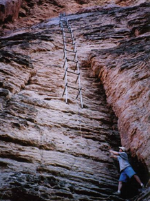
- Historical reports says it's only 30ft deep tunnel and that the bottom part of ladder is missing since indian boys were injured climbing up to the mine.
- Climbing equipment recommended to attempt the ascent, will need to climb first section of ladder that is missing, see pictures below to get an idea
Buddha Cave[edit]
- A short distance below Mooney, where the canyon is starting to narrow, the trail will go by a cave with a Buddha painting in it.
- You'll have to climb 6ft to get there, but it is easy. The cave provides shade and peace to visitors.
Jacuzzi Spring[edit]
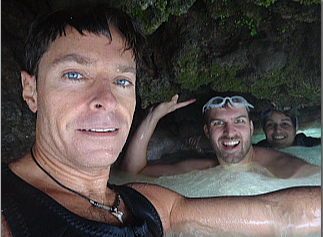
- A short distance down the canyons there is a spring that bubbles up creating a sort of natural jacuzzi in the middle of the river. You can recognize the location because it's immediately above a 10ft waterfall (see picture below).
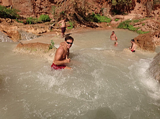
- In the middle of the big pool at the top there is a massive water jet that push upward, very fun to "body surf" it!
Rope Swing[edit]
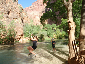
- A short distance down from the Jacuzzi Spring there used to be a rope swing that was really fun, but in 2012 I could not find it anymore.
- I was told the pool got too shallow after some flash flood, so it's no more. Still fun to look for it.
Beaver Falls[edit]
These pools are small, but still offer good swimming. Like the previous three falls, there are many places to cliff-jump and there are many good sites to explore. My suggestion is to visit the falls following the Wet route IN and the Dry route OUT. There are two underwater caves that are called the Green Room and the Blue Room.
Wet Route[edit]
- If the group has an adventurous spirit take the “wet route” to Beaver Falls; if you choose this option there will be the opportunity to swim to the “Blue Room” -- an under water air pocket accessed by swimming beneath the first tier of the waterfall! Once you emerge from the green room, the thrill of discovering this canyon secret will help you steel your courage to JUMP off the main fall (18’) into the frothy pool below (have someone check depth first!)
- Once at the base at the falls you can engage in the hunt for the fabled Green Room, another underwater cave that is harder to get than the Blue Room.
- About 50 yards down from Beaver there is a cliff about 60 feet high that you can jump off of, you'll recognize it by the deep blue pool. If you jump it, there’s not an easy way to get back up…but it can be done.
Dry Route[edit]
- The trail will lead to a point where there appears to be no way to go, except for getting wet. But to the right, on the rock ledge, there is a rope hanging down (always test ropes you did not place before climbing them). Climb up this rope. It is a difficult climb of around 8 feet (2.4 m).
- In 2012 rope was replaced with a wood ladder that makes the climb very easy, both up and down
- Follow the trail up and follow it downstream. There is a rock chute/slide located to your left; this is the difficult access to the falls. There is an easier access point if you hike to the point just before the trail turns north to continue down the canyon. Look for ducks here. River rafters have beaten a path to the 60ft ledge where they jump. Go on upstream, gradually working your way to the creek bed. Climb down to the creek and the falls are just upstream.
Blue Room (Top Tier Beaver Falls, dive 3ft down and 6ft in)[edit]
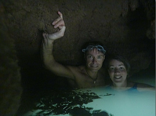
- Go to the top tier of the Beaver falls, start in from the left side and slip underwater and into a small cave.
- It is not very hard to get to as it is only a few feet behind the wall. Dive 3ft down and 6ft in into a small cave.
- You can feel the cave with your feet from the outside. Watch your head going in. From the inside, you can stick one foot out and help other people get in by letting them grab your leg and pulling them in. Watch their head.
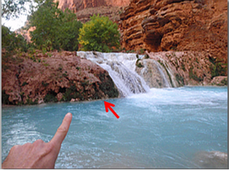
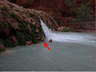
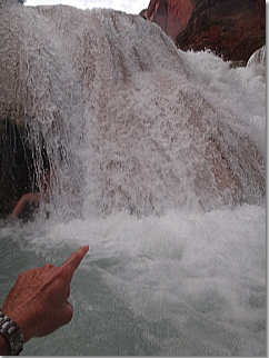
- Red arrow below marks the location of the underwater entrance (notice the difference that a sunny vs cloudy day makes on water colors).
- No need for flashlight/headlamp inside this cave
Green Room (Bottom Tier Beaver Falls, dive 9ft down and 10ft in)[edit]
- Accessing the Green Room is not for everyone. It requires strong swimming skills and the aid of diving goggles/mask.
- We could not access the Green Room because pool was filled in from last flash flood (August 2012). Below are quotes from people that claims visited the fabled Green Room:
- 'If you go to the beach at the base of beaver falls you will see an eddy current that brings you close to the fall. Enter that current and just before you would be hit with the fall dive under water. You should see a small cave under the water. It is not very large and will be very dark. Swimming into it is like a leap of faith. I can hold my breath for two minutes but was still very unnerved. Once inside the cave feel your way deeper for about ten feet or so. You will emerge without warning into a small air pocket. There is a small shelf you can stand on and there is only enough room for two people. Looking back the tunnel is a green color that lights up the cave.'
- 'I found the "Green Room." It was eight feet down and eight feet back approximately and not all that easy to find having no more than a pair of goggles to aid me in my search. It was much smaller than I would have thought, but enough area to get your head up and breath for a little bit. Since I went in the morning, it was also very dark and not green at all. Just search underneath a big underwater overhang under the large falls of Beaver.'
- 'I learn that you can swim behind Beaver Falls, descend about 7', go through a large hole for about 8' then ascend the 7' to a small cavern. (Careful - there's a stalactite that ends not too far above surface level - be very careful ascending!) It's called the Green Room, because of the color of the light that passes through the water and is apparently quite beautiful with ferns surrounding you. Tom Cruise was there a few years ago.'
False Green Room (Bottom Tier Beaver Falls, marginal diving involved)[edit]
- There is another “Green Room” in the bottom falls . This Green Room isn’t a submerged room but it is a pocket behind a waterfall. Its fun to try to get into it. Enter it from the side and slip into the small opening grabbing on the rocks to push yourself inside. Once inside there were no strong currents, but there were some outside of the cave.
- To come out you can just dive down and let the waterfall flush you out, but watch out for hydraulics!
Past Beaver Falls[edit]
- From Beaver Falls you can hike up and down Beaver canyon (1h strenuous climb up boulder strewn canyon, not sure it's worth it)
- From Beaver Falls you can hike 3 miles down to the confluence with the Colorado River (add 3h-5h more hours for the round trip). There are multiple ways to reach the Colorado, yet the best is to go back up the chute to the trail and follow that downstream. This spot is also popular for river rafters to stop and to head up the canyon.
- Stick to the trail (not the creek), follow the cairns and you'll do only 5 creek crossings.
- Colorado river is 7h-10h round trip from campground. If you want to do it be ready to leave predawn and come back in the dark, and do not expect to have much time to play in the waterfalls.
Exit[edit]
Options for the return:
- Leave camp at 4-5am for a grueling 10 mile hike uphill. (8 miles if leaving from lodge)
- Take it easy, play in the falls and time it to take the helicopter out at noon.
You should arrive at the hilltop at about the same time. You might consider leaving a carefully packed cooler in the car with some dry ice and your favorite beverage to wait for your return.
Red tape[edit]
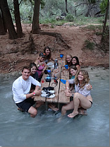
There are several spots along the campground where picnic tables have been set in the watercourse. Most of the times these are there to aid crossing of the stream, but some of these tables also make for a fantastic "pool bar" where you can rest legs and feet in the cool water while having a post-hike Happy Hour with your friends. Remember that alcohol is forbidden in the Indian reservation. We drank from Gatorade and Vitamin Water bottles.
Special note for Colorado River rafters: In 2018, during a 21-day rafting trip, we hiked up Havasu canyon after docking our boats at the confluence. We were stopped at Beaver Falls by a Havasupai guard with a walkie-talkie. He said that a daily entrance pass onto reservation land was $55pp, cash only. He would not take a credit card (we believed it would have been technically possible for him to call a cc number over his radio to charge from their office, but he would not try it). Although we had enough money back at the boats, there was no sign in the lower canyon advising us of the fee, and thus we did not know of it when we started the 3 mile hike up, so of course we did not have money on us. He turned all of our group back around the corner, out of sight of lower Beaver Falls. Keep this in mind if you are rafting and would like to visit the beautiful Havasupai land -- plan ahead either bringing cash or possibly arranging admission from the tribe in advance of your rafting trip (although timing the exact date of arrival during your rafting trip might be tricky).
Beta sites[edit]
 Chris Brennen's Adventure Hikes (Southwest) : Havasu Canyon
 ToddsHikingGuide.com : Havasu Canyon
 CanyonChronicles.com : Havasu Creek
 Grand Canyoneering Book by Todd Martin : Havasu Creek
