Luteren
| Rating: | |||||||||||||||||||||||||||||||
|---|---|---|---|---|---|---|---|---|---|---|---|---|---|---|---|---|---|---|---|---|---|---|---|---|---|---|---|---|---|---|---|
| | Raps:5, max ↨66ft
Red Tape: Shuttle:None Rock type:Conglomerate | ||||||||||||||||||||||||||||||
| Start: | |||||||||||||||||||||||||||||||
| Parking: | |||||||||||||||||||||||||||||||
| Condition Reports: | |||||||||||||||||||||||||||||||
| Best season: | Summer to Autumn
|
||||||||||||||||||||||||||||||
| Regions: | |||||||||||||||||||||||||||||||
Introduction[edit]
Very flat and open canyon, but due to the high waterflow it is quite technical.
Approach[edit]
The first waterfall can be seen immediatly from the bridge.
Descent[edit]
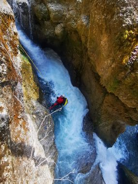
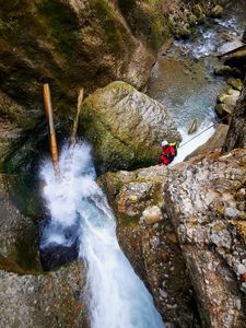
The first section starts with a dangerous pool and a natural arch which both haven't been abseiled through. Then another small 3 Meter step. Walk for a about 300m, then comes a 5m Fall which can be downclimbed and jumped (the last 2 meters). Again a few minutes of walking, and you'll get to the last section made of 2 Waterfalls, the first one could be done as a jump if the current isn't too strong.
Exit[edit]
Exit on the right side and walk up to the road.
Red tape[edit]
Beta sites[edit]
Trip reports and media[edit]
Background[edit]
The river has a water level measurement. First descent was done at 500L/s, but sometimes the flow goes down to 150, so it should be possible to go through the arch.

