Madden Falls
| Rating: | |||||||||||||||||||||||||||||||
|---|---|---|---|---|---|---|---|---|---|---|---|---|---|---|---|---|---|---|---|---|---|---|---|---|---|---|---|---|---|---|---|
| | Raps:13, max ↨213ft
Red Tape: Shuttle:Required 10min Watercraft:Yes Rock type:granite | ||||||||||||||||||||||||||||||
| Location: | |||||||||||||||||||||||||||||||
| Condition Reports: | |||||||||||||||||||||||||||||||
| Best season: | summer
|
||||||||||||||||||||||||||||||
| Regions: | |||||||||||||||||||||||||||||||
Introduction[edit]
First descent August 15th 2021.
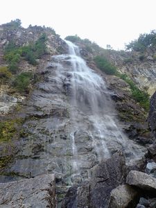
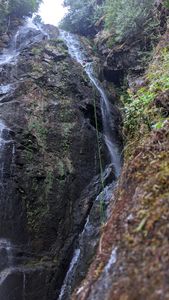
Madden Falls is located approximately 23km (as the eagle flies) up the Squamish Valley, located on the western side of the river, situated beneath the Tantalus range. Madden Falls forms as Madden Creek emerges from the northeastern flank of Pelion Mountain and cascades down towards the Squamish River in nine drops. The longest drop, measuring 152 m (499 ft) tall, is one of the tallest single drops founds in waterfalls across Canada. The total height of the currently descended canyon is 579m.
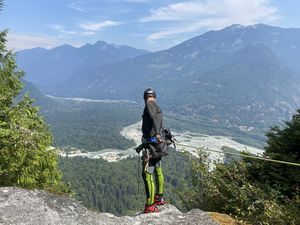
It has potential to become a classic Squamish canyoning experience given its stunning location, the unique point-to-point river access, views of Squamish Valley and beyond to Cloudburst and Garibaldi and the spectacular descent of Madden's largest drop. The descent begins at the top of the main drop and consists of a series of atmospheric rappels close to the main flow. It continues below through a series of large pleasant drops which take you back down to river level for an easy hike through forest back to the river's edge.
Upper sections of this canyon are in Tantalus Provincial Park and the lower sections are in Sigurd Creek Conservancy. This does not preclude access and recreational use but warrants respect and minimization of impact.
Approach[edit]
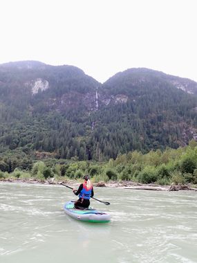
The canyon is accessed from the Squamish River. Put in at the Ashlu campground and paddle to the approximate start point (around 15 minutes paddle). There are no trails, but game trails may be found on the upper half and make the going a little more pleasant. The hike is steep and long and includes crossing multiple talus/boulder fields. It's best to start near the outflow of Madden so that at the end of the day you are not bush bashing looking for your ride home. Although the start of the currently descended canyon is at around 520m, the hike goes above this to around 600m and then drops down into the creek. The hike will take between 2 and 3 hours depending on the group and the amount of gear. There is a KML data file loaded which shows the path taken on ascent in the interactive map.
Descent[edit]
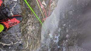
Rappel 1: 1 of 6 rappels, main drop. This first rappel gets you over the lip and into position on the wall before beginning the descent of the 150m drop proper. It is a short access pitch that allows for ease of rope retrieval on the next pitch. Use a tree anchor, from one of the trees set back from the edge on canyon right. There was no webbing or fixed gear used by the FD party for this rappel. Length: 5-10m (5m down from lip, but tree is about 5m back from edge).
Rappel 2: 2 of 6 rappels, main drop. Anchor is located on canyon right, on a section of wall covered in thick green moss out of the flow. It is a semi-hanging stance with limited foot placements, so it accommodates 1 comfortably, 2 with a little discomfort and 3 with great discomfort. Suggest sending the party in successively to minimise crowding. This rappel is a rope stretcher and goes all the way down the obvious ramp/slab next to the main flow until a small overlap is reached at about 50m, beneath this you will find the next anchor and a small ledge for another semi-hanging stance. It may be possible to continue past this anchor to the next with a 60m rope, but the FD party did not verify this. Length: 50/55m? or 60/65m if linking pitches?
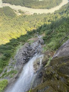
Rappel 3: 3 of 6 rappels, main drop. From the semi-hanging stance beneath the overlap on the slab, this pitch rappels a short ways down the slab and slightly left (towards the flow), until another overlap is reached, this one being much larger and with an obvous large overhang below, with which comes full view of the falls below and a sudden sense of exposure. The achor is found imediately below the lip of the overlap, again a semi-hanging position for rebelay. Length: 8-10m
Rappel 4: 4 of 6 rappels, main drop. Watch rope abrasion immediately below the anchor on this rappel. A free hanging rappel to start with, allows you to enjoy the view - as you will no doubt spin at least a full 360 before you reach the slab below. Once you reconnect with the wall below, continue down the slab another 15m or so until passing another overlap, below which the next anchor is found. This anchor is located directly above a small corner system and is positioned on the edge of the flow, so be preared to get wet and cold. It is also another semi-hanging stance. May be able to link this rappel and the next one, watching rope length and abrasion. Length: 40m?
Rappel 5: 5 of 6 rappels, main drop. A short rappel down the corner below, to another overlap down and slightly right (river right/away from flow), positions you for one final clean rappel to the base of the wall. Length: 8-10m?
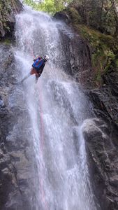
Rappel 6: 6 of 6 rappels, main drop.The final pitch of the main drop. A very enjoyable pitch that takes you to the base of the falls and ends in the creek below. Length: 50/55m?
Boulder hop your way down river, past the house-sized boulder to a flat open area above the next major drop.
Rappel 7: A tree anchor was used by the FD party and webbing and a mallion was left behind on one of the large trees located about 8m back from the edge on river right of the flow. This rappel is a rope stretcher, and given the anchor is set well back from the edge, pay close attention to rope management to ensure a clean and easy pull, there will be quite a bit of drag regardless. Descent line is river right of flow for its entire length. Length: 55-60m
Scramble down river a short distance before the next drop.
Rappel 8: A tree anchor on river left. Awkward and unpleasant to get to, scramble under bushy branches. From the base of this rappel the next ancor station is visible, located on the river right side of the flow on a mossy wall above the drop. Length: 20m?
Rappel 9: Approach this anchor with caution, as you must walk through the flow which has considerable mossy coverings around it. The anhcor is positioned on the mossy wall above the drop. This rappel is in the flow the entire way. Caution with rope management/placement at the lip for the last person down to ensure easy rope pull, potential to get your rope stuck on this one. Length: 50m
Scramble down river on river left side for 100m or so to a flat open area above the next drop, which is visible from the base of the previous rappel.
Rappel 10: Anchor is located on a tree on river right side of flow. Length: 35m - with a 60m rope it is likely possible to downclimb the last few meters.
Scramble down river for 5mins or so,
Rappel 11: Anchor is located on river right side of flow, rappel initiall through/over trees and then down onto rock slabs adjacent to the flow. Length: 15m
Continue scrambling down river for a short distance until you arrive at the next big drop, above the drop is a large flat rock around which the flow splits into two main streams, one on the left is fairly minor and the one on the right has the larger flow.
Rappel 12: This rappel begins from a tree on river right (right of the right split/stream). Initially you will head down the flow, but soon begin to angle river left, across the flow and slippery moss until you reach a wide (likely dry) slab, continue down and left until the lower section of the waterfall is visible, you should now be situated between each stream/flow. The next anchor is located on the downstream side of this slab, giving you a straight shot to the bottom on the next rappel. Length: 10m
Rappel 13: From the anchor located in between each of the two separate streams, rappel stright down and into the flow. You should be in the flow of the left stream now, which disappears below into what almost looks like a small narrow slot canyon below. Length: 60m?
Exit[edit]
Follow the southern fork of the creek bed back to the Squamish River and to your boats - it might be easier to exit into the forest for part of this. Note that in summer, the water disappears underground leaving the creek bed dry. Float down the Squamish River for about 15 minutes to get to Anderson Beach. Alternatively float for 2hrs until you get to the Watershed Restaurant and Bar in Brackendale. Great place to take out and drink a beer and eat a burger. Please note that the Pilchuk take out (20 minutes of paddling) requires crossing 5 metres of Squamish Nation land. So far we have not managed to negotiate access.
