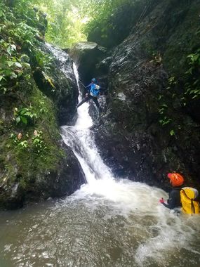
Mitan (Lower)
| Rating: | ||||||||||||||||
|---|---|---|---|---|---|---|---|---|---|---|---|---|---|---|---|---|
| | Difficulty:3B I (v2a2 II) Raps:10, max ↨49ft
Red Tape: Shuttle:Required 3.0km Rock type:Basalt | |||||||||||||||
| Location: | ||||||||||||||||
| Condition Reports: | 30 Dec 2018
"Fairy good flow due to 3 days of heavy rains. The anchors are very strange in this obviously heavily guided canyon. There seems to be a zip line set u |
|||||||||||||||
| Best season: | ||||||||||||||||
| Regions: | ||||||||||||||||
Introduction[edit]
A nice little beginner canyon with 3 bumpy toboggans, a few little rappels, and what appears to be a zip line used by guide companies.
Approach[edit]
Park at the end of the road and begin down the trail where you see the signage. A few meters on the trail there is a little chapel: The trail for lower Mitan is opposite on your left and descends parallel to the watercourse.
Descent[edit]
A few nice little rappels, some odd anchors.
Exit[edit]
When you get to the last element of the canyon you will see a zipline across the canyon, and a steel cable with anchor ring suspended above you. You can rappel this, or down climb instead on the right. From the bottom take the trail on your right which winds back and forth across the creek and then heads 10 feet up a drainage on the left. Immediately the trail heads up and to the right, with landlines installed. At the top you will begin an incredibly steep and muddy, slippery trail that descends through a cow field and some bananas to your car. At the car there is a hose for washing, which you will need because of all the smelly mud you just went through.
Red tape[edit]
On the exit trail there are some no trespassing signs that steer you to the left. This is at the top of the trail and from here to the car the trail is aweful.
Beta sites[edit]
 Descente-Canyon.com : Mitan (inférieur)
 An Kanion La-madinina : Mitan Inf.
 Mur d'Eau Caraibe : Rivière mitan inf.
 An Kanion La-madinina : Rivière Mitan (inf.) [PC-12]
