Mundbach
| Rating: | |||||||||||||||||||||||||||||||
|---|---|---|---|---|---|---|---|---|---|---|---|---|---|---|---|---|---|---|---|---|---|---|---|---|---|---|---|---|---|---|---|
| | Raps:20-25, max ↨82ft
Red Tape: Shuttle:Optional 20min Rock type:Gneiss | ||||||||||||||||||||||||||||||
| Start: | |||||||||||||||||||||||||||||||
| Parking: | |||||||||||||||||||||||||||||||
| Shuttle: | |||||||||||||||||||||||||||||||
| Condition Reports: | 8 Aug 2022
"Unusually early to do the canyon due to the dry period this summer.. As always quite slippery. |
||||||||||||||||||||||||||||||
| Best season: | Autumn
|
||||||||||||||||||||||||||||||
| Regions: | |||||||||||||||||||||||||||||||
Introduction[edit]
Canyon that has been done long time ago. Reequiped the upper part in 2021, lower part, made of open waterfalls, is still of more a "adventure" kind of canyon. With 80m of rope (exact length still has to be verified) you can rappel directly from the bridge.
Approach[edit]
Whether you go by foot or by car, you should first aim the big bridge of the main road to Mund, above the start of the canyon. From there you can walk down on a steep slope on the eastern side, or do a freehanging 80m rappel from the middle of the bridge. Then there is some 200m walking before encountering the first anchor.
Descent[edit]
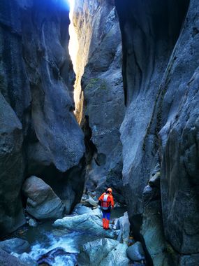
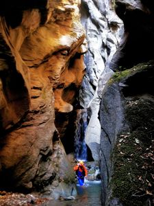
After a first narrow part of roughly 6 smaller waterfalls (up to 12m) it is possible to escape the canyon through an old "Suone" (water capture), some rappels later there is another one, just before entering the second narrow section, which has about the same length as the first one. Once the crag opens up, the difficulty of the canyon increases as the waterfall get bigger. It is possible to exit the canyon at this point. In the waterfall below the train bridge, there is a hanging pool which is tricky to get through.
Exit[edit]
The last boulders have not been equiped as there is nothing interesting to abseil, so take the steps next to the water pipes on the right to get out of the waterstream. The canyon ends nearby the parking, you just need to cross the Rhone river.
Red tape[edit]
Beta sites[edit]
 SwissCanyon.ch : Mundbach
 SwestCanyon.ch : Mundbach

