Santa Maria (Pordenone)
| Rating: | |||||||||||||||||||||||||||||||
|---|---|---|---|---|---|---|---|---|---|---|---|---|---|---|---|---|---|---|---|---|---|---|---|---|---|---|---|---|---|---|---|
| | Raps:10, max ↨26ft
Red Tape: Shuttle:None | ||||||||||||||||||||||||||||||
| Location: | |||||||||||||||||||||||||||||||
| Condition Reports: | 10 Aug 2014
"Most recent conditions reported at Catastoforre.AIC-Canyoning.it, see Trip Report for ful |
||||||||||||||||||||||||||||||
| Best season: | Jun - Sep
|
||||||||||||||||||||||||||||||
| Regions: | |||||||||||||||||||||||||||||||
Introduction[edit]
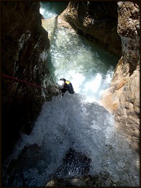
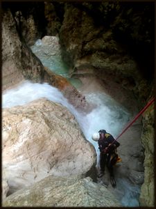
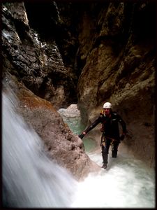
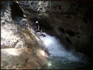
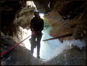
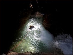
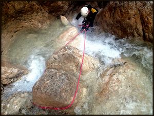
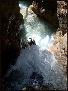
Rio Santa Maria is quite short but strong and impressive gorge. It's a quite deep and narrow canyon, formed in dolomite type of rock with somethimes strong flow of water and with cca. 11 very low waterfalls. Rio Santa Maria is located in wild valley Val de Santa Maria on right side of Val Cimoliana valley. Even it is short and not so fun we recommended this impressive and enclosed canyon.
Zone: Friuli – Pordenone – Cimolais (Val Cimoliana)
Dimensions: Entrance: 1170 m Exit: 1050 m Height: 120 m Length: 900 m
Period June-October
Times: Approach: 1,20 h Progression: 1.5-2 h Return: 20 min
Shuttle: No
Equipment: Expedition (insufficient) – multi monti spits (6mm) and ropes in hourglasses (clessidra) We went through the canyon with Corda Dana 10 mm ropes, but it is equipped for 9mm rope. We recommend you to have some cutting rope and maillons for the rappeling points or some extra bolts. There are 11cca. rappeling points in the canyon.
Rope: 1 x 20m
Biggest waterfall: 8 m
Possible exit Yes 1. After 1 hour no marked path on right .
Maps: Tabacco Number 021
Attraction: Local ( local with 4 stars of 5)
Basin: 3,05 km2
Difficulty: V3 a3 IV
Approach[edit]
From Cimolais follow the road signs for the Val Cimoliana valley to the toll hut ( toll 6 EUR per vechile in 2014). Continue through the valley up to the large parking area on the right at the enter of the Valle Santa Maria valley.
From the parking cross two streams (wooden footbridge over the first stream, for the second stream you find your own way, without bridge) and on the other side find the beginning of the path CAI 356-390. Follow this marked path to the junction, turn rigt on path CAI 356 (sign for Biv. Gervasutti). The path descends to the stream bed, cross the creek and shortly rises SE to a forest road. Briefly follow it (100m cca) to the place where marked path turns left and descend to the streambed again. Cross the Rio santa Maria and find the continaution of the marked path. This part of the path between crossing the streams in newly marked and it's different then in Tabacco map. The trail climbs steeply during the long series of hairpin bends on the left side of valley Santa Maria for 200 high meters. The trail then descends a little and rise again until the valley widens. Here you can first time downclimbing on the dry creekbed to the Rio Santa Maria streambed. We leave the marked path on approximately at 1290 meters.
Descent[edit]
400 m walking (15 min)
D 4m: right
D 6m: left
C 5m:1spit (6mm) (R)
C 6m:1 spit (6mm) (R)
C 4m: rope on hourglass-clessidra (R) C 4m: rope on hourglass-clessidra (L) C 5m: rope on hourglass-clessidra (L) D 3m
C 7m: 1spit (6mm) (L)
D 3m or rappel from trunk
C 4m : D or rappel from small stone in the river (not equippet)
C 6m: 1spit with rope (6mm) (R)
C 5m: 1spit (6mm)(L)
Possible exit on right (path)
C 8m: 1spit (6mm) with new maillon (L)
C 7m: 1spit (6mm)(R)
Exit[edit]
As ascent (15 minut).
Red tape[edit]
Beta sites[edit]
 Canyon.Carto.net : Valle Santa Maria
 Catastoforre AIC-Canyoning.it : Valle Santa Maria
Trip reports and media[edit]
Background[edit]
Checkpoint for the water level is not near the parking place, but higher where the marked path crosses the stream, witch divided into two parts. First descent: 24.9.2010 by P. Bolis, F. Cacace, D. Busatti, L. Guazzini First repetition 9.8.2014 by Georg Buol and David Sefaj 8Canyoning Cult Slovenia)
