Shake Tree Canyon
| Rating: | |||||||||||||||||||||||||||||||
|---|---|---|---|---|---|---|---|---|---|---|---|---|---|---|---|---|---|---|---|---|---|---|---|---|---|---|---|---|---|---|---|
| | Raps:9, max ↨165ft
Red Tape:No permit required Shuttle:None | ||||||||||||||||||||||||||||||
| Start: | |||||||||||||||||||||||||||||||
| Parking: | |||||||||||||||||||||||||||||||
| Condition Reports: | 5 Mar 2024
"The canyon was flowing moderately, pretty cold, nothing deeper than waist deep. 4 people, all in 3 mm full wetsuits with rain gear over and we were al |
||||||||||||||||||||||||||||||
| Best season: | BEST in Oct;Nov;Jan;Feb;Mar;Apr
|
||||||||||||||||||||||||||||||
| Regions: | |||||||||||||||||||||||||||||||
Introduction[edit]
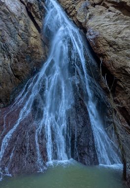
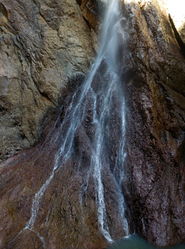
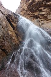
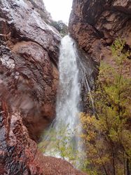
Shake Tree is a beautiful ravine/gully-style canyon with flowing water. Being spring fed, it has small flow most of the year even without recent rains. Descend the canyon in class C conditions for an optimal experience.
Approach[edit]
Approach 1
Starting at Barnhardt TH, hike along Y-Bar Trail which is an occasionally brushy but well-defined trail, and then scramble down to the streambed. Park at Barnhardt Trailhead: 34.092577, -111.422283, a large parking area that can accommodate more than a dozen vehicles. From the parking spot, look south for the trail sign. Soon after starting up the trail, be sure to take the branch left/straight to get on Trail 44. If you go up Trail 43 you will be heading up to Barnhardt Canyon, a much longer day. Stay on Trail 44 for about 2.4 miles, crossing 4 gullies (or dry streambeds) and then you will see a narrow scree field that the trail runs into. The drop in is just past this rockfall. Bushwack down about 200 or 300 feet in elevation (ref. KML track). Care should be taken to avoid the sharp cacti and yucca spikes. It will take about 1.5h to 2.5h to get to the streambed, the start of the technical canyoneering section.
Approach 2
4x4 approach. This route requires a high clearance. The trail is a fairly standard, moderate 4x4 trail with some ruts, gullies and rocky sections. Near the end there is a semi steep hill climb up loose rocks that could be a challenge without 4-low or aggressive tires. This route may marginally reduce hiking time and effort, but will NOT save much time overall, due to navigation of the 4x4 road. However, if you enjoy offroading and want a little extra adventure then air down your tires and enjoy the ride!
The social trail from 4x4 parking starts out good, then becomes faint as it weaves further up the ridgeline through juniper, manzanita, and a variety of cacti. Trace the ridge to Y-Bar trail. 1-2h and about 1.5mi from 4x4 parking to the first rappel.
Note: The south fork of the road which would be more direct is a private gated ranch that should not be used as a short cut. Reference the KML 4x4 track.
Descent[edit]
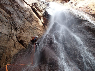
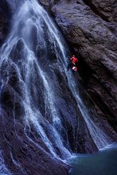
The technical section is short but packed with 9 rappels. Some deep wades may be encountered but swimming should not be necessary.
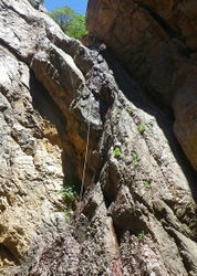
Be warned that many of the rocks in this canyon, even when dry, are smooth and slippery. Grippy shoes should be worn and knee and elbow pads should be considered. Several sharp edges also exist along some of the rappels. Be mindful of rope placement.
R1: 45’ rock pinch
R2: 40’ rock pinch
R3: 165’ tree Canyon Right
R4: 70’ tree
R5: 35’ tree high Canyon Left
R6: 75’ rock pinch
- High Water: 85’ tree
R7: 40’ tree Canyon Right
R8: 50’ rock pinch Canyon Right to first stage, then optional 15’ downclimb
- High Water: 65’ to the base of the falls
R9: 35’ rock pinch
Exit[edit]
Returning to Barnhardt TH
After the final rappel, continue downstream only a 1/4 mile or so to the canyon exit (34.06893, -111.42843). You will make your way left through the brush and then head straight up (around here: 34.069528, -111.427996) to the ridge above and then back to Y-Bar trail. The exit requires a bit of bushwacking and extreme care to avoid yucca and cacti. It is a steep ramp with about 800 ft gain. The exit can be rough for most beginners, yet is pretty standard for most seasoned canyoneers. Once at the top, however, it is a straightforward hike back to the car on the maintained trail.
Returning to 4x4 Parking
Continue down the brushy creek until just below your vehicles, then scramble 300 ft up the hillside back to the ridgeline. This ascent up to the ridge is notably less effort than the ascent back up to Y-Bar trail from just below the last rappel. As noted above, this option involves a less lengthy and strenuous hike but adds a 4x4 requirement and approximately 30-45min of offroading.
Red tape[edit]
Beta sites[edit]
 Super Amazing Map : Shake Tree Canyon
 OnRopeCanyoneering.com : Shake Tree Canyon
 HikeArizona.com : Shake Tree Canyon
Trip reports and media[edit]
- Stav is Lost Shake Tree Canyon (April 17, 2022)
- Facebook Album
EVEN FURTHER-SHAKE TREE CANYON
