Sotano Gavilancillo
| Rating: | |||||||||||||||||||||||||||||||
|---|---|---|---|---|---|---|---|---|---|---|---|---|---|---|---|---|---|---|---|---|---|---|---|---|---|---|---|---|---|---|---|
| | Difficulty:Pit Raps:1, max ↨110ft
Red Tape: Shuttle: Rock type:Limestone | ||||||||||||||||||||||||||||||
| Location: | |||||||||||||||||||||||||||||||
| Condition Reports: | 8 Apr 2021
"Surprisingly nice pit cave a short hike from Potrero Redondo. The cave was dry at this time of year. Nice formations, but short. We coupled this with |
||||||||||||||||||||||||||||||
| Best season: | All year
|
||||||||||||||||||||||||||||||
| Regions: | |||||||||||||||||||||||||||||||
Introduction[edit]
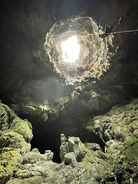
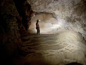
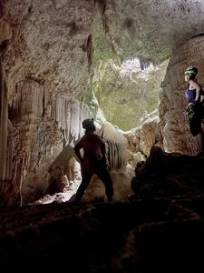
A nice pit cave near Potrero Redondo. The opening bells out into a free-hanging rappel, and down the second stage there is a very pretty ice cream cone formation for about 50 vertical feet that is downclimbable to the bottom of the cave.
Approach[edit]
The gps track describes the hike from Aldea Matacanes. To go from Potrero Redondo proper, add about 15 min to the hike each way. Follow the gps track, and also in 2021 orange flagging tape was tied through the woods to mark the trail.
Descent[edit]
The cave's opening is about 30ft across, and the pit bells out and drops in two stages. The same rope can be carried over to be used for the shorter second drop, about 30'. 100ft from the top plus some rope for rigging to the single bolt, using the tree behind it as backup. Both drops are free-hanging. From the bottom of the second drop, you can explore the ice cream cone formations and downclimb about 50' to the bottom of the cave. It can be slippery to get back up the ice cream cone formation, particularly in the rainy season, so you might want a second rope for this if it is wet. Even when dry there is one spot that requires a partner assist to climb up. Needless to say, bring ascending gear to climb back up the rope.
Exit[edit]
The hike is an out-and-back.


