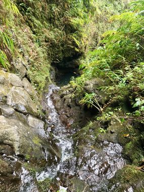
T5 Canyon (Honomanu Stream)
| Rating: | ||||
|---|---|---|---|---|
| | Raps: Metric
No Red Tape: Shuttle: | |||
| Location: | ||||
| Condition Reports: | (log in to submit report) |
|||
Weather: |
||||
| Best season: | ||||
| Regions: | ||||
Introduction[edit]
DO NOT ATTEMPT THIS CANYON. Cars are being burned at entry and exit points. There is a high likelihood of physical confrontation with local community on and off the road.
DO NOT ATTEMPT THIS CANYON UNLESS YOU HAVE ROPE AND COMPETENCY TO RAPPEL A 580-FOOT SINGLE PITCH. Since EMI (Eastern Maui Irrigation) un-diverted the water at the head of the canyon in 2017, the flow has been too great to safely rappel the nearly 600-foot waterfall unless in dry season and after a period of no rain. Another option is to descend neighboring T4, which lands you in Honomanu Stream just downstream from the bottom of the 600-foot waterfall. A short hike to see this exceedingly tall waterfall is very worth it.
Approach[edit]
Before committing to this canyon, observe the flow of Honomanu Stream at the highway, and keep a close eye on the rain forecast and cloud buildup. This is a huge drainage that requires stream-walking out for 1 mile directly in the stream. If flows are unreasonable for the big wall rappels, T4 is dry since the flow has been diverted out of T4, but the exit with a long stream walk must still be contended with.
Descent[edit]
There are 3 sections. The upper section involves rappelling down a 700 foot 4-pitch rappel. The middle section contains an approximately 1 mile stream walk with 2 nuisance rappels. The bottom section is the 580 foot waterfall rappel, which is typically done as a single pitch. If not bringing a 600 foot rappel, a drill and bolt kit is recommended as it is highly unlikely the re-belay stations will be there. There is a small cave/ledge about 1/2 way.
Exit[edit]
A 1 mile creek walk down Honomanu Stream. Check flow levels on the USGS stream gauge website and be very careful about the rain forecast. Although relatively flat and non-technical, creeking down this exit can be deadly in a flash and this is a rather large drainage.
Red tape[edit]
Beta sites[edit]
Trip reports and media[edit]
Background[edit]
555 aka Triple 5 or T5 estimated height of final waterfall
Incidents
Credits
In all habitats live animals and plants that deserve respect, please minimize impact on the environment and observe the local ethics. Canyoneering, Canyoning, Caving and other activities described in this site are inherently dangerous. Reliance on the information contained on this site is solely at your own risk. There is no warranty as to accuracy, timeliness or completeness of the information provided on this site. The site administrators and all the contributing authors expressly disclaim any and all liability for any loss or injury caused, in whole or in part, by its actions, omissions, or negligence in procuring, compiling or providing information through this site, including without limitation, liability with respect to any use of the information contained herein. If you notice any omission or mistakes, please contribute your knowledge (more information).
