Uerc
| Rating: | |||||||||||||||||||||||||||||||
|---|---|---|---|---|---|---|---|---|---|---|---|---|---|---|---|---|---|---|---|---|---|---|---|---|---|---|---|---|---|---|---|
| | Difficulty:4B III R (v5a2 IV) Raps:max ↨197ft
Red Tape: Shuttle:None | ||||||||||||||||||||||||||||||
| Location: | |||||||||||||||||||||||||||||||
| Condition Reports: | |||||||||||||||||||||||||||||||
| Best season: | Apr - Oct
|
||||||||||||||||||||||||||||||
| Regions: | |||||||||||||||||||||||||||||||
Introduction[edit]
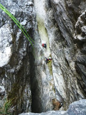
Rio Uerc is a creek at the south face of Monte Pisimone. It is a very wild canyon. The best time to go to the canyon is one day after the heavy rain, when other canyons are impossible to go through due to high waterlevel (it is interesting to go through only if you see the big waterfall from the main road in Ressuita. The highest waterfall is 110m high. Some rappeling points are hard to find and to reach. It is recomended to carry some pieces of cutting rope with you.
Zone: Friuli – Udine – Canal del Ferro (Ovedasso)
Qualities: Entrance: 1080 m Exit: 480 m Height: 600 m Length: 1300 m
Period April-October
Times: Approach: 1,5 h Progression: 4-5 h Return: 10 min
Shuttle: No
Equipment: Expedition (the highest waterfall is equipped sufficiently)
Rope: 3 x 60 m
Possible exit Yes
Maps: Tabacco Number 18
Attraction: Local
Difficulty: V5 a2 IV
Approach[edit]
From Tolmezzo, drive towards Moggio Udinese, follow the signs for Ovedasso. In Ovedasso, after you cross the bridge over rio Uerc, on the first crossroad turn left and drive uphill for 200m. Near a big building (not yet finished) the road finishes – park the car there.
From the building follow the path number 423. After an hour you will cross Stavioli Uerc (ruined buildings). Follow the path for another 10 minutes and when you reach the iron cross (blue-grey color), turn on badly visible path going left. Follow this path until you reach the stream.
Descent[edit]
D 3m
C 6m: rope through the stone sandhour (L)
C 15m: 1 spit and tree with rope (R)
D 5m
C 6m: rope in the centre of the boulder (barely visible)
C 15m: 2 spits with rope (L)
D + walking 150 m
C 10m: 1 spit with rope (L)
C 13m: 1 spit (L)
D 5m
walking 100 m
C 10m: 1 spit with rope (R)
D 4m
C 8m: tree (R)
C 30m: 2 spits with rope (R)
D + walking 100 m
Possible exit on the left (difficult)
C 10m: tree with rope (L)
C 7m: 1 spit (R)
C 2m (handrail): 1 spit + tree with rope (L)
C 110m: C 50m (2 spits with chain (L)) + C 60m (2 spits with chain (L) – on the ledge with enough space for 4 people)
Possible exit on the left
C 50m: tree with rope (R)
D + walking 100 m
C 8m: tree with rope (R) C 5m: 1 spit with rope (L) D + walking 100 m
C 8m: tree with rope (R) / C 3m + T 5m
C 12m: 1 spit with rope (R)
C 10m: 1 spit with rope (L)
Possible exit on the left (path crossing the stream)
D 4m
C 10m: 1 spit with rope (R)
C 8m: tree (L)
C 25m: tree with rope (L) - two cascades
C 12m: root with rope (R)
C 15m: 1 spit with rope (L)
C 30m: tree with rope (L)
walking 100 m
Exit on the left (follow the path marked with red dots)
Exit[edit]
Red tape[edit]
Beta sites[edit]
Trip reports and media[edit]
Background[edit]
Equipped by Canyoning Cult Slovenia in 2012 and partially in 2013
