Van Trump Creek
| Rating: | |||||||||||||||||||||||||||||||
|---|---|---|---|---|---|---|---|---|---|---|---|---|---|---|---|---|---|---|---|---|---|---|---|---|---|---|---|---|---|---|---|
| | Raps:
Red Tape:Permit required Shuttle: | ||||||||||||||||||||||||||||||
| Location: | |||||||||||||||||||||||||||||||
| Condition Reports: | |||||||||||||||||||||||||||||||
| Best season: | Sep-Oct
|
||||||||||||||||||||||||||||||
| Regions: | |||||||||||||||||||||||||||||||
Introduction[edit]
As of 2019, Comet Falls (Upper Van Trump Creek) has been descended, but the lower, more gorge-like section (including Christine Falls) has not been descended. As of 2024, Comet falls and upper van trump creek has been descended. (by you know who) Christine falls has not been descended.
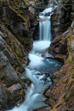
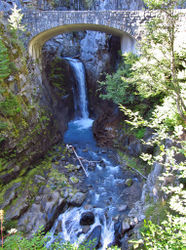
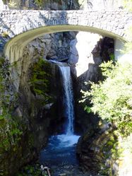
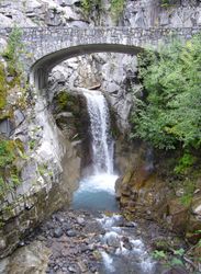
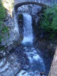
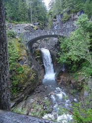
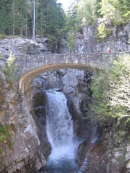
This canyon begins with the four-tiered Comet Falls (390'), one of Mount Rainier National Park's most spectacular. Below it, approximately 4-6 drops on two major waterfall features complete the upper portion of the canyon. For a half-mile, the creek continues in a broad, open gorge and parallels the Comet Falls trail. There are likely no rappels or notable features in this section. Below, the canyon narrows and deepens, with 4-6 additional drops and some challenging swiftwater features before culminating in the two-tiered Christine Falls (69'), one of the most photographed waterfalls in the park. A final section of deep canyon and at least one drop await before the exit.
This creek is fed by glacial melt from the Van Trump Glaciers, and its water is slightly milky in color. Water flow is actually very high in the summer, even late summer, when sun and heat melt the glacial ice. During cooler periods in spring and fall, the flow can be substantially less, especially on cloudy days. Observed water flows can be very low in winter, but the creek is buried deeply by snow throughout the winter season and Christine Falls is often coated with thick ice.
Approach[edit]
Parking: Park at the trailhead for the Comet Falls Trail; approach is via this trail. Parking is limited, with room for perhaps 20 cars, and the lot is often full due to the popularity of the Comet Falls hike. If parking is full, a few additional spots are available at the Christine Falls viewpoint, 0.25 miles up the road.
Upper Section (Comet Falls): Hike 2.8 miles and +1600 feet of elevation gain, and access where the trail crosses the creek on its way to Van Trump Park.
Middle Section: Very few features in this middle section appear to be worth doing. Using the trail is advisable between the upper and lower sections.
Lower Section (undescended): Hike approximately 0.8 miles up the trail (gaining 700 feet along the way), then cut cross-country to the west and drop into the canyon at about the 4200 ft elevation contour. (Since the lower section of the canyon has not yet been descended, further drop-in points may be possible and have yet to be explored.)
Descent[edit]
Comet Falls (Upper Van Trump Creek) has been descended as of 2017. However, anchor options are limited, which presents quite a challenge.
The lower sections of the canyon including Christine Falls and the sections directly above and below, have not had a documented descent (see "Red Tape" below for additional details)
Exit[edit]
Red tape[edit]
Multiple challenges present themselves in regards to a descent of Van Trump Creek:
- Risks: High water/hydraulic features throughout the majority of the year.
- Limited Anchor Options: Natural anchor options appear to be extremely limited in Van Trump Creek. The vast majority of the canyon is also within a wilderness area, which has strict policies on bolting. Making a descent of this canyon without proper bolts would likely be extremely difficult or impractical.
- Public View: There is a growing sentiment in the NW canyoning community to avoid canyoning at popular tourist areas. Christine Falls is one of the most photographed waterfalls in the park and would definitely fit into this category. The goal is to avoid drawing unwanted attention that could have consequences for the future of the sport, and/or cause issues with land managers. Fortunately, many new canyons are being opened in the Pacific Northwest every year, which means there are many other options to choose from for your canyoning trip.
It is worth noting that as of September 2017, the park has no policy in regard to canyoning and a permit is not required.
A day use fee ($25) or an annual National Park Pass is required for each vehicle to enter the park.
Beta sites[edit]
- Canyon Prospects in Mt. Rainier National Park: https://web.archive.org/web/20210527212206/www.canyoneeringnorthwest.com/Canyoneering_Prospects_In_Mount_Rainier_National_Park.php
- Lower canyon scouting trip, Sep 2017: https://www.flickr.com/photos/jeffbartlett/albums/72157685827486671
Trip reports and media[edit]
Background[edit]
Original information about this prospect was provided by Ira Lewis. Van Trump was later found to also be described on Canyoneering Northwest.
