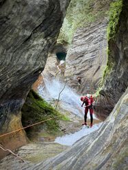
Agua Fria (Upper, Queretaro)
| Rating: | |||||||||||||||||||||||||||||||
|---|---|---|---|---|---|---|---|---|---|---|---|---|---|---|---|---|---|---|---|---|---|---|---|---|---|---|---|---|---|---|---|
| | Raps:8, max ↨148ft
Red Tape: Shuttle:None Vehicle:Passenger Rock type:Limestone | ||||||||||||||||||||||||||||||
| Start: | |||||||||||||||||||||||||||||||
| Parking: | |||||||||||||||||||||||||||||||
| Condition Reports: | 18 Apr 2025
"Just a light trickle moving through the canyon. Anchors in fine condition, though agree with others in that the R2 rebelay would be better positioned |
||||||||||||||||||||||||||||||
| Best season: | Anytime;EXCEPT in After rains
|
||||||||||||||||||||||||||||||
| Regions: | |||||||||||||||||||||||||||||||
Introduction[edit]
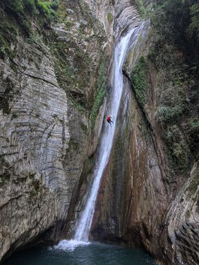
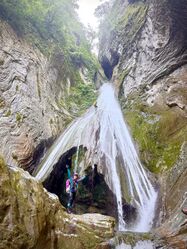
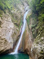
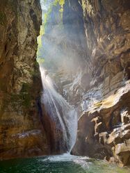
Agua Fria is a beautiful limestone canyon with large travertine rappels. The entrance and exit are straightforward and accessed via well-traveled paths. The KML/GPX can be trusted to keep you on the right track.
The canyon is accessed from La Barranca and has a steep vertical profile (i.e., it has many rappels in quick succession, with several being over 100 feet). The PG rating is due to exposure at several rappel stations, including one where it is best to exercise caution and ensure you are clipped into the next station before disconnecting from the previous rappel station.
Be sure to read the Queretaro region notes for more information on the area.
The information on this page is only for the upper section ("Agua Fria I"). The full route to Puente de Dios (including "Agua Fria II") would take a full day or more and involve a lot of difficult "creek walking." It is not described here.
There is another track crossing the creek about 1km after the exit. There is some canyon in here. After this, there isn't really any canyon. Though some nice creek walking. Flow at the intersection with La Barranca is substantially higher than in the upper technical section of Agua Fria.
Approach[edit]
The approach hike is about 45 minutes. From the elementary school at La Barranca, follow the old and well-worn path that climbs up and over the ridge to the north. You'll pass by an old church and some houses. Drop over the ridge and to the left. Stay just left of a field down from the saddle until finding the trail going down. Don't accidentally take the more straight ahead trail at the saddle; that's going to be your exit. From the saddle the approach trail drops quickly into Agua Fria.
Descent[edit]
- Downclimb 7m DCL (or 9m rappel from tree) to small pool.
- 7m slide (semi-slow) to large pool. (Alternatively: meat anchor or use logs at the top for an anchor.)
- R1 18m from bolts DCL to exposed anchor DCL in large alcove (R2). The pull from these bolts can be difficult. Recommend the last person rappel two-strand for an easier pull. (There is a bolt station DCR which would be a much easier pull, but these bolts need to be replaced.)
- R2 45m from exposed bolt station DCL down a huge travertine falls to waist-deep pool.
- R3 14m from single bolt DCL to pool.
- R4 42m from bolts DCR to big pool; pull is best from a ledge at far end of pool DCR.
- R5 6m from single bolt DCR.
- R6 24m DCL to midway pool then DCR to large pool.
Short walk.
- R7 21m from tree back DCR, to pool. Or 9m jump.
Short swim, DC channel to short swim.
- R8 21m bolts DCL to pool (these need upgrading, and ideally positioned for a in-flow line).
Continue downstream to wooden footbridge.
Exit[edit]
When you reach the small wooden footbridge, exit RDC. Follow this steep trail, staying to the right whenever you have a choice (just like on the approach, you can trust the KML/GPX to guide you out).
The exit hike is steep but well constructed having some excellent stonework – you’ll gain almost 1,000 vertical feet in half a mile.
Soon, you will return to the church and buildings on the ridge that you passed through on the approach.
Red tape[edit]
The property owner (at the saddle) tried to claim (November 2024) that he is now charging 80 pesos to use the trail exiting up. However, it sounds like the norm for the area is "right of way" on trails. Clarification is needed. Use your discretion, or hope no one sees you passing.
Beta sites[edit]
 Wikiloc.com : cañón Agua Fría
 Cañonismo.com : Agua Fria I
