Alder Creek (Christmas Canyon)
| Rating: | |||||||||||||||||||||||||||||||
|---|---|---|---|---|---|---|---|---|---|---|---|---|---|---|---|---|---|---|---|---|---|---|---|---|---|---|---|---|---|---|---|
| | Raps:5-6, max ↨140ft
Red Tape:No permit required Shuttle:Required 45 min Vehicle:High Clearance | ||||||||||||||||||||||||||||||
| Start: | |||||||||||||||||||||||||||||||
| Parking: | |||||||||||||||||||||||||||||||
| Shuttle: | |||||||||||||||||||||||||||||||
| Condition Reports: | 8 Aug 2022
"Flow: Completely dry creek bed at the top, then stagnant pools including one swimmer, only a trickle at R1-R4, some flow at R5. Water temps: The w |
||||||||||||||||||||||||||||||
| Best season: | Anytime (avg for this region)
|
||||||||||||||||||||||||||||||
| Regions: | |||||||||||||||||||||||||||||||
Introduction[edit]
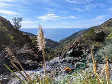
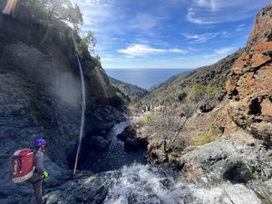
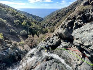
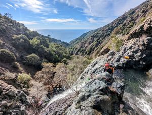
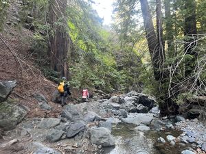
Christmas Canyon is so named for the red and green (Serpentinite?) rocks that blanket the technical section and for the fact that it's a winter canyon. Located on the coastal side of the Santa Lucia Range, Alder Creek starts near the old gold mining town of Manchester (Los Burros District) and cascades westward down the steep canyon, providing stunning views of the Pacific Ocean and lush redwood groves.
Christmas Canyon was first run a little over a month after the last significant rainfall, and the flow was very manageable. It is unknown how low the creek runs during the dry season, but there are signs of high flow during and following rainfall.
Approach[edit]
Following the shuttle route, drive down the offshoot from Los Burros road to Alder Creek Campground as far as possible. This road gets progressively worse, but there are a couple pull offs to park if you are not comfortable driving all the way to the camp. Once reaching the camp, follow the Buckeye trail along Alder creek until it crosses the creek.
Descent[edit]
Head away from the road on the Buckeye Trail until it crosses with Alder Creek. Either head down the creek following the path of least resistance to avoid branches/poison oak until the technical section, or (easier option to bypass some of the creek walking) cross Alder creek and continue along the trail until you reach a second creek/dryflow crossing right after the "silver peak wilderness" sign. Follow this drainage down to Alder creek.
Note: The Rappel lengths are rough estimates. All are definitely no longer than 150ft.
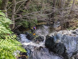
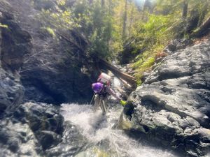
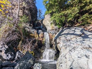
R1: 60ft from a tree LDC. Not super steep, can be downclimbed in low flow by staying in the watercourse.
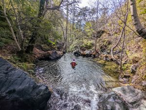
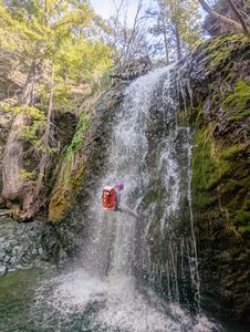
R2: 80ft from a redwood RDC. Nearly vertical drop into a deep pool.
R3: 60ft from a boulder LDC.
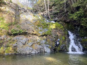
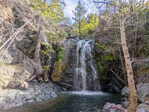
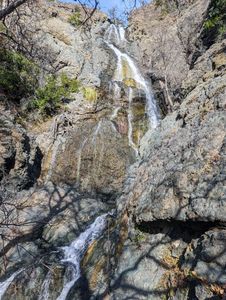
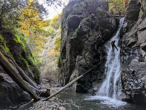
R4a: 80ft from a boulder RDC. This is the first step of the large falls known as Cinnamon Falls.
R4b: 140ft from a boulder/knot chock LDC. A tree RDC could also be used to avoid the flow.
After Cinnamon Falls there is a long and steep downstream creekwalk. In medium/low flow, the 20-30ft waterfall marked as “downclimb” can be safely downclimbed by descending RDC and then climbing up and over dry rock to a LDC gulley. Rope might be needed in higher flow.
R5: 70ft. This waterfall is separated from the main technical section by about a mile of creekwalking. We used a large dead tree lodged across the creek as our anchor, but there are also boulders and trees around if that tree is gone. It is known as Irideus Falls.
Exit[edit]
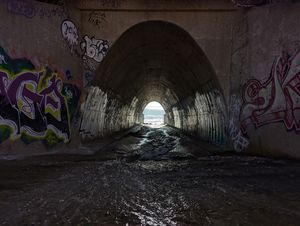
Shuttle: Walk down the creek until you reach the tunnel under Highway 1 that leads to the ocean. Find your way onto the highway and your shuttle vehicle. Note: the last 500-1000 vertical feet of creekwalking/scrambling is a little trickier and has more vegetation in the way. When you do this canyon in winter, be aware of sunset and start early to avoid navigating this portion by headlamp.
Non-Shuttle (untested, but should be feasible): After R4b, follow contour over to the next ridge LDC, then follow the ridge up until reaching the Buckeye trail, 750ft elevation gain.
Red tape[edit]
Beta sites[edit]
Trip reports and media[edit]
Background[edit]
Scouted by Felipe Roz Barscevicius and Boof Truchan in January 2022. First Descent by Felipe Roz Barscevicius, Boof Truchan, and Carly Robison in February 2022.
Alder Creek was the first documented oceanside canyon in the California Central Coast mountains and shows great potential for other drainages in the area. We encourage the further exploration of this region!
