Ape Canyon
| Rating: | |||||||||||||||||||||||||||||||
|---|---|---|---|---|---|---|---|---|---|---|---|---|---|---|---|---|---|---|---|---|---|---|---|---|---|---|---|---|---|---|---|
| | Raps:20-25, max ↨85ft
Red Tape:No permit required Shuttle:Optional 20min Vehicle:High Clearance | ||||||||||||||||||||||||||||||
| Start: | |||||||||||||||||||||||||||||||
| Parking: | |||||||||||||||||||||||||||||||
| Shuttle: | |||||||||||||||||||||||||||||||
| Condition Reports: | 23 Jul 2025
"This is a fun canyon to experience for the beauty and commitment. However, you should mentally, physically, and spiritually prepare for less-than-idea |
||||||||||||||||||||||||||||||
| Best season: | Aug-Sept
|
||||||||||||||||||||||||||||||
| Regions: | |||||||||||||||||||||||||||||||
Introduction[edit]
A narrow and extremely-committing majestic gorge descending from the Plains of Abraham on the northeast side of Mt. St. Helens. Ape Canyon was scoured out by lahars (volcanic mud flows) during the volcanic eruption in 1980, which reduced the mountain from 9677ft to 8363ft, leaving behind a mile-wide crater at its summit. Today, Ape Canyon is seldom descended; it has a relatively high pay-to-play.
- Ape Canyon can be run in a very long day by a strong, efficient team. Team members should be dialed on efficient anchor-building using a minimum of materials. It's good to start early, hiking up in the dark, then dropping into the canyon at first light. Give yourself plenty of daylight to complete the technical section and bushwhack out. Be prepared for an unexpected overnight mid-canyon if you end out moving more slowly than expected. Have an emergency callout in place and a plan for rescue.
- Teams should be prepared to rebuild every anchor in the canyon - anchors are primarily cairns, chocks, and rock pinches. Bring enough anchor material to re-rig at least 20 rappels. If your team is not proficient at downclimbing, you may need even more anchors. A bolt kit is also good idea for safety and to help avoid the possibility of sticking ropes. Teams should have sufficient experience/leadership & ropes/gear to "leapfrog" one another - i.e., one rigging team can move ahead and start working on the next anchor while folks are still coming down the previous one.
- Rockfall is a serious hazard in the upper canyon. Expect everything underfoot to be uneven and loose. This is a really bad place to have an accident. It's likely that the interior of the canyon gets re-arranged every year during the spring floods.
Watershed[edit]
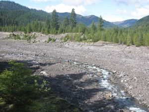
Ape Canyon has a watershed of about 1.8mi^2 which also encompasses the fragmentary Ape Glacier on the side of Mt. St Helens. The highest point is a formation on the crater rim known as the Dog's Head at about 7700ft elevation. The upper part of the canyon is usually dry, with water appearing somewhere around R5. Water increases slowly as one descends, coming from small tributaries and springs along the canyon walls. Water was definitely felt colder near the top of the canyon. Further down the canyon, there are more waterfalls and pools, but the water felt warmer. There are a couple very short swims.
- As a snow/glacial-fed creek, water in the chasm may be running higher on hot summer days. In 2023, after a week-long heat wave, wet sand and mud were encountered above R1 suggesting that the entire canyon may experience greater flow from time to time.
- Be aware: Ape Canyon, despite its relatively low elevation, collects avalanche snow during the winter months. Snow bridges, protected from the sun by steep canyon walls, may linger on well into the summer months. It may be wise to run the canyon only later in the year. No bridges were encountered in 2023.
Approach[edit]
It's best to set up a shuttle for Ape Canyon; otherwise, you're looking at a long uphill slog on the way out. (See "Exit" below.)
Lower Smith Creek Trailhead[edit]
From the Ape Canyon trailhead, backtrack southwest on FR 83 for ~0.6mi and turn left on the first dirt road just past the Lahar Viewpoint parking area. Follow this FR 8322 for 0.5mi, then bear left at a junction. Follow the road for down ~4mi to the Smith Creek trailhead. High clearance is nice for this road, but a 2WD vehicle can be driven with care. There are a number of campsites near the lower trailhead.
Ape Canyon Trail[edit]
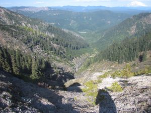
Return to the Ape Canyon trailhead, and follow the trail upward (~4.2mi, 1600' gain) to an obvious viewpoint looking down on Ape Canyon to the north. Continue a few hundred feet further along the trail and locate a safe route down the scree to the head of the canyon. The descent is loose; beware knocking rocks down on one another. (If it looks too steep, you may need to continue about 0.25mi further west along the trail to find a safe place to drop into the wash. Walk/scramble back downstream to the start of the canyon.) R1 is right there at the obvious start to the canyon.
- Mountain goats are sometimes seen in this area.
- If the Ape Canyon parking area is full (it's quite small and fills early), you might be able to park just down the road at Lava Canyon.
Descent[edit]
The beta that follows was updated in 2023:
2024 update: There was a lot of rockfall over the winter and many of the upper and middle canyon rappels have changed. The most accurate beta to know is, you are going to dig out and build pinch type anchors for the majority of the canyon. We only found four of the, perhaps, 20+ webbing anchors left in 2023, and two of those had to be replaced due to damage. Three bolts were installed in 2023, two were damaged, but useable, in 2024.
Upper Canyon[edit]
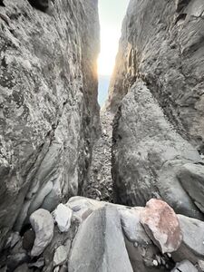
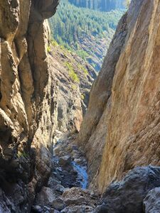
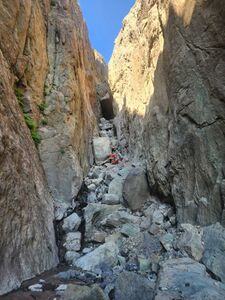
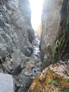
The upper canyon feels like an anomaly in the Pacific Northwest and has more in common with canyons found in the Colorado Plateau. This section of the canyon is dry, dusty, with high walls, and loses a lot of elevation in a hurry. There are some daunting views looking down-canyon. Be aware: there's lots of loose rock underfoot: either washed in from above, or fallen from the canyon walls. Watch your footing and take it carefully. Be aware: this beta may not be exact and there's a lot of downclimbing (or possible rappels depending on your team's level of comfort) that are not described here. Partner assists may be helpful in places.
- R1: 40ft from a manky anchor (used for winching snowmobiles out of the chasm?) located right at the top of R1. Rappel into a big cave-like space. When you pull your rope here, you're committing yourself to the entire descent. There is no escape before the bottom.
- In 2023, there was a crashed snowmobile at the bottom of R1. Unclear how long it's been here. Hope the operator made it out okay. It would be great to get this wreck out of the canyon.
- R2: 50ft down a crumbling pile of boulders.
- R3: 35ft from a rock pinch hidden under an overhang DCL.
- R4: The Bolt Hole - 50ft from a single bolt on boulder canyon center down through a rabbit hole. There are two impressive (car-sized) chockstones suspended between the canyon walls here. Rappel into another cave-like space beneath. 2024: This anchor now has large boulders piled above it and requires a meat anchor and assisted downclimb to access it. A better placement would be on top of the new mess of boulders.
- R5: 30ft.
- R6: 6ft nuisance rappel. (Possible downclimb DCR?).
Middle Canyon[edit]
After R6, water appears and the nature of the canyon changes. In August 2023, flow was low; just a trickling stream to keep you company. Continue down-canyon until the walls close in and you reach the next big drop at R7. This rappel is fully in the flow, so you may wish to suit up before rappelling this one. Below this point, the rappels come fast and furious.
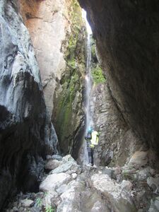
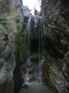
- R7: 100ft from the anchor, down through a 80ft waterfall. This is one of the narrowest parts of the canyon.
- R8: 20ft.
In 2012, a series of snow bridges were encountered somewhere in here spanning the entire canyon (i.e. old avalanche snow). No snow bridges were found in Aug 2023.
- R9: 30ft.
- R10: 30ft.
- R11: 15ft
- R12: 40ft from single bolt DCR.
- R13: 40ft
- R14: 40ft
Lower Canyon[edit]
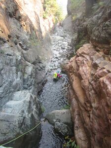
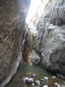
The beginning of the lower canyon is marked by an obvious, narrow tributary (with a little more water) entering DCL. The character of the canyon changes again, becoming narrower with more frequent short drops. There's a lot more exposed bedrock, more pools, and a couple short swims.
- R15: 15ft
- R16: 10ft from single bolt DCL.
- R17: 12ft
- R18: 10ft into a pool. (Could be a technical jump?)
- R19: 30ft
- R20: 35ft from unlinked bolts DCL into a pool.
A short distance downstream, the walls of the canyon fall away. Continue ahead through the creek 100 yards to find a lovely rock platform DCL. Looking back up, you can see the top of Ape Canyon far above. It's an impressive sight.
Exit[edit]
From the platform, it's about 1.4mi of off-trail hiking / creek wading to reach the Smith Creek trail. There are several more waterfalls along the way (20-40ft), but they can all be bypassed on one side or the other. From the platform, descend the obvious ridge DCL. Down at the creek, cross, and climb up the rocky embankment on the far side. This will put you in a nice mossy/open area to make rapid progress for a fair distance downstream. After this point, head downstream taking the path of least resistance, crisscrossing the creek as needed. Sometimes, there's nice bedrock to walk along the creek; other times it's more convenient to hop up on a bench on one side or the other. 2024: when the mossy open areas end and you find yourself in the forest, we found an elk trail 100ft DCR of the creek that ran almost all the way to the smith creek trail. Only the very end of the bushwack required a few easy creek crossings but try to travel DCR when you have a choice.
Upon reaching the obvious Smith Creek trail, turn right and follow it about 2.7mi (+200ft gain) to the Muddy River. If the water's low enough, drop down and cross to the far. In 2024, there were 2 logs placed across the river, one to walk on and the other a hand hold, easy crossing! On the far side, continue downstream and climb up a mountain bike trail to the parking lot.
- If the river's running too high to cross safely (might be high on a hot summer day), continue southwest on the trail towards Lava Canyon, cross at the hiker bridge, then backtrack on the opposite side of the river. This will add +2mi, 300ft gain.
- If you don't have a shuttle, you can hike the mountain bike connector that links the Smith Creek trail to the Ape Canyon trailhead. The junction for this trail is ~0.3mi before reaching the Muddy River. This will add +3.2mi, and 1200ft elevation gain.
- The Lava Canyon trail is another possible exit route up to the Ape Canyon trailhead. Check ahead to time to be sure this trail is open. There was a sketchy exposed traverse on the trail in 2015. Otherwise, it's a pretty neat exit, hiking up past numerous waterfalls along the Muddy River. There are some ladders to climb. You will need to hike a short distance along the road between the Lava Canyon and Ape Canyon trailheads. Expect lots of tourists at the top. Stats: +2.8mi, 1200ft gain.
Red tape[edit]
A Northwest Forest Pass is required to park at the Ape Canyon trailhead. No pass is required at the Lower Smith Creek trailhead.
Beta sites[edit]
 CanyoneeringNorthwest.com (archive.org) : Ape Canyon
Trip reports and media[edit]
Background[edit]
Ape Canyon gets its name from an alleged violent incident that took place in 1924 when a group of miners in a nearby cabin were attacked by a posse of "ape-men" (aka sasquatch). William Halliday (director of the Western Speleological Society) theorized, in a 1983 pamphlet, that the attackers were actually kids from the local YMCA youth camp at Spirit Lake who were throwing rocks into the canyon after dark, not realizing anyone was below. Whatever the truth, in 1969, Skamania County adopted an official ordinance for the protection of sasquatch (Ordinance No 6901). It's still on the books as of 2023. Please report any encounters with hostile ape-men.
- Wikipedia - The 1980 Eruption of Mt. St. Helens - this is a fascinating read.
- The first descent of Ape Canyon post-eruption was likely in October 2011 by Benjamin Hoffman, Sam Kellogg, and Erik Lundgren.
Further Explorations[edit]
Ape Canyon's northern branch has yet to be explored ... and looks even more technical.

