Arroyo Blanco Canyon
| Rating: | |||||||||||||||||||||||||||||||
|---|---|---|---|---|---|---|---|---|---|---|---|---|---|---|---|---|---|---|---|---|---|---|---|---|---|---|---|---|---|---|---|
| | Raps:3-5, max ↨82ft
Red Tape:No permit required Shuttle:Optional 5.0km Vehicle:High Clearance Rock type:Limestone | ||||||||||||||||||||||||||||||
| Location: | |||||||||||||||||||||||||||||||
| Shuttle: | |||||||||||||||||||||||||||||||
| Condition Reports: | |||||||||||||||||||||||||||||||
| Best season: | Anytime, flows all year
|
||||||||||||||||||||||||||||||
| Regions: | |||||||||||||||||||||||||||||||
Introduction[edit]
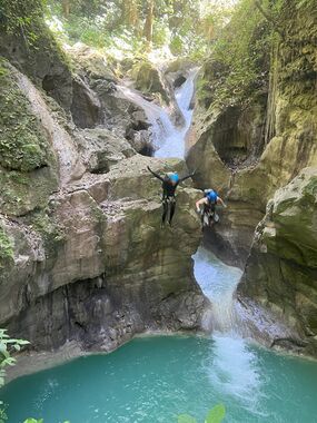
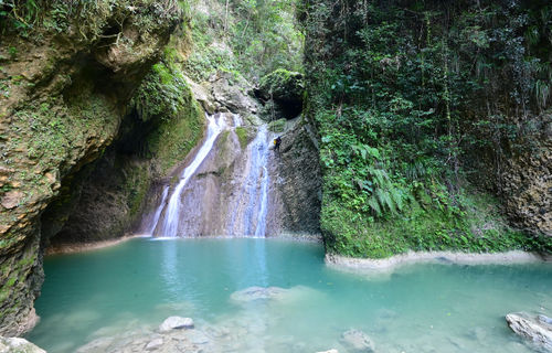
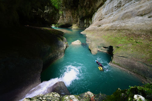
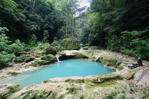
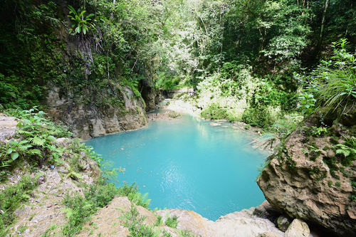
Arroyo Blanco Canyon is a fantastically fun and beautiful route easily doable in a day. The surreal blue water in the verdant jungle makes this one especially photogenic. Tour companies run tours here once or twice a week, but generally only over the very first section. Locals appear to have no opposition to, and are happy to welcome, independent canyoneers.
The route is not very difficult and the logistics are easy. It can be run year round, but obviously should be avoided during or right after heavy rain. Throughout the wet seasons, flows are higher and it can be more challenging. In the dry seasons (January-April, July-August), the middle section mostly dries out and presents some extremely deep keeper potholes which will require at least one sketchy traverse to avoid, with bolts available. Most of the canyon is still flowing good throughout the year, even in the driest periods.
As with all canyons in the DR, always ask permission from locals to park, and to make sure your car will be safe. Locals are generally friendly, but may offer you wrong advice on the canyon despite meaning well. ‘It’s best to go with a guide’ is a common refrain for all outdoor activities in the DR, even though there’s no known rules that say so for this canyon. Nor would any moderately experienced canyoneer with this page’s beta need a guide! It’s logistically simple, and most locals that try to steer you towards guides have never done the canyon themselves. Culturally, Dominicans are generally very averse to any sort of adventure, including day hikes, and overwhelmingly will pay for guides. There are valid reasons for doing so in certain places in the country, such as poorly marked trails or assaults on solo travelers, but this canyon is not one of those places. The canyon is easily doable by independent canyoneers with proper equipment, experience and beta. Enjoy.
Approach[edit]
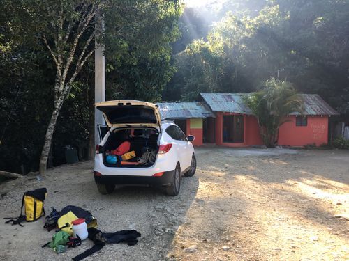
Drive down the dirt road. It’s best to have a vehicle with high clearance for this route (as you absolutely should for all the DR due to giant speed bumps and potholes). Park at or near the GPS point. It’s a sharp right-hand curve marked by a house. Ask the local women if it’s ok to park there, and don’t be shy to offer maybe 200 pesos ($4 USD).
You will be walking back the entire road on the return, so if you don't have a vehicle with high-clearance, you can leave your vehicle at the top where it is still paved. There is a small convenience store up there. Recommended to ask someone to watch your car and pay them a few hundred pesos. Bear in mind that if you decide to park at the top, there will be a lot of people around and you are more likely to be approached by someone wanting to impose their 'guiding services' on you.
Walk down the stairs at the parking area and suit up at the stream's edge, to minimize hassling by the guys wanting to sell you a guide. The water begins immediately and the first rappel not long after.
Sadly, this first part of the canyon can be lined with trash. The locals are so proud of this majestic canyon, and speak so highly of tourism and the money it brings them, but continue to throw their trash all over. The DR has decent trash collection service in most areas, yet littering remains an enormous problem (but that’s another discussion). Regardless, the trash quickly ends, and the canyon begins.
Descent[edit]
Less than 5 minutes after leaving the parking area is the first jump of around 3 meters. Continue down the slippery rocks. Another few minutes later is the first rappel.
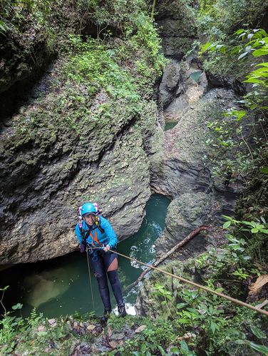
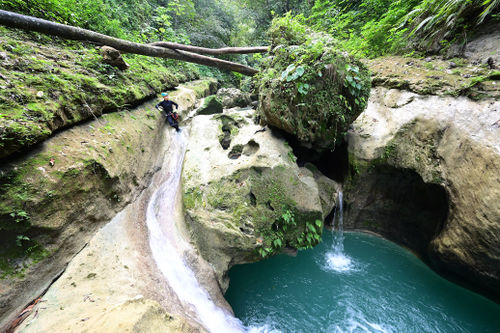
R1: Traverse line to bolt DCR near tree. 25m down to pool.
For R1, you’ll likely want to belay off a bolt on the left to access the anchor on the right. A slip here would result in a >20-meter fall into deep water. Some jump this, but you can’t see the landing from above, and you have to jump out far. You better know what you’re doing if you jump this one!
Continue a few minutes downstream to find R2.
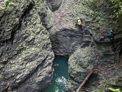
R2: 6m then 25m.
R2 has two bolts on the downstream side of a boulder in the middle of the canyon. You can rappel these bolts 6m, or downclimb. Next 3 bolts & chains are then found high up on a right-hand boulder. This rap takes you down to the deep pool below. This pool should be clean to jump, and is rumored to have been jumped from a ledge on canyon right of around 25 meters. Check first...
Continue down canyon for ~30 minutes.
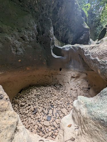
There are a few fun jumps and swims, and then, if it's the dry season, the water disappears beneath the ground. There's lots of boulder-hopping and creek walking, then you'll come to a section with huge keeper potholes, bypassed on the left.
R3: Traverse line to tree. Then 20m down.
At the first big drop after the potholes, stay high and to the right. You need to run a traverse line from bolts out to the tree anchor. Don't descend into the inviting corridor pool, there is no anchor down there.
While here at the tree, look downstream and observe the wall at the end of the pool below, and figure out your plan (see below).
Once below R3, if the wet season, swim across the pool. If the dry season, you’ll have to awkwardly climb out of the pothole on the right, and do a sketchy traverse along the wall. This traverse is protected by two bolts. For the first person on belay, a fall on these slippery rocks would result in a bad and painful pendulum swing (which is the reason for the PG rating). The traverse is really not that bad, however, and a fall seems unlikely. For subsequent members of the group a traverse line can be rigged on the bolts for safety.
R4: 4m or jump
After the traverse is R4, which can easily be jumped. Scout first. Swim across the pool and continue down canyon. The flowing water, if the dry season, soon returns.
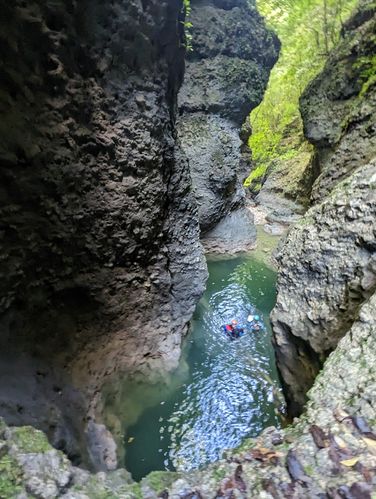
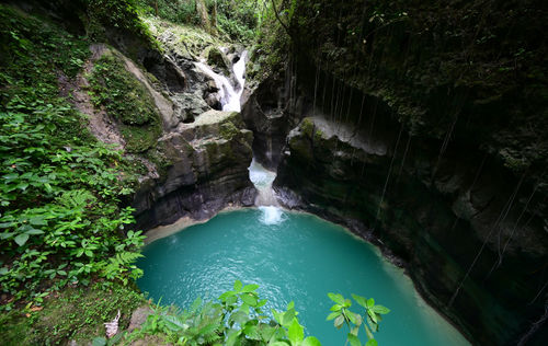
The flow picks up, with some incredibly beautiful pools and jumps.
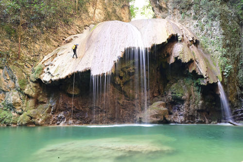
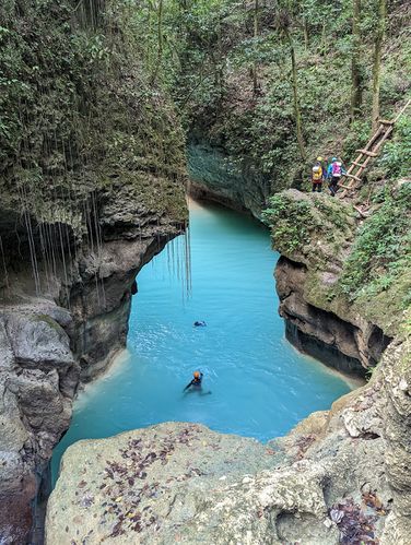
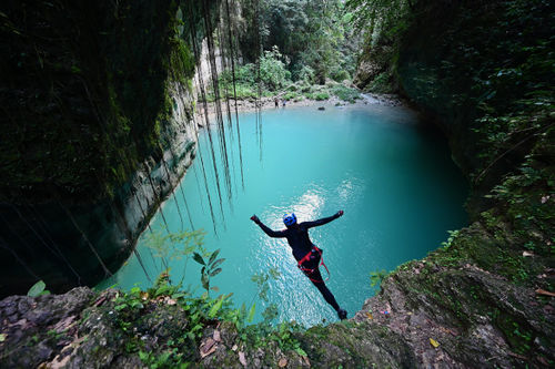
You'll then reach the outstanding Cola de Pato (Duck’s Tail). There is a collapsing wooden ladder DCR used to reach a balcony. From here, you can jump 8-12m, or rig an anchor from a tree for those who prefer to rap.
Downstream from this huge pool are more beautiful and smaller pools, some of which can be jumped.
Soon you will reach a gorgeous and very distinct slide. Scout first, but this slide dumps you into a deep pool with a long swim. Beware it can be a little bumpy as the slide carries you up the wall-ride corner.
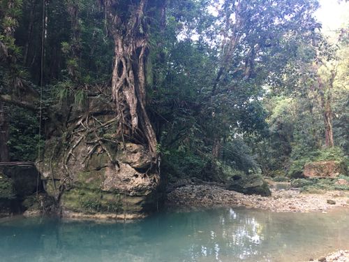
A few minutes later, the canyon sadly ends. Time to exit at the distinct tree growing from a rock outcrop.
Exit[edit]
There are one or two midpoint exit trails in this canyon that locals may tell you about. Even with GPS coordinates for these exits (which no one has recorded) you’ll probably never find these very faint trails, despite their weekly use by groups of tourists. Plan on finishing the canyon and taking out at this page’s described exit.
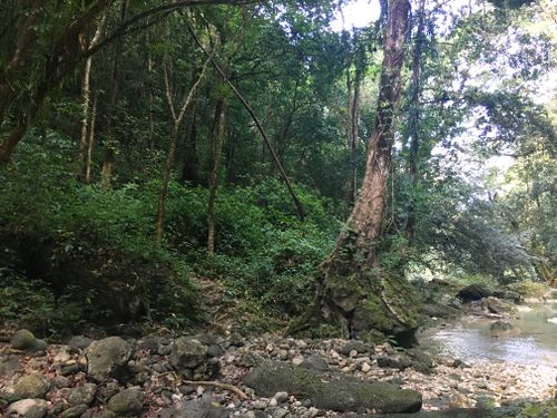
After the last obstacle, which is the toboggan slide, continue downstream about 100 meters. You’ll see a very distinct tree on the left bank with lots of roots on top of a house sized boulder. Just 10 meters after this boulder, on the left (west) side of the canyon is an obvious trail. This is your exit.
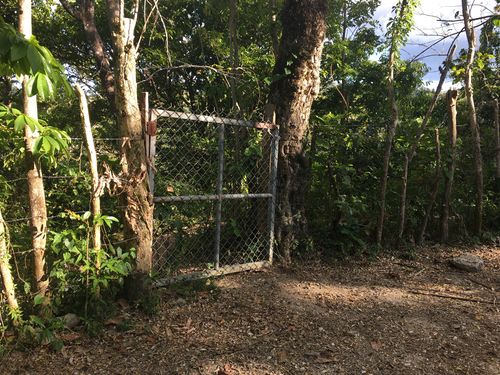
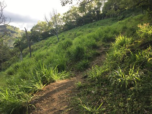
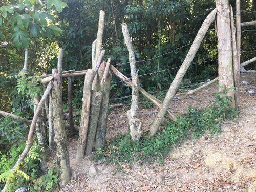
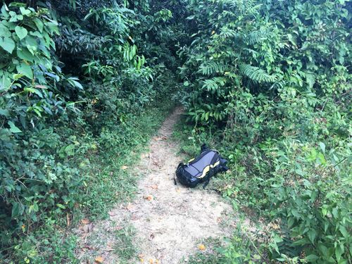
Head up this trail. You’ll spend around 25 minutes on this very distinct and steep trail, going up through the forest. This trail will then intersect with a larger path, where you’ll have to pass through barbed wire or through a metal gate. When you get to this point, head left on this larger path. It will briefly go down, then up, across fields, and then into the forest, passing though a cattle gate.
Keep following it, coming to a T-intersection in the forest. Turn right, and walk uphill. After only a minute or two, you’ll have to pass through a cattle gate. After a few more minutes going uphill, you’ll come out at a house and the dirt road.
If you chose to use a shuttle, your second car should be parked near here, saving about 45min of walking. If not, it’s a 3.6 kilometer walk to the left back to the start of the canyon where your car is, all on a dirt road with only mild elevation gain.
In addition to this description, use a GPS, with satellite images, to navigate. No trails in the entire DR seem to ever have any signs to help you.
Red tape[edit]
Local guides indicate you must buy a permit. There's no signs saying this, no known written rules confirming it, and no stated price of the permit per the guides. Nor is there any specific place to buy a permit. If in doubt, just leave a few dollars with the women at the trailhead.
Beta sites[edit]
Trip reports and media[edit]
https://www.lukaseddy.com/canyons-of-the-dominican-republic
Background[edit]
The first descent is unknown. Local villagers appear to have known about most parts of this canyon for decades or centuries, as there are farms very close by. Two tour guides, possibly Helmut and Alberto (?) may have done the first descent around the year 2000, searching for a route for tourists. As of 2022, they are still guiding, and Alberto literally jumps every rappel, up to 22 meters, and does not use a helmet, with no accidents in his hundreds of descents.
