Ash Creek Canyon
| Rating: | |||||||||||||||||||||||||||||||
|---|---|---|---|---|---|---|---|---|---|---|---|---|---|---|---|---|---|---|---|---|---|---|---|---|---|---|---|---|---|---|---|
| | Raps:6, max ↨175ft
Red Tape:No permit required Shuttle:None Vehicle:Passenger | ||||||||||||||||||||||||||||||
| Location: | |||||||||||||||||||||||||||||||
| Condition Reports: | 12 Jun 2025
"I created an account to write this review because I wanted to share trail conditions with folks.. First off, we had it easy; the water was still f |
||||||||||||||||||||||||||||||
| Best season: | Spring;Summer;Fall
|
||||||||||||||||||||||||||||||
| Regions: | |||||||||||||||||||||||||||||||
Introduction[edit]
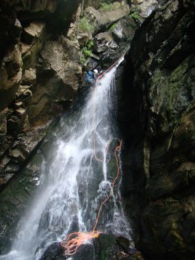
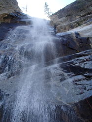
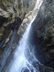
For Class C aficionados, this may be one of the best and most technical canyons in AZ, with a 175-foot waterfall rappel to kick off the technical section, a large multi-pitch waterfall drop through a slot, with mandatory waterfall crossings while on rappel, and multiple other cascades to navigate when in high flow.
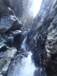
IN HIGH FLOW THIS CANYON SHOULD NOT BE ATTEMPTED BY ANYONE WHO IS NOT AN EXPERT IN SWIFT WATER CANYONEERING. The "Dark Chasm" is the crux and it a test of wills if not performed efficiently.
No audible nor visual communication is possible in the "Dark Chasm" due to the noise of the waterfalls and the geometry.
WATER-PROOF RADIOS ARE HIGHLY RECOMMENDED.
If you reach the "Dark Chasm" and find water to be too high, you can abort the descent by climbing up on canyon left. But once you start the rappel into the "Dark Chasm" any escape will be impossible till the next section.
There is plenty of great camping at the trailhead via Columbine Campground! First come, first serve, pay at the sign.
Approach[edit]
Park at the Columbine Campground. Follow Ash Creek Trail #307 straight out of the campground for quite a ways. You will eventually turn off the trail (reference GPS file) and stay in the water course. After some sculpted slick rock sections, you come across your first rappel.
Descent[edit]
R1: 175' Tree DCL.
Continue down watercourse until the walls start to slot up. Downclimb log across pool over to R2; the first rappel of the "Dark Chasm".
R2: 90' Rock pinch DCR. (Rappel OVER rock, not down through "rabbit hole", to avoid rope getting stuck) Pass 1st shelf, stop at 2nd shelf.
R3: 170' Rock pinch DCL. This will take you to the bottom of the "Dark Chasm". The rappel bends around a few corners, watch rope placement!
R4: 140' Tree DCL immediately outside of slot or possible anchor in watercourse DCR
R5: 50' Rock sling in watercourse after downclimb
R6: 160' Tree DCL
Exit[edit]
Hike down the watercourse a short ways to the faint trail on canyon left that heads steeply up switchbacks. (Reference GPS File)
Red tape[edit]
$5 day use fee at Ash Creek TH. $15 per day to camp at Columbine Campground. Pit toilets available at TH.
Beta sites[edit]
 Super Amazing Map : Ash Creek Canyon
 HikeArizona.com : Ash Creek Canyon
 Arizona Technical Canyoneering Book by Todd Martin : Ash Creek Canyon
 OnRopeCanyoneering.com : Ash Creek Canyon
Trip reports and media[edit]
- https://www.facebook.com/pat.winstanley.7/media_set?set=a.419621288096574.95155.100001461198708&type=3
 Candition.com : Ash Creek Canyon
Background[edit]
POINTS OF INTREST
Trailhead Parking: 32.70630, -109.91300, elevation 9,503 ft, at Columbine Campground
Trail Junction: 32.71243, -109.91018, go right over creek
Meadow: 32.71868, -109.90508, Mount Graham Mill Site relics
Leave Trail on Approach: 32.72312, -109.90211, trail turns left, stay straight following creek
Down Slickrock: 32.72740, -109.89550, elevation 8,292 ft, leave trail and head down canyon left
Camp Site: 32.72921, -109.89373, cross creek to camp on canyon right
First Rappel: 32.72979, -109.89397, Ash Creek Falls
End of Dark Chasm: 32.73177, -109.89198
Exit Up Switchbacks: 32.73380, -109.89120
Top of Switchbacks: 32.73480, -109.89470, elevation 7,669 ft, head southwesterly and up
Trail Junction: 32.72898, -109.89509, stay on trail right


