Badger Canyon
| Rating: | |||||||||||||||||||||||||||||||
|---|---|---|---|---|---|---|---|---|---|---|---|---|---|---|---|---|---|---|---|---|---|---|---|---|---|---|---|---|---|---|---|
| | Difficulty:3A III (v3a1 III) Raps:4-5, max ↨60ft
Red Tape:No permit required Shuttle:Optional Vehicle:Passenger | ||||||||||||||||||||||||||||||
| Location: | |||||||||||||||||||||||||||||||
| Condition Reports: | 12 Dec 2025
"Descended the North Fork via South entry point (North entry point looks to yield an additional 60’ drop that looks nice!) We fixed all our ropes, we |
||||||||||||||||||||||||||||||
| Best season: | Fall;Winter;Spring
|
||||||||||||||||||||||||||||||
| Regions: | |||||||||||||||||||||||||||||||
Introduction[edit]
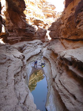
This is one of the most accessible Grand Canyon canyons. There are 2 different technical routes to choose from - North Fork or South Fork - as well as 2 different river exits.
This canyon usually has some deep pools that are avoidable and lots of mud. In the wet season more pools appear that are not avoidable.
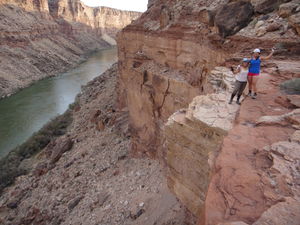
Most people exit by ascending back up the ropes. However, those of us that have hiked it out believe the most spectacular part of the canyon might actually be the exit. The hike out is a strenuous bushwhack along the Colorado river going upstream for two miles (Todd Martin's calls it a "leisure walk" but it's not true). Then comes a strenuous climb up a series of ledges along the Grand Canyon vertical walls. This option is not for everyone, but the scenery is spectacular. Alternatively, a slightly shorter southern exit hike also involves boulder hopping along the river, some class 4 scrambling, a short 5th class pitch, and is also beautiful.
Approach[edit]
There is a parking area on left side of highway near start, from here hike across flat desert to drop in. Alternatively, you can follow dirt trails a bit further down to get even closer to the drop in, which would make sense if ascending the raps or shuttling. However, this brings your vehicle further from the exit if not shuttling (lots of primitive camping options in this area too!).
If you are doing the full route then a short shuttle can be set to slightly cut back on the exit hikes.
Descent[edit]
Depending on which fork you choose, you'll have different obstacles...
South Fork Sequence
R1: 50' rock pinch LDC
R2: 40' bolt LDC (or stop short on first ledge to downclimb around pools) overhung
R3: 40' boulder RDC
R4: 60' boulder LDC overhung
North Fork Sequence
R1: 40' chockstone on ledge RDC
R2: 60' boulder LDC
20' chute downclimb in watercourse or ledge downclimb further LDC.
R3: 50' rock pinch LDC
Both forks converge into Badger Creek (usually dry) where, after a few downclimbs, you come across the final rappel...
Final Rap: 35' boulder & natural arch LDC overhung
Exit[edit]
"Spectacular scenery will await those that will dare to hike it out rather than ascend the ropes back out." Lucach.
Exit 1 = Re-ascend your ropes
Go back up-canyon.
Exit 2 = South
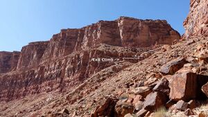
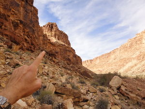
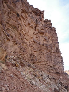
The Southern exit route starts with roughly 1 mile of boulder hopping downstream. Stay close to the river, avoiding the brush when possible. You will come to a drainage as shown on the map. Continue past the drainage, head up along the far side of the berm forming the south edge of the drainage, climbing steeply until you reach the cliffs which are ascended with some class 4 scrambling that ends in one 5th class move. Follow the drainage until you can easily walk out, staying high left up canyon next to the cliff band. A faint social/game trail with sparse cairns will keep you high on the south side and out of the drainage below. Once on top of the ridge and canyon opens up, head left/west to skirt around the deeper parts of some minor tributaries to Badger. This exit is 4.5 miles total.
Photos by Richard Pattison below:
Exit 3 = North
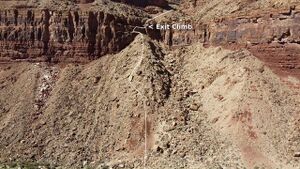
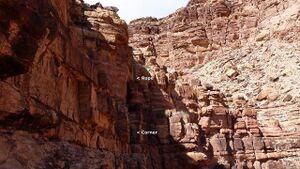
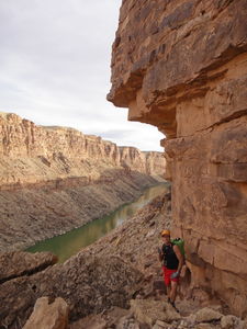
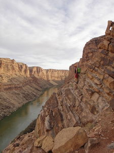
The Northern exit route starts with roughly 2 miles of boulder hopping along the shoreline until reaching a spot to where you can scramble up loose rock/scree to the cliff band above. From here traverse back along a very narrow edge to a large drainage following it up and out, finally crossing the open desert to meet up with the dirt road. This exit is 5.25 miles total.
Photos by Lucach below:
Red tape[edit]
Some choose to packraft to Soap Canyon to exit. This requires a permit from the NPS, even if you are not overnighting. The River Assisted Backcountry Travel (RABT) permit can be obtained by calling the Grand Canyon National Park backcountry information center.
Beta sites[edit]
 ToddsHikingGuide.com : Badger Canyon
 CanyonChronicles.com : Badger Canyon
 HikeArizona.com : Badger Canyon
 Grand Canyoneering Book by Todd Martin : Badger Canyon - North Fork
 Grand Canyoneering Book by Todd Martin : Badger Canyon - South Fork
 Arizona Technical Canyoneering Book by Todd Martin : Badger Canyon
 Super Amazing Map : Badger Canyon
Trip reports and media[edit]
- http://www.bogley.com/forum/showthread.php?34138-South-Fork-Badger-Marble-Canyon-AZ-02-14-2009
- https://www.facebook.com/pat.winstanley.7/media_set?set=a.428602500531786.97333.100001461198708&type=3
 Candition.com : Badger Canyon
- http://adamhaydock.blogspot.com/2017/03/badger-canyon-seven-mile-draw-grand.html : Badger Canyon
- Gallery July 1, 2012 by Christian Lupercio
 YouTube.com : Richard Pattison, Badger Canyon movie
