Big Kahuna Canyon
| Rating: | |||||||||||||||||||||||||||||||
|---|---|---|---|---|---|---|---|---|---|---|---|---|---|---|---|---|---|---|---|---|---|---|---|---|---|---|---|---|---|---|---|
| | Difficulty:3B III (v3a2 III) Raps:4-5, max ↨140ft
Red Tape:No permit required Shuttle:None Vehicle:Passenger | ||||||||||||||||||||||||||||||
| Location: | |||||||||||||||||||||||||||||||
| Condition Reports: | 4 Mar 2023
"About a foot of snow at the drop in for lower section. Ice within the watercourse was minimal and did not present any issues. Snowmelt had produced so |
||||||||||||||||||||||||||||||
| Best season: | BEST in Feb;Mar;Apr
|
||||||||||||||||||||||||||||||
| Regions: | |||||||||||||||||||||||||||||||
Introduction[edit]
Big Kahuna Canyon is the shortest technical canyon in the Mazatzal Mountains, and as with all the others, is quite a bit more fun when flowing well with water - unfortunately (and perhaps not surprisingly for Arizona) this is not always the case.
Best conditions can typically be found in the spring months given there has been some snow to melt or enough recent rains to run off the slopes of the mountain to feed the deep red gorges of the range.
The hike begins and ends at Barhardt Trailhead in the town of Rye, AZ. The trailhead can be reached by driving 5 miles west on Barnhardt Rd (usually well-graded dirt, though it can get a bit muddy and close to impassable after heavy rains) which is just north of mile marker 239 on AZ87 - the trail begins at the south end of the parking lot.
Approach[edit]
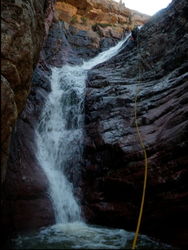
Starting off on Barnhardt Trail you will pretty quickly come to the split with Y-Bar Trail. Turn right to stay on Barnhardt Trail heading west. The trail winds its way up the mountain above Barnhardt Creek which can be seen below and might give an impression of how water flows are in the area. At 3.4 miles you will reach Big Kahuna Canyon, the falls of the first rappel can be seen with a very short detour up canyon to the south - this is also a popular hiking destination. The canyon above the trail has one 140 foot rappel, but takes a steep, bush-wacking detour to get there so is optional.
To get above the first falls continue hiking up Barnhadt trail another hundred feet or so before leaving the trail to the left up the steep, brushy slope. The going is made easier by staying in the minor rocky washes along the way, but thick stands of manzanita make the going fairly slow. Head up the slope to the west, then south to round the cliffs of the rocky outcrop on your left. Once over the saddle, head down the slope (less brushy but more steep) on the other side to enter the canyon.
Descent[edit]
The first rappel is down canyon a short distance from the drop in.
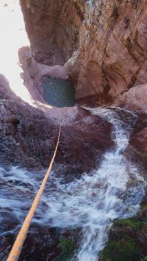
R1: 140’ off bolts RDC. Two-stage. There is a deep pool at the first stage (about 30’ above the bottom of the drop) that can be bypassed by carefully clinging to the wall LDC while still on rappel.
After this drop you will reach the trail you hiked in on, continue down canyon (or begin the route here if skipping the upper falls) roughly another half of a mile before reaching the second drop.
R2: 45’ anchored from a pinch point LDC through a small rabbit hole.
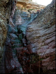
R3: 65’ anchored from a tree in the watercourse. There is a short, but deep pool at the bottom of this drop. The final tier in this section is often bypassed RDC.
R4: 50’ anchored high off a tree RDC.
R5: 25' anchored from rock pinch LDC, or rabbit hole rappel / downclimb center canyon. Alternatively, this obstacle can be scrambled around RDC through the brush.
Shortly after the canyon comes close to the Barnhardt Trail. (.9 miles in the canyon overall). Reference the KML track and find the exit trail on the right.
Exit[edit]
Once you reach Barnhardt Trail, turn left for the return hike of about two miles back to the trail head.
Red tape[edit]
Beta sites[edit]
 Super Amazing Map : Big Kahuna Canyon
 HikeArizona.com : Big Kahuna Canyon
 WildPathsAZ.com : Big Kahuna Canyon
Trip reports and media[edit]
 Candition.com : Big Kahuna Canyon


