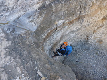
Bighorn Canyon (East Fork)
Jump to navigation
Jump to search
| Rating: | |||||||||||||||||||||||||||||||
|---|---|---|---|---|---|---|---|---|---|---|---|---|---|---|---|---|---|---|---|---|---|---|---|---|---|---|---|---|---|---|---|
| | Difficulty:3A V (v3a1 V) Raps:17, max ↨85ft
Red Tape:No permit required Shuttle: | ||||||||||||||||||||||||||||||
| Location: | |||||||||||||||||||||||||||||||
| Condition Reports: | |||||||||||||||||||||||||||||||
| Best season: | Nov-Mar (avg for this region)
|
||||||||||||||||||||||||||||||
| Regions: | |||||||||||||||||||||||||||||||
Introduction[edit]
THIS IS DAY TWO OF A THREE DAY BACKPACK, AND DESCENT THIS UNKNOWN FORK OF BIGHORN CANYON.
Approach[edit]
WE STARTED ALONG THE RIDGELINE AT THE 7500' LEVEL AND DESCENDED(AND RE-CLIMBED) UP THREE DIFFERENT FORKS OVER A THREE DAY PERIOD. anD COVERED OVER TWENTY MILES. aND HAD A VERTICAL LOSS OF OVER 10,000 FEET DOING IT. wILD ADVENTURE INTO A SELDOM TRAVELED AREA.
Descent[edit]
Exit[edit]
USED A CAR SHUTTLE, SO WE DIDN'T HAVE TO CLIMB BACK UP THAT THING
Red tape[edit]
Beta sites[edit]
 Super Amazing Map : Bighorn E Fork
Trip reports and media[edit]
ALSO SEE THIS REPORT:
Background[edit]
Originally explored by Scott Swaney & team on 2-22-14 - see Trip Report above for details & team
