Bindook Chasm
| Rating: | |||||||||||||||||||||||||||||||
|---|---|---|---|---|---|---|---|---|---|---|---|---|---|---|---|---|---|---|---|---|---|---|---|---|---|---|---|---|---|---|---|
| | Difficulty:3B III (v4a2 III) Raps:7, max ↨148ft
Red Tape:No permit required Shuttle:None Rock type:Barrallier Ignimbrite | ||||||||||||||||||||||||||||||
| Start: | |||||||||||||||||||||||||||||||
| Parking: | |||||||||||||||||||||||||||||||
| Condition Reports: | |||||||||||||||||||||||||||||||
| Best season: | Oct-Apr (avg for this region)
|
||||||||||||||||||||||||||||||
| Regions: | |||||||||||||||||||||||||||||||
Introduction[edit]
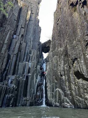
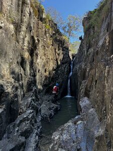
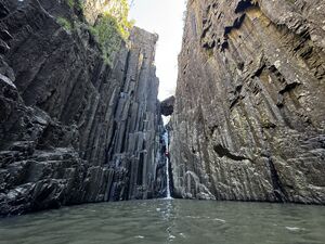
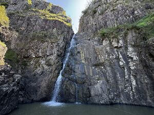
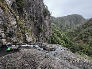
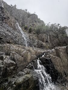
Bindook Chasm canyon (v4a2) an interesting a short trip and good option for those searching to expand beyond the typical Blue Mountains canyons. It is an anomaly in the area which has no other known published constricted canyons. The canyon features cliff walls of hexagonal columns made of Barrallier Ignimbrite (created from volcanic ash flows).
Bring your own drinking water or water filter. Water in canyon is not fit for drinking untreated. Farmland above.
Water levels[edit]
- Water levels can be observed at the crossing of Colong Stock route over Bindook Creek at -34.16716, 150.08532 (Google Maps link)
- Based on very limited trip reports the canyon is normally low flow and has an aquatic grade of a1 to a2
- The catchment for Bindook Chasm in approximately 23 km²
Camping[edit]
- Mt Werong Campground is a great place to camp if planning a trip to Bindook Chasm.
- It features shelters and a drop toilet.
- It is approximately 45 minutes before the parking spot for Bindook Chasm.
- Drive to campground is approx 1 hour drive from Boyd River campground in Kanangra, making it a feasible easier second day trip if enjoying one of the more epic Kanangra canyons on your first day.
Approach[edit]
- Park at the corner of Colong Stock Route and Bindook Access road at -34.1724, 150.0956 (Google Maps link) where there is plenty of room for several cars
- From the carpark walk approx south west through the bush to the fenced border between private property and national park
- Skirt the the border, clockwise, of the private land following the fence line
- This route in approximately 1.4 km to the start of Bindook Chasm (-34.1775, 150.0854)
Descent[edit]
| Problem ID | Metres | Location | Note |
|---|---|---|---|
| 1 | 15m | River left | Bolts |
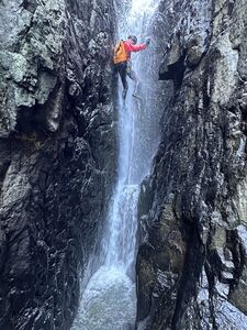
| 2 | 20m | River left | Bolts. Redirect bolt about halfway down on RL. Lower half features extremely narrow slot with risk of entrapment. |
| 3 | 25m | River left | Bolts on wall under chock stone. |
| 4 | 45m | River left | Bolt on wall. Approach bolt 2m before. Admire the 4 old rusty pitons that used to be the anchor. It is possible to exit the canyon by ascending a gully on the river right at the bottom of P4. |
| 5 | 45m | River left | Bolts on wall near spill over. Low grade abseil to P6 |
| 6 | 40m | River left | Bolts on wall. Ledge large enough for party of 5 (use sling to provide safety attachment). |
| Follow the flow of water down a small 2m down climb to the next large ledge. | |||
| 7 | 35m | River left | Bolts on wall |
Photos[edit]
Exit[edit]
- Early exit can be made from the top of the 4th abseil (problem ID 4) on river right.
- Final exit via gully on the river right.
- Gully is steep scree. Exercise caution.
- Gully also features stinging nettles. Long pants recommended.
Red tape[edit]
Beta sites[edit]
Trip reports and media[edit]
 Wild Elly : Bindoon Chasm 21 August 2023
 David Noble : Colong Caves and Bindook Chasm - 1975
 Bindook Chasm - Sleep When We Are Dead
 YouTube.com : Richard Pattison, Bindook Chasm movie
Background[edit]
Historical descent information[edit]
Note: Out-of-date as of 1 June 2025
From Sydney University Rovers Club, from the publication "Gundungura"
Based on the 1961 Kowmung Country sketch map by Geoff Ford, the 1965 pamphlet by Athol Abrahams, the Gundungura booklet was first released in 1970.
For the Canyoner, here is a short but thrilling descent - 100 yards before reaching the chasm edge Bindook Creek has cut down through the igneous rock, removing the vertical columns (so formed by columnar jointing) to form a slot 200 feet deep and as little as ten feet wide through which it cascades from pool to pool.
From a tree thirty yards around on the left hand side of the slot, the first abseil is made through a bush, fifty feet to a ledge which runs from the first cascade to a huge chock stone which is jammed in the centre of the slot.
A second cascade underneath the chock stone falls sixty feet into a third pool stretching twenty yards to the mouth of the slot.
A piton on the ledge to the left under the chock stone provides a belay for the second abseil through the fall to a small ledge at water level. From here one may climb along a semi-submerged ledge to the right of the pool or swim to the mouth of the slot. A bit of rock climbing is called for in traversing right, across the cliff face at the head of the chasm to a scree-filled gu1ly which runs down to the top of the 180 foot fall.
One may easily scramble around the last fall to the right or left, however, a belay to the tree on the right of the falls offers an irresistible 240 foot abseil.
Two ropes are sufficient for a single strand descent, but four ropes (doubling up) are recommended.
The best route out of the chasm lies up an obvious gully to the right (west).
