Black Sheep Canyon
| Rating: | |||||||||||||||||||||||||||||||
|---|---|---|---|---|---|---|---|---|---|---|---|---|---|---|---|---|---|---|---|---|---|---|---|---|---|---|---|---|---|---|---|
| | Difficulty:3B III (v3a2 III) Raps:1, max ↨240ft
Red Tape:No permit required Shuttle:None Vehicle:Passenger Rock type:Volcanic ash | ||||||||||||||||||||||||||||||
| Start: | |||||||||||||||||||||||||||||||
| Parking: | |||||||||||||||||||||||||||||||
| Condition Reports: | |||||||||||||||||||||||||||||||
| Best season: | winter, spring, fall
|
||||||||||||||||||||||||||||||
| Regions: | |||||||||||||||||||||||||||||||
Introduction[edit]
An interesting Superstition Mountains canyon with one very big rappel.
From Phoenix, drive east on US60, then east on state route 88. From Tortilla Flat, continue east on SR88 for 4.3 miles, then turn left on NF80 (not signed) and drive for 1.7 miles to park before a locked gate.
Approach[edit]
From the parking area, follow a fairly well defined trail as it travels north, then west around the head of Crucifix canyon. The trail continues west, then up to gain the ridge above. Once on the ridge, the trail splits, go left here following the trail to the west/north west towards an isolated butte with an interesting cave in it - a short spur trail leads up to the cave. After the junction with the cave spur the trail dies out, though you may be able to follow a few cairns and trail fragments as you continue west along the rim. After a little bit of route finding to get around a fairly large drainage flowing north the upper reaches of Black Sheep Canyon will be apparent. Hike down through the upper washes and into the canyon.
Descent[edit]
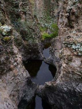
Head down through the rocky, brushy upper canyon; don't miss a nice, tiny section of narrows at the confluence of the two upper forks. Soon enough the canyon cuts into narrows with a few pools (one very short swimmer); a moderate downclimb drops you into the narrows. A 25 foot drop through a nice chute is encountered after and can either be rappelled (just for fun) or climbed around on canyon right. More canyon travel, another pool in a shallow narrows section that can be stemmed over and a few more downclimbs leads to the one mandatory rappel in the canyon. The drop is roughly 240 feet from a pinch point anchor on the left. After the big drop, a very short bushwack leads you to the confluence with Crucifix Canyon.
If the need arises, it is possible to escape the canyon before the big drop and still make it down to Crucifix Canyon for the exit by scrambling up the slope on canyon left just before the big rappel, then route finding and bushwacking your way down this adjacent drainage.
Exit[edit]
Head left (east) and up Crucifix Canyon which is scenic, but uneventful other than a few relatively minor upclimbs. After about 1.4 miles is a drainage on the right (canyon left) that leads up to an amazing double natural bridge at the top. It is possible to hike back to the road and the car from the top, but is not recommended as the way is complex and adds mileage. A more prudent way to finish the hike if exploring the bridge is to just go back down to Crucifix Canyon and follow it the remaining distance back to the parking area.
Red tape[edit]
Beta sites[edit]
 Super Amazing Map : Black Sheep Canyon
