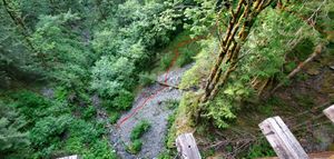
Boetzke Canyon
| Rating: | |||||||||||||||||||||||||||||||
|---|---|---|---|---|---|---|---|---|---|---|---|---|---|---|---|---|---|---|---|---|---|---|---|---|---|---|---|---|---|---|---|
| | Raps:9, max ↨240ft
Red Tape: Shuttle: Vehicle:Passenger Rock type:andesitic hornfels (locally known as rhinostone) and metagabbro | ||||||||||||||||||||||||||||||
| Location: | |||||||||||||||||||||||||||||||
| Condition Reports: | 23 Jun 2021
"It was a warm weekday afternoon. We biked from Mt. Washington trailhead and locked the bikes to the bridge. Followed the existing approach coordinates |
||||||||||||||||||||||||||||||
| Best season: | Jun-Sep
|
||||||||||||||||||||||||||||||
| Regions: | |||||||||||||||||||||||||||||||
Introduction[edit]
Yet another canyon coming off the flanks of Mt. Washington. Don't expect jumps, slides, or whitewater.
Approach[edit]
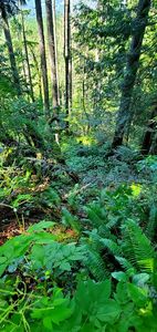
Park at Rattlesnake Lake. If you park as close to the Iron Horse as you can get, you'll need a Discovery Pass. Parking at any of the other many parking lots is free, though. Bike or hike the Iron Horse (old railroad grade) trail until you come to Boetzke Creek. Check out the flow, stash/lock bikes if you have them, and head uphill following the ridge on the west side of the canyon. There is no obvious trail, you will have to bushwhack your way up. Watch your steps and go slow as it is steep and loose in some sections. A fall may result in a serious injury. Stick to the ridgeline as much as possible, until you're around 150 ft below the entrance to the canyon, then start cutting across a couple small gulleys to the canyon until you come to near the top of the first falls. You'll know it if you come to the canyon too low - go higher. If you come in too high, the creek won't look like much of a creek, just a bunch of dense, thorny brush. Check the gps coordinates uploaded by Geormorphdan. The bushwhacking is mostly BW3, but it's not hard to get yourself into some not-so-fun BW4 or BW4+ if you stray from the ridgeline too much. Use the force, and find the path of least resistance, or something.
Descent[edit]
From the entrance, head down canyon. The rock is super chossy and ranges from super sticky and fun to downclimb to slick as snot and not so fun to downclimb.
Note that this canyon requires natural anchor skills. Bolts will not last in this canyon. You must be prepared to scout drops, check for anchors for the next drop, look for escapes, etc. After a big flood, it would probably be smart to have a skilled climber to be able to escape. Even then, escaping this canyon would require scrambling with lots of exposure over some of the chossiest rock you can find in a canyon in the region.
R = right, looking down-canyon L = left, looking down-canyon
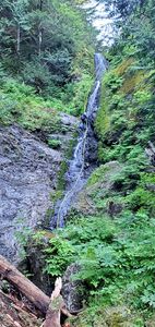
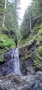
R1: 170 ft - actual drop is close to 140ft, although closest anchor point requires an additional 10ft of rope at a minimum. It could be done with a 300ft of rope.
R2: 30 ft - Pretty straigtforward, but it maybe difficult to find a suitable anchor point near the drop.
R3: 30 ft - Obvious anchor spot on a tree on DCL. This could be used for both R3 and R4. Scout R4 before pulling your rope down.
Tributary comes in from R and approximately doubles the flow
R4: 60 ft Actual drop is very short, maybe 20 ft. May need to be combined with R3 depending on anchor availability. 130 ft rope is needed if combining R3 and R4.
Landslide comes in from L, filling the canyon with sharp, crumbly rock ranging from boulders to gravel
R5: 20 ft - This could be downclimb on DCR; however, it is very slippery. At the very least, first person should rappel down in order to assist rest of the group with downclimb. Scout R6 anchor options before going down.
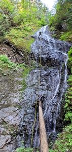
R6: 140 ft, although shorter if you find an anchor close to the lip. Your only options maybe the the logs or tree trunks fallen into the creek.
Look L as you go down R6 to see a fault coming in from the L and striking downstream to the R. Look down in the bottom of the canyon to see slickensides (rock squished and abraded smooth from fault motion - two blocks of Earth moving along the plane of this fault). The slickensides range from white to black and have great exposure. See if you can tell what the orientation of motion was for this fault!
Series of short downclimbs until you get to next rappel.
R7: 50 ft
R8: 60 ft, although could be considerably longer depending on downclimbing comfort and anchor availability
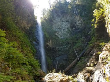
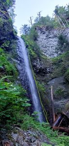
R9: 240 ft - Actual drop is closer to 200ft. Anchor options are mostly on the right side. There are 3 trees in a row. Top one and the middle one are the best options. Total rope length of 500ft is the minimum to complete this rappel.
Exit[edit]
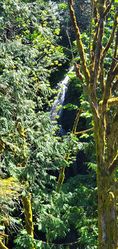
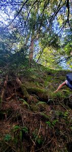
After you get to the bottom of the last rap (the falls you can see from the bridge over Boetzke), walk downstream (there's a good changing spot under the bridge). There are a few options for getting back to the Iron Horse, some likely much better than others. We took a nasty scree slope that comes in on the R just downstream of the bridge, which ended with an overhanging root-climb, then bushwhack to the iron horse. That sucked, so consider going a bit further downstream, cutting up left, and bushwhacking up from there back to the iron horse. Please edit this if you find a more preferable exit downstream.
Once back to the bridge, head back along the Iron Horse to your car.
Red tape[edit]
Media[edit]
==Trip reports and media==
