Bongo Canyon
| Rating: | |||||||||||||||||||||||||||||||
|---|---|---|---|---|---|---|---|---|---|---|---|---|---|---|---|---|---|---|---|---|---|---|---|---|---|---|---|---|---|---|---|
| | Difficulty:3B IV (v4a1 V) Raps:11, max ↨275ft
Red Tape:No permit required Shuttle:None Vehicle:4WD Rock type:Sandstone | ||||||||||||||||||||||||||||||
| Start: | |||||||||||||||||||||||||||||||
| Parking: | |||||||||||||||||||||||||||||||
| Condition Reports: | 22 Feb 2025
"Fun romp through Bongo as the start to the warmer weather. This is definitely not one Id want to do mid summer. The canyon starts out with a few smal |
||||||||||||||||||||||||||||||
| Best season: | Apr-May, Sep-Oct
|
||||||||||||||||||||||||||||||
| Regions: | |||||||||||||||||||||||||||||||
Introduction[edit]
The Eastern Reef is referred to as the 'Sandstone Alps' by Mountain Project with a long list of climbing routes up the front faces from I-70 south with crags listed alphabetically from A to U.
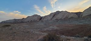
Bongo is named on Mountain Project as the drainage between J and K Crags. The descent includes 10 rappels starting higher above on the mesa of the Swell, quickly traverses the valley behind the hogbacks, and finishes with a final, 11th large headwall rappel.
The canyon is carved throughout, without any flat walking sections. A mandatory swim or two are brief and other larger pools can be mostly be skirted with knee deep water. Sandtraps are not the tool for this canyon as most drops are all rock and many of the cracks were flared in the wrong directions, making rock chocks challenging. Lots of webbing and some fiddlesticking became the anchors of choice.
Approach[edit]
Exit I-70 at Black Dragon Canyon, a dirt road on the north side of the highway at the East side of the reef. Drive under the highway in the culvert and continue south on 1028 / South Hart Ranch Bypass to Uneva Canyon. Take a short spur to get closer to the reef. Park at (38.88188, -110.45021)
Another parking/campsite is available another 650' along this road, but the vehicle clearance must be greater. To continue the short distance to the mouth of Uneva canyon requires an even more capable vehicle or motorcycle.
Begin hiking to the mouth of Uneva Canyon (38.88336, -110.45598) and through to the valley on the backside of the sandstone hogback. Uneva Mine and remnants of an old structure are just above the wash when rounding the corner.
Side trip: another drainage flows into Uneva Canyon from the north. FYI: That canyon's final headwall appears to be about 180' to 200+'.
Continue South up to the saddle, trending west (uphill) to gain the start of the mesa top of San Rafael Swell. Aim for this waypoint (38.88062, -110.46766). Once upon the mesa top of the Swell, continue West to the drop in point (38.87837, -110.47972)
A Sneak Route is possible to just rappel the final 275' rappel. Use the old narrow gauge mine cart trail on the east side until it switches back to the north and continue to the saddle. Hike down the other side into the wash below R10 and head for R11. The sneak route might be 2hrs car to car.
Descent[edit]
R1: 45' from a pinch for a 12' drop followed by a second 12' drop. Both could potentially be downclimbed.
R2: 35' from a chockstone in Canyon Center
R3: 45' from a chockstone in Canyon Center
R4: 50' from a higher tree on Canyon Right
R5: 45' from a boulder pinch in Canyon Center - the only sign of an existing anchor in the canyon
R6: 85' from a pair of equalized smaller trees into the lower pool, bypassing the first deep potential keeper pothole. (no great anchor opportunities for the really big deep pothole in the watercourse). The pool below can be walked around counterclockwise at knee depth.
R7: 100' from a thick short tree higher on Canyon Left
R8: 110' from a chockstone pinch set a ways behind/through cattails. This could potentially be downclimbed on Canyon Left. All cracks closer to the drop are flared in the wrong directions.
A stranded pothole (38.87594, -110.47098) seems to terminate the watercourse, but hiking back uphill Canyon Left gains access to the continued drainage and a long ramp of downclimbing on Canyon Left.
R9: 110' from a pinch between a large boulder in Canyon Center and the canyon wall. The low angle rappel ends in a pool which can be climbed around counter clockwise.
R10: 80' from a tree on Canyon Right into another pool which can be mostly skirted under a tree on Canyon Left.
The upper section opens in the wash behind the hogback. Continue downstream into the final section cutting through the sandstone front range of the reef.
After a short downclimb on Canyon Left, arrive at the top of the final headwall rappel.
R11: 275' from a pinch. A ledge is 75' down from the anchor before 100'+ of free hang then feet on the wall again. The pool at the bottom can be avoided.
Exit[edit]
Follow the wash to the Northeast, cross a ridge and another wash to gain the hillside to walk to the parking location. Alternatively, follow game trails next to the reef north to the mouth of Uneva Canyon.
Red tape[edit]
Beta sites[edit]
Trip reports and media[edit]
16Apr2022: Not the first descent based on one old anchor found at R5, but certainly the first through trip or complete descent in a very long time. Ira Lewis, Andrew Tanasescu and Kati Wright


