Bowman Creek
| Rating: | |||||||||||||||||||||||||||||||
|---|---|---|---|---|---|---|---|---|---|---|---|---|---|---|---|---|---|---|---|---|---|---|---|---|---|---|---|---|---|---|---|
| | Raps:3, max ↨110ft
Red Tape:No permit required Shuttle:Optional 5.7mi Vehicle:Passenger | ||||||||||||||||||||||||||||||
| Start: | |||||||||||||||||||||||||||||||
| Parking: | |||||||||||||||||||||||||||||||
| Shuttle: | |||||||||||||||||||||||||||||||
| Condition Reports: | 15 Oct 2023
"Checking out a new shuttle route into Bowman. Pretty nice, although the creek is pretty brushy. The going would be a lot faster getting out of the cre |
||||||||||||||||||||||||||||||
| Best season: | July-Sept
|
||||||||||||||||||||||||||||||
| Regions: | |||||||||||||||||||||||||||||||
Introduction[edit]
A significant tributary of the Little Klickitat River, located about 7mi east of Klickitat, WA. Unlike nearby Skookum Creek, Bowman flows all year round, but the flow is significantly reduced in the summer months. Bowman sports three noteworthy waterfalls and some interesting rock formations, although the hiking along the creek is overgrown and a bit tedious. Expect much splash-whacking. Despite the uphill gain, it's likely faster to exit the creek and locate open routes higher on the slopes that avoid thick vegetation.
- Ticks can likely be a problem at certain times of the year.
- This area seems to be very popular with hunters at certain times of the year. Wear bright colors and avoid deer costumes.
Approach[edit]
GPS & maps are recommended to ensure you stay on public land.
Shuttle[edit]
Drop a car at the bottom (there are some good pullouts west of the bridge) and shuttle up to the top of the plateau. There are a number of private homes along Zelinski Road, so respect all postings. At 1.3mi from the Glenwood-Goldendale Rd is the first possible parking spot in a pullout on the right/north side of the road. Pullout is on land owned by the Department of Fish & Wildlife.
- If the pullout is full of hunter vehicles, continue another 0.2mi further up the road and take a left on a dirt road. Just before the boundary with DNR land is a large area with plenty of parking. Parking is on land owned by the Department of Fish & Wildlife.
Pass through the gate (be sure to close it behind you) and head south/southeast to find a good crossing of Bowman Creek. Look for a game trail that avoids most of the brush. Climb up the far side and find a route that skirts around an inholding of private property. You may have to cross a fence (for cattle) around CLT land. The hiking is all through open forest and very easy. After crossing back onto DNR land descend the ridge, finding a path down through the rim rock to reach Bowman Creek below. Head downstream a short distance to R1.
No Shuttle[edit]
If you don't have a shuttle, you'll need to hike up an dover the ridge immediately east of the lower parking area. Skirt along the south side of Bowman Creek, staying on public land until you reach the falls. The hike in is only ~0.75mi, but gains about 900ft.
Descent[edit]
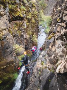
- R1: Upper Bowman Falls - 110ft from tree/thicket DCL.
- R2: Middle Bowman Falls - 55ft from tree DCL. Beware potential for foot entrapment in the chute. Pool at the bottom is deep.
- The slot would be quite dangerous in high flow. Rappel from a boulder high DCR to avoid the chute.
Walk for close to a half-mile. It's probably faster to exit the creek DCR below the narrows and contour over to drop back in right above R3.
- R3: Lower Bowman Falls - 60ft from convenient tree DCR. There are two hanging shallow pools.
Make your way down through a narrows (one short downclimb) with some interesting rock formations to the confluence with Canyon Creek coming in DCR.
Exit[edit]
Below the falls, it's possible to just follow the creek downstream until reach the bridge on WA-142. Alternatively, break off and climb up the ridge to stay in open forest and meadow areas which is probably a lot faster hiking. Drop back in near a dry tributary just above the bridge.
Red tape[edit]
Use caution to avoid private land when visiting / descending the creek.


