Buck Canyon (Upper)
| Rating: | |||||||||||||||||||||||||||||||
|---|---|---|---|---|---|---|---|---|---|---|---|---|---|---|---|---|---|---|---|---|---|---|---|---|---|---|---|---|---|---|---|
| | Raps:4-8, max ↨200ft
Red Tape:Permit required Shuttle:Optional Vehicle:Passenger Rock type:Granute | ||||||||||||||||||||||||||||||
| Location: | |||||||||||||||||||||||||||||||
| Condition Reports: | |||||||||||||||||||||||||||||||
| Best season: | July-Sept
|
||||||||||||||||||||||||||||||
| Regions: | |||||||||||||||||||||||||||||||
Introduction[edit]
Upper Buck Canyon is one of several technical canyoneering routes near Bearpaw Meadow in Sequoia National Park. While it would not be worthwhile on it's own, it makes for a great addition to a trip including Lower Buck Canyon, and Lonepine Creek.
Upper Buck Canyon starts fairly high up with a serious of beautiful and deep pools, before dropping down into a deep boulder filled gorge. It's a fairly short day and very scenic. On the downside there is not a particularly great approach, and you will find yourself doing some bushwhacking to make your way to the top.
Approach[edit]
There are a couple ways to go about this. Hiking down from Bearpaw Meadow you could start your cross country adventure at the first lefthand switchback going left on the High Sierra trail, and try to traverse your way up canyon. Alternatively it may be a better idea to start from where the HST crosses Buck Creek, hike up canyon, and make your way up right to the east side of the canyon before it gorges in. Stay as low as you can along the cliffs as you traverse around the top of the canyon and eventually make your way around the top of it 36.585310,-118.624162. Some ledges work well to make an easy traverse through the small drainage you'll find at the end.
It may also be possible to get around the West side of the canyon to the top. This would be more exposed, less safe, but perhaps less brushy.
Once at the top you can head down a ridge between the canyon to your right and a gully to your left. Eventually a series of ~30 foot falls and deep pools starts to the right. If it's warm enough out, it would be quite fun to descend this with rappels and or jumps, but you may feel like enjoying the pools from a distance and staying on the ridge. It will take you down to the top of a large cascading waterfall.
Descent[edit]
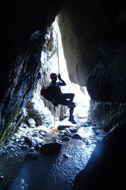
We anchored for this waterfall from a pocket down to the left off a large rock and rappelled around 200 feet to the bottom of the canyon. From here everything proved fairly simple, and fun, with lots of boulders to anchor from. Because of cold water temperatures we bypassed several optional rappels, and only rappelled two or three times. One section of talus has a cave underneath it that is worth going back into to see the waterfall underneath. Soon enough you'll be out of the walls and back to the HST.
Exit[edit]
Red tape[edit]
You'll need a backcountry permit for your trip
