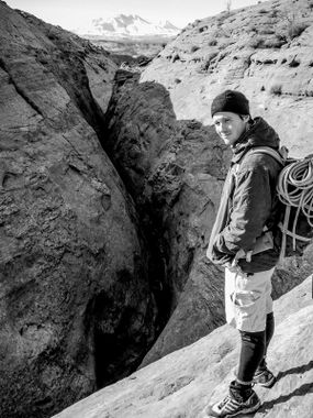
Burr Slot
| Rating: | |||||||||||||||||||||||||||||||
|---|---|---|---|---|---|---|---|---|---|---|---|---|---|---|---|---|---|---|---|---|---|---|---|---|---|---|---|---|---|---|---|
| | Difficulty:3A II R (v5a1 II) Raps:1-2, max ↨197ft
Red Tape: Shuttle:Required Vehicle:4WD - High Clearance Rock type:Sandstone | ||||||||||||||||||||||||||||||
| Location: | |||||||||||||||||||||||||||||||
| Condition Reports: | |||||||||||||||||||||||||||||||
| Best season: | Any; hot in Summer, cold in winter
|
||||||||||||||||||||||||||||||
| Regions: | |||||||||||||||||||||||||||||||
Introduction[edit]
You read that correctly, the entire technical section is 350 feet in length, while the hike out is 5.2 miles and the approach hike is 0.9 miles. 6.1 miles of deep sandy, wide open desert hiking for 350 feet of fun, hampered by the weight of a 200-foot rope and many liters of water you need for the hike out. This route undoubtedly has the worst pay-to-play ratios of any canyon in the region. The exit hike is a long, boring slog through deep sand for 2.5 miles down a wide-open canyon through multiple mine fields of cow paddies and lacking any particular views. After this is the ascent up several geologic layers of sandstone, again in deep desert sand for almost another 3 miles. The hiking in deep sand rarely gives way to slickrock and hard-pack. The views along the way are lackluster compared to what other canyons in the area have to offer. Having to carry a 200-foot rope and 3-4 liters of water minimum through a tight slot with high-stemming is very unpleasant. It is hard not to give this route 1-star. The technical section does contain mandatory, real, R-rated, high-stemming, offers an optional X-rated 50-foot high silo crossing, and has a notable 165 foot rappel at the end - so it is only fair to give it 2-stars.
Be sure to bring 50-feet of webbing. The final rappel requires a long leader of webbing or pulling the rope is not possible. A 160-foot rope is sufficient assuming the webbing extends 40-feet from the chockstone.
To make this canyon much more enjoyable, set a rope at the downclimb after the silo and up-climb the canyon instead of doing the big rappel and terrible hike out.
Approach[edit]
From the trailhead at 38.17217, -110.46689 head south-southwest into the obvious head of the drainage. In less than 1 mile you arrive at the obvious slot and start of the technical section at 38.16251, -110.47521.
Descent[edit]
From the start of the technical section to the end at 38.16130, -110.47690, is approximately 350 feet in length. Right away you will encounter an R-rated silo crossing about 15 feet high and just wide enough that canyoneers new to R slots will hesitate. Anyone who finds this intimidating probably should turn around. Soon you will be stemming 30 - 40 feet above the deck. After about 100 feet of stemming you arrive at the crux, two back-to-back high silos. The first silo is a good width at the top yet is 40 feet high. The next one is wider and has inverted walls at the top making it much more difficult. It may be an X move to go high across this one. There is an anchor on a chockstone about 20 feet before the silos. You can use this anchor to rappel into the middle of the body of the big silo, about 15 feet above the pool at the bottom. It is possible to get off rappel at the bottom but is required to chimney back up to this mid-level. From the middle of the silo you must chimney up another 10 feet to a corridor about 30 feet high that is just wide enough to sideways-stem. The walls are smooth and going low is not an option until you see a small chockstone after about 100 feet. From here drop down to put your feet on the floor for a brief moment. From here until the final rappel is easy down-climbing and a couple swirls to negotiate for about 100 feet. The anchor is extended with about 40-feet of webbing, needed for the pull. This rappel involves descending over a chockstone and down a crack for the first 100 feet. it is an obvious rope-pull concern.
Exit[edit]
Call for a helicopter pick up. The hike out is fully exposed to the sun the entire way. Bring lots and lots of water.
Red tape[edit]
Beta sites[edit]
 RoadTripRyan.com : Burr Slot
 CanyonCollective.com : Burr Slot
 Super Amazing Map : Burr Slot
Trip reports and media[edit]
http://amazingslots.blogspot.com/2017/01/burr-slot.html
