Cadillac Crash Canyon
| Rating: | |||||||||||||||||||||||||||||||
|---|---|---|---|---|---|---|---|---|---|---|---|---|---|---|---|---|---|---|---|---|---|---|---|---|---|---|---|---|---|---|---|
| | Difficulty:3A II (v3a1 II) Raps:2 (3), max ↨55ft
Red Tape:Closed to entry Shuttle:None Vehicle:Passenger Rock type:Mix | ||||||||||||||||||||||||||||||
| Location: | |||||||||||||||||||||||||||||||
| Condition Reports: | 27 Nov 2021
"Sneak approach gully has gotten extremely deep since its made of dirt rather than rock. Downclimbed R1. Canyon is not that brushy overall. |
||||||||||||||||||||||||||||||
| Best season: | Dec-May
|
||||||||||||||||||||||||||||||
| Regions: | |||||||||||||||||||||||||||||||
Introduction[edit]
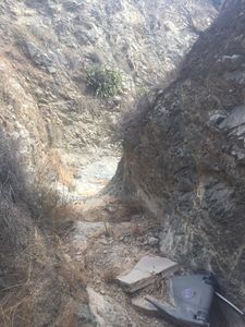
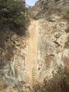
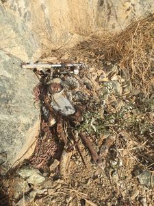
This easily accessible canyon actually has an amazingly deep rocky section, and one good rappel! Unfortunately, people have dumped trash off the cliff above which has accumulated in the canyon over the years, included a crashed motorcycle (intro photo). The full route adds one more bad down climb or 25 foot rappel (R0) and a half mile of bushwhacking in a creek bed. Descending the erosion gully for the sneak route bypasses most all the bushwhacking and gets quickly to the rocky canyon part. The times listed are for the sneak route vs. the full route instead of the normal range.
Approach[edit]
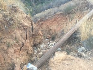
From Trabuco Canyon road where it crosses the Trabuco Canyon wash, follow the dirt and gravel road 1.9 miles to a spot with a loop pull-off on the North side. Park there, off the main road as there is a parking restriction on the main road. Hike up Cadillac Grade road which goes West (not straight up the erosion slope due North) from the parking area. For the sneak route, follow Cadillac Grade for 0.66 miles (450 foot gain) to an erosion gully with a telephone pole in it. Or for the full route hike 1.47 miles (1100 foot gain) to a sharp bend back West.
Descent[edit]
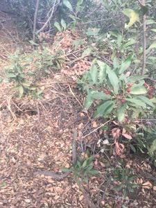
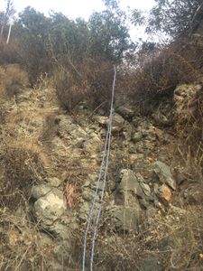
From the erosion gully (sneak route) down climb 100 feet down, approx 300 feet horizontal to the main creek. Hike down the creek (minimal bushwhacking) a bit until you get in the the good part of the canyon. The low angle and short R1 requires 50 feet of rope, because the anchor point LDC is far back. After passing along all the trash in the best part of the canyon, you quickly reach the 55 foot R2, which starts low angle, but drops 30 feet quite steep. At the bottom is the crashed motorcycle. From the road (full route) traverse over into the creek bed above a giant oak tree down stream. Bushwhack your way down stream a half mile with the crumbly R0 about 1/3 way down. Bring a strong pair of tree limb loppers if you choose the full route!
Exit[edit]
Hike down canyon for 5 minutes, exit right and you are at the parking area.
Red tape[edit]
None, Cleveland National Forest Service property
As a result of the Airport Fire Closure this area is closed by the Forest Service from Oct 5th, 2024 to Oct 4th, 2025. See Forest order No. 02-24-29. Also closure map.

