Candy Canyon
| Rating: | |||||||||||||||||||||||||||||||
|---|---|---|---|---|---|---|---|---|---|---|---|---|---|---|---|---|---|---|---|---|---|---|---|---|---|---|---|---|---|---|---|
| | Difficulty:3A II (v3a1 II) Raps:3-4, max ↨100ft
Red Tape:Access is Restricted Shuttle:None Vehicle:High Clearance Rock type:Sandstone | ||||||||||||||||||||||||||||||
| Location: | |||||||||||||||||||||||||||||||
| Condition Reports: | 31 Oct 2020
"Completely dry. A few dark areas with spiderwebs - bring a headlight and watch out for black widow spiders. |
||||||||||||||||||||||||||||||
| Best season: | Sep-May
|
||||||||||||||||||||||||||||||
| Regions: | |||||||||||||||||||||||||||||||
Introduction[edit]
Candy Canyon is a sandstone slot canyon on the Navajo Indian Reservation. This canyon was first descended on Halloween 2020 by Suhei and Lukas Eddy. It is part of the Potato Canyon complex. This complex does not have any known exits, and all canyoneering routes require fixing ropes and ascending back up to exit.
Bring at least three 100-foot ropes, and several lengths of webbing of 30+ feet.
All Kaibeto-area canyons are closed to visitation of any kind by non-Navajo persons. These closures are documented in Michael Kelsey's book Technical Slot Canyon Guide to the Colorado Plateau and on the Navajo Parks and Recreation Department website here: [1]. Visitation to all Kaibeto area canyons is considered trespassing and is illegal.
Approach[edit]
Follow the map above to reach the parking area. From the parking area, use your GPS to navigate 15 minutes or so to the start of the slot. Go down the small hill towards the northwest, and follow the main wash. You'll pass through a brief section of slot with a downclimb, which will then open up before becoming the main slot.
Descent[edit]
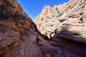
Downclimb into the slot. There are several tricky downclimbs in the beginning. This slot has only a midway exit, so you'll need to return back up the slot. Anything you descend, you must be able to ascend. If in doubt at any downclimb, fix a rope or handline.
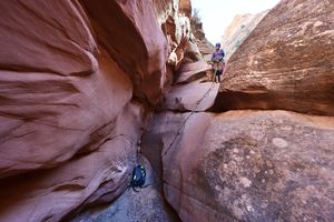
As such, you must not pull your ropes, and you need complete ascending gear to ascend all rappels. All rappels are to be left fixed in place.
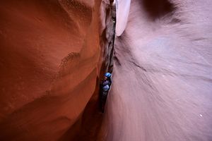
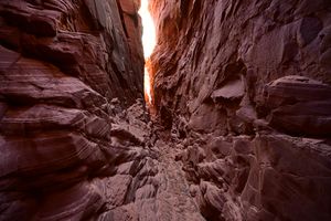
The slot will deepen and tighten quickly. There is one brief dark area that involves crawling under large boulders.
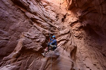
Then comes rappel 1, 60+ feet. The anchor is a chockstone back 20 feet from the lip.
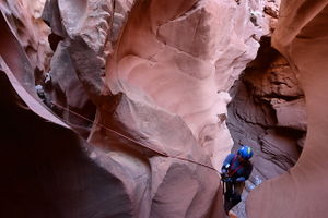
After rappel 1, you'll quickly reach rappel 2. Rappel 2 is maybe 40 feet, but the anchor, a semi-buried boulder, is far up canyon, and you'll need at least 100 feet of rope. A rope protector is a good idea, to protect both your rope and the fragile sandstone.
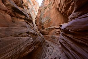
The slot after R2 is gorgeous, especially in the right lighting.
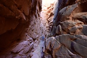
The slot opens for several minutes of walking. Here, you'll find a Class II escape route on canyon right, should you need it.
Continuing, you are faced with a 20 foot slab which would be impossible to decend or ascend without a handline. You can fix a handline or an etrier off a boulder.
Next, the canyon has a downclimb into what may be a deep pool, or a dry mud pit. From here, it's a 30-foot rappel off a natural anchor farther upcanyon.
Below this rappel, the canyon is easy walking and arrives at an intersection. Turn around when comfortable, and ascend back upcanyon.
Exit[edit]
Return the way you came, ascending all downclimbs and rappels.
Red tape[edit]
Entry to this area is restricted for all non-Navajo persons. If you are not Navajo, and are in this canyon, is it considered illegal. Please respect local rules and regulations when planning your canyoneering trip.
Beta sites[edit]
Trip reports and media[edit]
First descended on 10/31/2020. No bolts were placed. All natural anchors were used.
Background[edit]
This canyon, while easily accessible, was first descended on Halloween 2020. Though other canyons in Kaibeto were first descended in the 1980s and 1990s, this one may have been skipped over due to its small size.
