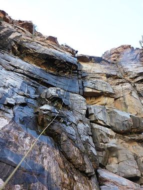
Castle Creek Canyon
| Rating: | |||||||||||||||||||||||||||||||
|---|---|---|---|---|---|---|---|---|---|---|---|---|---|---|---|---|---|---|---|---|---|---|---|---|---|---|---|---|---|---|---|
| | Difficulty:3B III (v3a2 III) Raps:3, max ↨160ft
Red Tape:No permit required Shuttle:None Vehicle:4WD - Very High Clearance | ||||||||||||||||||||||||||||||
| Location: | |||||||||||||||||||||||||||||||
| Condition Reports: | 12 Jan 2019
"Light flow, very cold water probably from snow melt. Rebuilt all anchors. Dirt road getting out there is very rough, requiring heavy-duty 4x4. |
||||||||||||||||||||||||||||||
| Best season: | BEST in Nov;Dec;Feb;Mar
|
||||||||||||||||||||||||||||||
| Regions: | |||||||||||||||||||||||||||||||
Introduction[edit]
A decent canyon with a short, but nice section of technical granite waterfalls in fairly close proximity to the Phoenix metropolitan area - the convenience of which is made up for in how bad the access road is.
Approach[edit]
From I-17 take Exit 248 for Bumble Bee / Crown King. This soon turns to the high clearance dirt road to Crown King. From I-17 follow 4.8 miles to FR 684 on the left. 684 is a very rough 4x4 road with multiple creek crossings, large boulders and very steep sections - standard SUV type vehicles will likely not be able to make this drive - additional clearance and skid plates highly recommended. Follow this road with an appropriate vehicle until it is washed out or it gets too rough. The washed out section is about 2 miles before Castle Creek Trail. As of 1/2019 it was not wide enough for an SUV but quad or similar would pass.
Hike up the Castle Creek trail to 4,000' and drop into the canyon.
Descent[edit]
- R1 two tiered drop of ~20', then ~30' - can be split into two drops to aid in rope pull
- DC1 40' falls can be bypassed on the left or rappelled from a chockstone on the right
- DC2 15' elevator downclimb with a pool to swim after the drop. This can also be bypassed on canyon left with some easy scrambling.
- R2 another two tiered section with two 15 foot drops through some large boulders. Rope pull is difficult again here - a second anchor can be added or the first 15' drop can be bypassed on canyon left.
- R3 ~160' anchored from a small tree on canyon left
Exit[edit]
Hike down the creek until you can get back on the approach road.
Red tape[edit]
Beta sites[edit]
 HikeArizona.com : Castle Creek Canyon
