Chavez Canyon
| Rating: | |||||||||||||||||||||||||||||||
|---|---|---|---|---|---|---|---|---|---|---|---|---|---|---|---|---|---|---|---|---|---|---|---|---|---|---|---|---|---|---|---|
| | Difficulty:3A II (v3a1 II) Raps:4, max ↨70ft
Red Tape:No permit required Shuttle:Optional 1hr15min Vehicle:Passenger Rock type:sandstone | ||||||||||||||||||||||||||||||
| Start: | |||||||||||||||||||||||||||||||
| Parking: | |||||||||||||||||||||||||||||||
| Shuttle: | |||||||||||||||||||||||||||||||
| Condition Reports: | |||||||||||||||||||||||||||||||
| Best season: | Mar-May;Sep-Nov
|
||||||||||||||||||||||||||||||
| Regions: | |||||||||||||||||||||||||||||||
Introduction[edit]
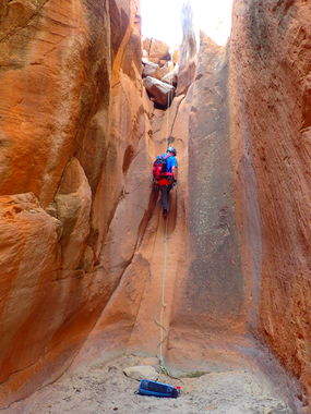
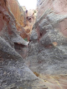
Chavez Canyon has been done for many years and contains several nice narrows sections and several short rappels in the two forks of this sandstone layer.
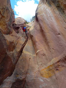
This was previously listed as Scrambling rather than Technical Rope Work because most drops can be scrambled around. However, there are several good rappels in these slots.
Approach[edit]
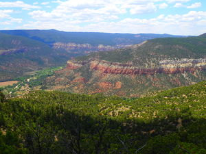
(Preferred) Bottom-up Approach: The summit post beta indicates a bottom up approach. Park (36.36813, -106.67772) below the slot south of the Christ of the Desert Monastery and hike up to the confluence of the North and Main Chavez Forks (36.37500, -106.67020). Gain the top of the sandstone layer by hiking off trail up the slope on Rappeller's Left (Left Up Canyon) just downstream of the confluence. Hike above each of the rappels and repeat the other fork as desired.
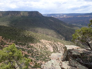
(Not Recommended) Car Shuttle Option: It is possible to park a car at the top of Mesa de Los Viejos, but the shuttle is a long 1hr 15min one way drive time, which is a lot for these small slots. From the parking location at Chavez Tank, a large watering hole on top of the mesa above the slot, hike west-southwest down an old road and either access the Main Fork by a tributary or the North Fork by scrambling down the point of the ridge. The North Fork alternate approach with car shuttle as indicated in the kml on this ropewiki page is doable, but is a really long path for two rappels and required a 60' rappel with retrievable anchor off a juniper to manage one of the ledge systems. A higher clearance or 4WD vehicle would be better for the mesa top car shuttle
Descent[edit]
North Fork Chavez Canyon:
NF R0: 60' from juniper with retrievable anchor to manage the ridge descent (skip this route, it's unnecessary)
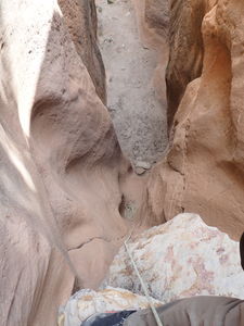
NF R1: 70' from a tree Canyon Left, followed by 15' drop
NF R2: R2: 55ft from a rock pinch Canyon Left
Main Fork Chavez Canyon:
R1: 50' (approx, based on other beta)
R2: 25' (approx, based on other beta)
DC: 12' (approx, based on other beta)
Exit[edit]
From the confluence, hike the trail back to the roadside parking (0.85 miles -250' elevation).
Red tape[edit]
Beta sites[edit]
 SummitPost.org : Chavez Canyon
 Doug Scott's New Mexico Slot Canyons : Chavez Canyon
Trip reports and media[edit]
2017 https://www.sfreporter.com/news/theenthusiast/2017/03/21/backyard-canyoneering/
2019Jun30 photos and kml uploaded from this date, NF descent. Ira Lewis and Scott Smith
