Chikamin Narrows
| Rating: | |||||||||||||||||||||||||||||||
|---|---|---|---|---|---|---|---|---|---|---|---|---|---|---|---|---|---|---|---|---|---|---|---|---|---|---|---|---|---|---|---|
| | Raps:4-6, max ↨60ft
Red Tape:No permit required Shuttle:None Vehicle:High Clearance | ||||||||||||||||||||||||||||||
| Start: | |||||||||||||||||||||||||||||||
| Parking: | |||||||||||||||||||||||||||||||
| Condition Reports: | 13 Jul 2025
"No other anchors were found, so possible first descent. Dropped in upstream of the narrows to catch several rappels. R2 is excellent, dropping into a |
||||||||||||||||||||||||||||||
| Best season: | May-Jul
|
||||||||||||||||||||||||||||||
| Regions: | |||||||||||||||||||||||||||||||
Introduction[edit]
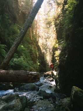
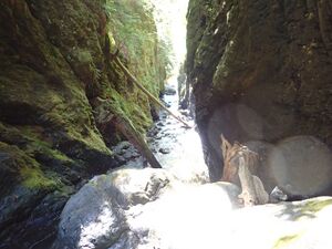
An interesting fault-crack in the northern end of the Wynoochee River Valley. Beautiful and photogenic, but lacking a bit in technical interest.
- Watershed: 2.8mi^2. The highest point in the watershed is Discovery Peak at 4840ft.
- Could be easily combined with other outings in the Wynoochee Valley.
Approach[edit]
Walk up the road a short distance past a local highpoint on the right, then drop down through open forest to enter the creek just above R1. If you find the right spot, you do not need a rope to get into the creek.
Descent[edit]
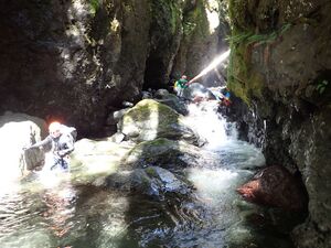
Expect a number of downclimbs and nuisance rappels which are not listed in the beta. You may do more or less rappels based on comfort. Jumping is a leading cause of canyon accidents. Be sure to check all pools ahead of time.
- R1: 12ft from log DCL and downclimb the rest of the way.
- R2: 60ft from tree on an island creek-center. In low flow, the creek goes all DCL with a dry channel DCR.
- R3: 15ft from a log, or jump (?) DCR.
Inside the narrows:
- R4: 12ft rappel from log DCR at the edge of a logjam.
- R5: 25ft two-stage through a boulder jam from vertical tree jammed back behind the rocks DCR.
Exit[edit]
You know you're drawing near the end when the canyon walls fall back and a small waterfall (unnamed minor tributary) enters DCR. There's also a gigantic old-growth log that's fallen across the creek here. Go downstream perhaps 100 yards, then scramble out DCR onto a mini-ridge which provided relatively easy access up the bank into open forest beyond. Head generally southwest wherever is easiest, staying just south of the aforementioned mini-tributary. You can avoid thorny devil's club and swampy areas by staying on higher ground. When you spot the road above, just turn south and ascend directly to it. Walk back up the road to the pullout.
Red tape[edit]
The northern end of Wynoochee Valley is closed seasonally from Oct 1 through April 30 and is gated at approximately 47.44722, -123.55027 on FR 2270. (Oddly in 2023, the season was extended until November 1.) Access is still legal on foot or by mountain bike.
Beta sites[edit]
Trip reports and media[edit]
Background[edit]
First descended by Kevin Clark, Wade Hewitt, Ashley Driscoll, and Eric Rutz in July 2025.


