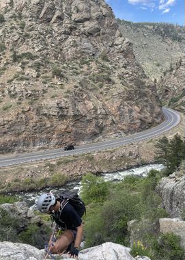
Coors Lite Falls
| Rating: | |||||||||||||||||||||||||||||||
|---|---|---|---|---|---|---|---|---|---|---|---|---|---|---|---|---|---|---|---|---|---|---|---|---|---|---|---|---|---|---|---|
| | Difficulty:3A I PG (v4a1 I) Raps:2-3, max ↨90ft
Red Tape:No permit required Shuttle: Vehicle:Passenger Rock type:Granite | ||||||||||||||||||||||||||||||
| Start: | |||||||||||||||||||||||||||||||
| Parking: | |||||||||||||||||||||||||||||||
| Condition Reports: | 26 Apr 2024
"Fun little excursion within 30 minutes of home! Well bolted but fun rappels right through the flow (trickle) of water are a nice cooldown after the hi |
||||||||||||||||||||||||||||||
| Best season: | Ices up in Winter, spring with snowmelt
|
||||||||||||||||||||||||||||||
| Regions: | |||||||||||||||||||||||||||||||
Introduction[edit]
This is primarily an ice climbing area but when there isn't ice, there is a nice trail to the top and bolts for the rappels.
The gulch seems to be mostly dry for the majority of the year, but it could turn into a class B after some rains. Water flow would be easily seen from the highway, as well as from the approach trail.
Approach[edit]
From the intersection of HWY 93 and HWY 6 in Golden, take HWY 6 up Clear Creek Canyon (West) for about 4 miles to the first bridge over the river and park on either side.
Cross over to the south side of the creek and walk east (downstream) along the creek for about 100 yards to the base of the falls. There is a steep trail up on west side of falls (LDC).
Descent[edit]
The trail drops you off at the top of the upper most rappel or near it.
R1: 50’ from two bolts LDC.
Next is a short 20’ drop which can be rappelled from one of many bushes or downclimbed on the right.
R2: 90' three stage rappel off of two bolts LDC.
- WARNING: The 3rd stage of this rappel has a very sharp lip and could easily cut ropes. Do not try to get away from the fall line as the whole third stage is overhung and you'll just increase the distance that you'll swing when you eventually drop over the lip.
- Additionally, there is quite a bit of rockfall on the upper stages that could stick a rope upon retrieval. Pulling from LDC is likely the best way to mitigate this risk.
Exit[edit]
From the bottom of the last rappel, a quick scramble gets you back down to the trail along the river. Take this back west to the bridge.
Red tape[edit]
Beta sites[edit]
https://www.mountainproject.com/route/105747143/coors-lite
