Corral Creek (Chipeta Falls)
| Rating: | |||||||||||||||||||||||||||||||
|---|---|---|---|---|---|---|---|---|---|---|---|---|---|---|---|---|---|---|---|---|---|---|---|---|---|---|---|---|---|---|---|
| | Raps:4, max ↨130ft
Red Tape:No permit required Shuttle: Vehicle:Passenger Rock type:Gneiss | ||||||||||||||||||||||||||||||
| Start: | |||||||||||||||||||||||||||||||
| Parking: | |||||||||||||||||||||||||||||||
| Condition Reports: | |||||||||||||||||||||||||||||||
| Best season: | Jun-Sep
|
||||||||||||||||||||||||||||||
| Regions: | |||||||||||||||||||||||||||||||
Introduction[edit]
Chipeta Falls is a WI3 ice climb in the winter. Ice climbers hike from the road above (CO 92) and rappel into the Black Canyon of the Gunnison in the Curecanti National Recreation Area, then climb back up the frozen waterfalls.
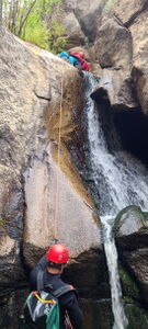
Canyoners, however, need to ascend fixed lines to get back up to the tops of the falls above.
Caution this is not the place to practice your ascending system.
Do not ascend in water flows greater than A3, or mild water flow. If the falls have force, reascending can be very dangerous.
Consider the size of the group and the time it will take to ascend. Setting up a second line for Chipeta Falls can speed the process.
The Black Canyon of the Gunnison is known for poison ivy. This route didn't have it.
Approach[edit]
Drive 4.6 miles west on CO 92 toward Crawford and Hotchkiss from US 50 over the Blue Mesa Dam on the west end of Blue Mesa Reservoir.
Park at one of two pullouts on the south side of the road near the apex of the bend in the road.
Hike downhill aiming for the creek bottom. Walking up the road a short distance before descending the hillside at (38.45556, -107.39125) was deemed to be the better path (return) than tracing the bottom of Corral Creek the whole way (approach). Continue downstream until the first granite pothole and pause for wetsuits.
Descent[edit]
If re-ascending, set fixed lines for all rappels.
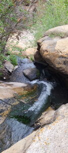
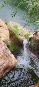
R1: 30' off a tree for a short 10' falls into shallow pothole
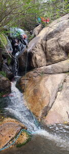
R2: 25' off a tree for a vertical waterfall in a pool. This may be down/upclimbed with the aid of two trees on Canyon Left.
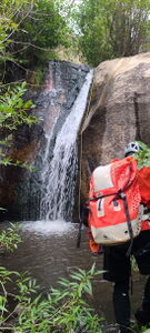
R3: 50' off a tree into a pool
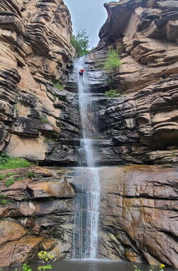
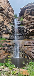
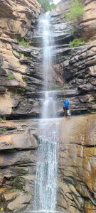
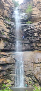
R4: 130' Chipeta Falls from bolts on Canyon Left or from a tree.
Exit[edit]
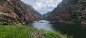
From the bottom of R4 on the bank on Morrow Point Reservoir along the Gunnison River, the fun begins with the ascent up Chipeta Falls and the three short waterfalls above. Follow the creek upstream back to the road and parking.
Ascending a line from the bolts minimizes being in the flow. A line from the tree is directly in the flow.
Alternatively inflate a packraft and paddle one mile west in Morrow Point Reservoir, then hike 1.8 miles +950' on the north side of the reservoir up the Curricanti Trail to a car shuttle parked at (38.45392, -107.41491).
Red tape[edit]
Beta sites[edit]
Trip reports and media[edit]
https://www.summitpost.org/chipeta-falls-wi3/840097
https://www.mountainproject.com/route/116091966/chipeta-falls
Background[edit]
2021 First known summer descent and pack raft exit. Kit Davidson.
2024-08-11 Beta added. First summer re-ascent. Ira Lewis, Rob Demis, Jim Rickard, Carl Bern, Wayne Herrick, Ryan Humphries
