Cougar Canyon (Anza Borrego Desert)
| Rating: | |||||||||||||||||||||||||||||||
|---|---|---|---|---|---|---|---|---|---|---|---|---|---|---|---|---|---|---|---|---|---|---|---|---|---|---|---|---|---|---|---|
| | Difficulty:3B III (v3a2 III) Raps:13, max ↨70ft
Red Tape:No permit required Shuttle:None Vehicle:4WD | ||||||||||||||||||||||||||||||
| Location: | |||||||||||||||||||||||||||||||
| Condition Reports: | 7 Feb 2026
"Fun canyon! We hiked in from Desert Gardens about 6 miles and camped at the mouth of Cougar. The next day, we spent nine hours completing the canyon, |
||||||||||||||||||||||||||||||
| Best season: | Nov-Mar (avg for this region)
|
||||||||||||||||||||||||||||||
| Regions: | |||||||||||||||||||||||||||||||
Introduction[edit]
Cougar Canyon is a unique canyon located in a remote area of the Anza-Borrego Desert State Park that is fed by a mountain spring that flows all year around. This is a true palm-filled oasis in the middle of a scorching desert.
This canyon was first descended by Chris Brennen (see beta reference) and has been rarely descended since then due to the difficult access logistics. Chris descended the canyon by setting up a long shuttle and camping at the Los Coyotes Indian Reservation, an option that is no longer available nor recommended.
There is a dirt track that goes all the way to Sheep Camp, only a few minutes walk from the mouth of Cougar Canyon; however, the quality varies greatly from year to year, depending on recent flooding and maintenance by the park.
Currently, as of February 2026, a 2WD/low clearance vehicle can reach Desert Gardens, which is about a six mile walk from the mouth of Cougar. An SUV with clearance can reach Third Crossing, about a five mile walk from the mouth of Cougar. Third Crossing has a closed and locked vehicle gate, so the only way forward currently is on foot. Be sure to check Anza Borrego's website for current conditions.
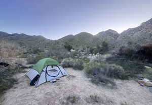
When hiking in, the preferred camping spot is the mouth of Cougar, where there are ample sandy campsites and dependable water. Sheep Camp has picnic tablets and an outhouse but no water.
Because of these current conditions (February 2026), it's recommended to do Cougar as a two-night adventure.
Approach[edit]
You'll likely be parking near Desert Gardens or Third Crossing and then have a ~five mile gently uphill hike to the mouth of Cougar Canyon.
From the mouth, start before dawn to head up Indian Canyon. There is a faint trail here that eventually disappears.
Continue to follow the gully upstream, at times passing intermittent water and groves of palm trees. This area is called the Valley of the Ten Thousand Springs.
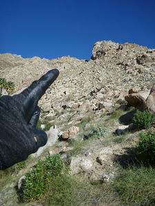
Follow the GPS track. You'll eventually begin a steep and intense scramble up a mountain, bearing to climber's-left of a prominent rock outcrop.
From the saddle, climb down into the canyon. The first rappel is a few minutes downstream.
With this approach we deliberately omitted from the descent the upper technical section of the canyon (3 rappels). To include these one should follow the longer approach, which would add 2h-3h to the descent (not recommended).
Descent[edit]
The approach hike involves rough rock scrambling through the hot desert, where at noon in April/May it may get to 110F. So Starting to hike at dawn and traveling light is a good idea. Carry enough water for the approach and plan to filter the rest. In Spring you can count on finding flowing water in the canyon, but in Fall it may dry up and have stagnant pools or not even that. Wetsuits are usually NOT required even in Spring. Waterproof jacket/pants + some undergarment should be enough for most people. Notice the "should"... most of the rappels will just splash you but some, especially the last set, may completely soak you. Pools change with sand deposits, they may get deeper or get blocked and become full swimmers. Be prepared for anything!
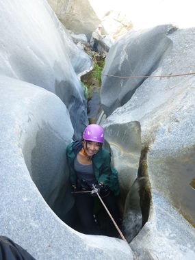
The descent is well documented by Chris Brennen, just skip the first section of narrows (3 rappels) and everything is more or less still valid. However, Chris team exited the canyon after 10h at elevation 2360ft, that is right before the set of narrows above the Psychedelic Eye. Those narrows are exceptionally beautiful and present 4 more raps that are a bit technical, but have good anchors from tree and pitons. The final rappel drops you in a pool at the edge of the Psychedelic Eye (1970s rock art) which marks the end of the technical canyon at elevation 2020ft. The Eye is hidden behind a big boulder on canyon right, you won't see it until you are right in front of it.
Most of the anchors are natural, usually webbing around a tree, bush or rock. Some are hard to spot, some may be missing and some may be too old. So bring webbing and rings and be ready to build anchors. You may need to use retrievable anchors if you run out of webbing (http://www.canyoneeringusa.com/techtips/tworingretrievableanchor/). Please try to NOT just sling rope around a tree and pull down from there. I know it's easy and cheap, but if many people did that the tree would die.
Exit[edit]
From the Psychedelic Eye one can find a faint trail on canyon left that takes you down to the valley and to the car.
Red tape[edit]
The road to access the canyon from the bottom is closed from June to October for Big Horn breeding. You don't want to be in the desert that time of year anyway.
Access to the canyon may temporarily closed due to road closures that include Coyote Canyon. Up to date information can be found here.
Beta sites[edit]
 Chris Brennen's Adventure Hikes (Southwest) : Cougar Canyon
- http://adventureplus.smugmug.com/CanyoneeringBackpacking/Cougar-Canyon/26985479_TdP8LK/2262258477_jdg7NDZ
- http://www.galletameadows.com/
 CanyonCollective.com : Cougar Canyon
Trip reports and media[edit]
- https://www.facebook.com/media/set/?set=a.10152426583321103.1073741888.669366102&type=1&l=2ea8bc193a
Background[edit]
First descent by Chris Brennen, Mark Duttweiler and Clancy Rowley on Mar.24, 2001.


