Cougar Creek
| Rating: | |||||||||||||||||||||||||||||||
|---|---|---|---|---|---|---|---|---|---|---|---|---|---|---|---|---|---|---|---|---|---|---|---|---|---|---|---|---|---|---|---|
| | Raps:6 - 10, max ↨130ft
Red Tape:No permit required Shuttle:Required 15 mins Vehicle:High Clearance Rock type:Basalt | ||||||||||||||||||||||||||||||
| Start: | |||||||||||||||||||||||||||||||
| Parking: | |||||||||||||||||||||||||||||||
| Shuttle: | |||||||||||||||||||||||||||||||
| Condition Reports: | 28 Jun 2025
"Dropped into Cougar via the northeast tributary, which is a canyon unto itself. Will be documented elsewhere on ropewiki. This approach drops into cla |
||||||||||||||||||||||||||||||
| Best season: | July
|
||||||||||||||||||||||||||||||
| Regions: | |||||||||||||||||||||||||||||||
Introduction[edit]
Cougar Creek is a major tributary of the Lewis River, located south/southwest of Mt. St. Helens. Cougar packs a lot of variety between big pools, jumps, and a long free-hanging rappel. A beautiful lower narrows. Warning: Cougar is a relatively high pay-to-play. Start early, and be prepared for a long day. There's a 2mi crosscountry hike out.
- Water flow increases as you descend the canyon. Flow at the end of the narrows is likely about 3-4x the place where you drop in.
- This canyon is not visited regularly. Be prepared to rebuild anchors and adjust to new obstacles.
- Another option is Cougar Creek Northeast which is a canyon destination unto itself.
Approach[edit]
Drop a shuttle car at the Trail of Two Forests and drive up on the paved road past Ape Cave. Turn on to a dirt forest road at 46.12382, -122.24213 and follow down this until the creek has washed out the road (the drop in point). Your vehicle probably won't make it all the way, a RAV4 made it to 0.6 miles away from the drop in point. This is the parking area noted on the map. (If you don't have a 4WD-HC vehicle, you can park just off the road at the turn off and walk in which adds like +5-10min.)
- If you want to skip the upper part of the creek, it may be possible bushwhack directly downslopes to the start of the Hall of Moss.
- An unexplored, but possibly better approach could be to drive on the paved road until 46.12456, -122.26307, then drop into the creek at 46.12453, -122.25921. It looks like this could add a rappel too.
Descent[edit]
Upper Section[edit]
- R1: 40ft from bolt DCL.
- R2: 70ft from tree DCR 20ft back.
A long brushy creek walk with few downclimbs. Two falls with potential for rappelling in higher flow.
The Hall of Moss[edit]
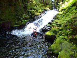
This section starts shortly after the confluence. It has many pools that look like jumps, but none of them go except the mandatory one. Scrambling around is generally easy, some more rappels could be added here for fun.
- R3: 40ft from bolt on large boulder canyon center.
- J1: 15ft jump. Or rappel from tree DCR.
More waterpark features.
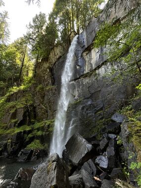
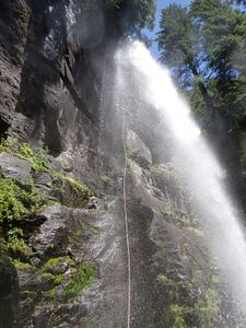
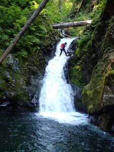
- R4: 130ft from tree DCR. This line will hit you with all the water right in the face as you go over the lip, the rest will be free hanging. The edge atop the pitch is extremely sharp; slipping/creeping the rope is recommended. Watch for glorious rainbows on a sunny day.
Below the big falls, there's about 0.5mi of soul-sucking bouldery creek-walking to the narrows.
The Narrows[edit]
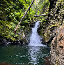
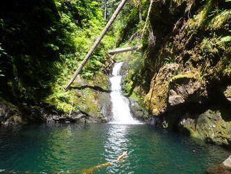
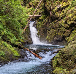
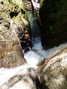
- R5: 25ft from bolt DCL.
- 8ft drop, downclimbed on log DCR.
- 3ft plunge out of slot. DO NOT JUMP (big boulders hidden under the water), lower yourself down.
Reach the confluence with Cougar Creek NE entering via a nice waterfall DCL. Just below the confluence (as of 2025) is a large logjam with a drop DCR. It's easy to bypass by sticking to the DCL canyon wall. (Possible jump from a log DCL?)
- R6: 25ft from log DCR.
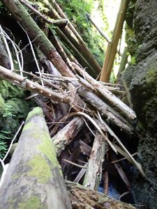
Just ahead, a monster logjam of pickup-sticks fills the canyon. In 2024, getting through required some delicate balance work, scooching over logs, and two nuisance rappels to get out. (Possible 15ft jump out of the jam.) Use extreme caution as it's likely the jam gets re-arranged every year. Getting through this obstacle may be the most dangerous part of the canyon.
Bypass: If anxiety-inducing logjams are not your thing, we discovered in 2025 that it's relatively easy to scramble up a narrow rocky ridge immediately DCR of the jam. It flattens out on top. Walk downstream along the canyon rim about 100 yards, and rappel back in (from convenient tree; ~45ft dirty rappel) downstream of the jam. This bypass is likely faster and safer than scrambling through.
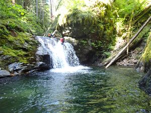
- J2: 25ft. (Must jump out ~5ft to avoid lip.) Or rappel from single bolt DCR.
- R7: 35ft from log DCL. (Previously, there was an anchor allowing you to run the flow, but this proved to be a bad line as rappellers wenter a deep hanging pothole with the full force of the creek coming down on top of them. This could be a deadly trap in high flow.)
Exit[edit]
After the last plunge pool, continue walking down the creek, you will pass a nice waterfall DCR. The canyon starts to open and the creek gets shallow and gravel-bottomed (possibly disappearing completely). Follow the creekbed south until it passes near a mini-saddle DCL. This might be a good place to change out of your wetsuit. Look carefully for elk trails climbing up and over the saddle, then cross an overgrown meadow/swamping area on the far side, following along it's left edge through grassy terrain. The swamp can be pretty thick thrashing, but goes relatively quickly. Beyond, hike up through the forest to eventually reach the Trail of Two Forests trailhead. Most of the hiking is atop an old lava flow which has minimal, low-growing brush. Taking a slight southerly detour makes for easier walking. Total distance is around 2mi, 600ft gain.
- It may be a good idea tank up on water (i.e., to drink on the hike out) immediately after the final rappel.
- Use caution in the lava field as there are a number of open vertical shafts (old tree casts) here and there. Falling into one would probably not go well. Running around after dark not recommended.
Red tape[edit]
- The Trail of Two Forests trailhead requires a NW Forest Pass.
- You will pass the booth for the Ape Cave parking area. If open, they will ask you if you have a reservation. Tell them you are going up the forest road to take pictures of the waterfalls on Cougar Creek. (Ape Cave is extremely popular and has timed entry permits to reduce crowding.)
- FR 8303 has a gate just past the Trail of Two Forests that is closed in winter.
Beta sites[edit]
Trip reports and media[edit]
Background[edit]
Scouted by Eric Jorgenson on June 10, 2023. First descent by Eric Jorgenson, Amy Kolor and Lauren Kenyon on July 3, 2023.
