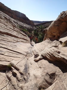
Crescent Canyon
| Rating: | |||||||||||||||||||||||||||||||
|---|---|---|---|---|---|---|---|---|---|---|---|---|---|---|---|---|---|---|---|---|---|---|---|---|---|---|---|---|---|---|---|
| | Difficulty:3A I (v2a1 II) Raps:2, max ↨25ft
Red Tape:No permit required Shuttle:None Vehicle:High Clearance Rock type:sandstone | ||||||||||||||||||||||||||||||
| Start: | |||||||||||||||||||||||||||||||
| Parking: | |||||||||||||||||||||||||||||||
| Condition Reports: | |||||||||||||||||||||||||||||||
| Best season: | Apr-May; Sep-Nov
|
||||||||||||||||||||||||||||||
| Regions: | |||||||||||||||||||||||||||||||
Introduction[edit]
The reef in the Northern Swell forms short, east-facing, wide canyons with potholes.
Individually these canyons aren't headliners, but together they can make a fun practice destination and several can be descended in a day.
Getting There[edit]
Drive to TH:
Option 1: From the exit on I-70 for Highway 24, head north on County Rd 1029 (S. Four Corners Mine Rd) up Buckmaster Draw for 4.8 miles. After a curve to the east, continue north on CR 1032 (South Buckmaster Rd) for 2.4 miles to the Junction of South Buckmaster Rd, North Buckmaster Rd and Smith Camp Rd.
Option 2: From I-70, drive north on US Hwy 6/191 for 4.7 miles and exit West onto County Road 1080 (Smith Camp/North Buckmaster Rd) for 2.25 miles to the same Junction.
From the Junction, drive north on CR 1030 (Smith Camp Rd) for 4.3 miles to the junction with Smith Cabin Tidwell Draw Rd and Cottonwood Wash.
Crescent Canyon is 1.5 miles south on Smith Cabin Tidwell Draw Rd. The road is good for the first 0.9 miles, then gets a little rougher, probably requiring 4WD/HC for the next 0.6 miles.
Turn off to the west at a vertical signpost indicated a dead end spur to park 1000' from Smith Cabin Tidwell Draw Rd.
Approach[edit]
On foot:
Depart to the south and hike west up a shallow drainage north of Crescent Canyon. Remnants of an old sandstone rock house is by the spring close to the parking.
Up canyon is a little narrows, which can be optionally upclimbed. Crest the ridge to the southwest, descend a small tributary and enter the upper portion of Crescent Canyon, beginning the descent. A GPS is helpful.
Descent[edit]
Trees are set back from the pour overs in this region and, as a result, seems to present good opportunities to fiddlestick from a webbing anchor with a rapide to get the anchor point away from brushy vegetation, but still benefit from the fiddlestick reducing rope grooves and pull rope friction.
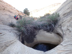
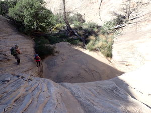
About 9 potholes can be seen on satellite imagery. All but the last two can be walked around, although a longer day could be had setting up rappels to practice.
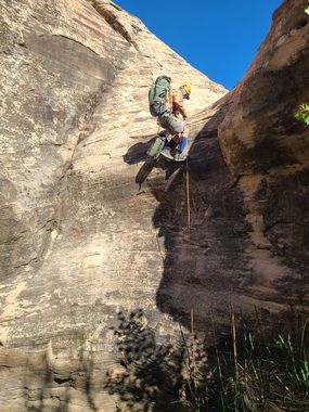
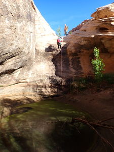
R1: 45' from a tree in canyon center for a shorter drop
R2: 105' rope from a tree in canyon center for a 20' drop
Exit[edit]
Hike downstream in the drainage, then head north to the cars.
