Crystal Canyon
| Rating: | |||||||||||||||||||||||||||||||
|---|---|---|---|---|---|---|---|---|---|---|---|---|---|---|---|---|---|---|---|---|---|---|---|---|---|---|---|---|---|---|---|
| | Raps:2, max ↨40ft
Red Tape:Closed to entry Shuttle:None Vehicle:Passenger | ||||||||||||||||||||||||||||||
| Location: | |||||||||||||||||||||||||||||||
| Condition Reports: | 11 Apr 2021
"Started from "4wd" parking. 4wd not necessarily, high clearance all that is needed. Did not take petroglyphs route, but one in team went most of way u |
||||||||||||||||||||||||||||||
| Best season: | spring or fall
|
||||||||||||||||||||||||||||||
| Regions: | |||||||||||||||||||||||||||||||
Introduction[edit]
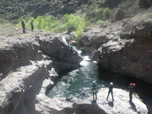
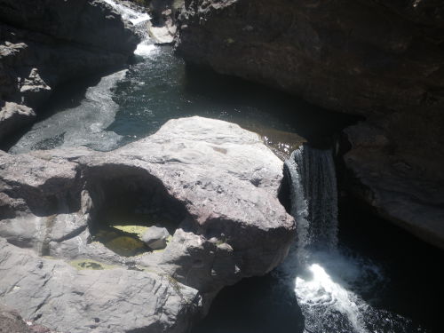
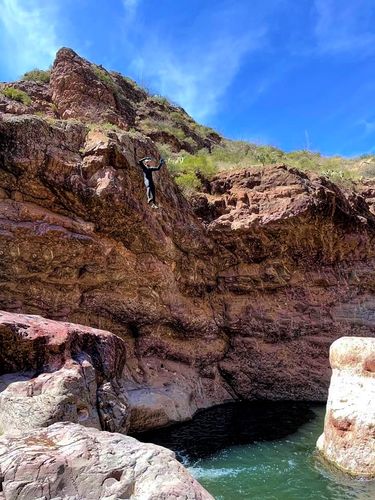
Tucked in the middle of a flat and unforgiving stretch of Arizona desert is this hidden gem of a waterpark that offers some of the best Class C in the state. Crystal Canyon is a short set of waterfalls in the narrows of the San Carlos River, which has some of the highest perennial waterflow in Arizona. Although short, the technical section offers memorable jumps into deep plunge pools and two challenging rappels in big water. The canyon is very scenic, with undulating basalt walls that morph in color from red to black to brown. Crystal Canyon is named after the abundant white crystal laced throughout the bedrock.
Approach[edit]
From the town of Peridot, drive east on AZ-70 for 5 miles then turn left onto Indian Route 8, which is also signed for Point of Pines. After 8 miles, turn left onto Triplets Road and an immediate right onto another well-graded dirt road. When the road ends after 0.8 miles, turn right onto Warm Springs Road.
If you have 2WD without high clearance, continue down Warm Springs Road for 6.4 miles to the 2WD parking at 33.420433, -110.228653 near an old water tank. Hike west/northwest through an impressive staghorn cholla forest for 2.2 miles to the major break in the cliffs for the Break Approach or 2.5 miles to the petroglyph for the Petroglyph Route. Be mindful that the overland hike to reach the canyon rim travels through open, shadeless desert and there is no trail to guide you - this route would not be fun (read: safe) in the heat of summer.
If you have 4WD with high clearance, continue down Warm Springs Road for 5.0 miles until you reach a cattle guard and barbed wire fence at 33.40764, -110.24527 with a faint dirt road that parallels the near side of the fence. Turn left onto the faint dirt road and follow it for 2.2 miles to the 4WD HC parking at 33.43344, -110.25788 near the canyon rim. As of 4/10/21, the 4WD HC road is passable with 2WD if you have high clearance.
The dirt roads in this area may be impassable when wet or after recent rains.
Break Route
From the 4WD HC parking, hike towards an obvious break in the cliff at 33.434580, -110.256821 (4,208 ft elevation). Scramble down an easy-to-follow boulder field to the bottom of the drainage and the San Carlos River.
Petroglyph Route
From the 4WD HC parking, hike west/northwest along the rim towards the petroglyph at 33.43500, -110.26050 (4,050 ft elevation). There are a few cairns leading the way down a faint use trail through brush on talus. Before getting all the way down to the river, start sliding left around 33.43550, -110.26131. You are aiming for a large v-shaped cottonwood. There is a beautiful pool and small cirque of falls about 200 feet upriver.
Continue downcanyon roughly 1.3 miles (from the Break Route) or 1.0 mile (from the Petroglyph Route) through brush and boulders to reach the falls. The going is fairly tedious and there is no trail. The technical section begins at 33.44120, -110.27090 (3,720 ft elevation).
The entry/exit routes to and from the canyon rim are difficult to find without GPS, which is highly recommended.
Descent[edit]
All of these features are optional and do not have to be descended. You may walk around everything along the RDC canyon rim. However, if you descend R1, you are committed to descending R2.
- Slide: 10 feet vertical drop over 60 feet horizontal distance
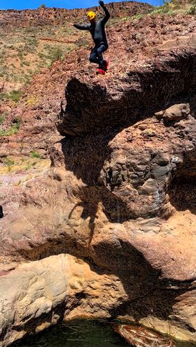
- Jump 1: 20 feet, RDC of slide. Check the bottom carefully as there are boulders if you jump too far to the right.
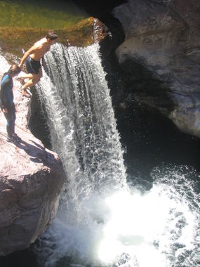
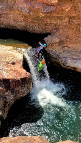
- Jump 2: 12 feet, RDC of undercut waterfall into a deep plunge pool (banner picture)
- Jump 3: 35 feet, RDC off ledge high above Jump 2 into a deep plunge pool
- Jump 4: 45 feet, LDC off slightly sloped ledge into deep pool below waterfall (be wary of knocking loose rocks down on the approach to the lip)
Exit 10 yards downstream of the plunge pool on RDC to repeat slide and jumps. The technical section starts immediately after the waterpark. The technical section is not recommended for beginners to Class C without at least two competent and experienced swiftwater leaders.
- R1: 40 feet off LDC boulder pinch into a deep pool with potential hydraulic in higher water. Set the rope for the first person at water level to avoid getting stuck on rope in the hydraulic. Once in the pool, swim LDC to get atop a small rock outcropping with a single bolt to set up a retrievable handline.
From the pool below R1, all of the water in the San Carlos River funnels into a narrow, 3-foot wide slot at the top of R2. Swim the pool to the R2 anchor, taking care to avoid getting pulled into the pourover at the drop. The first person will need to approach the drop and hook their safety line into a bolt set 3-4 feet above the water surface while the current is pushing them towards the pourover. There are some slippery underwater ledges to assist. In higher water, you may wish to set up a belay for the first person to reach the R2 anchor. Setting up a retrievable handline for the rest of the group is recommended.
- R2: 25 feet off RDC single bolt. The fall line from the anchor will drop you along the RDC edge of the waterflow onto boulders. Stay out of the boil and instead use the RDC ledge to walk off. As of 4/10/21, the single bolt anchor had a highly corroded bolt and spinning hanger.
Exit[edit]
Scramble down to the pool after R2 and swim out 40 yards. Exit the pool RDC and hike up a steep slope formed by rockfall. Traverse a faint trail back to the first anchor. Hike out the way you came.
Red tape[edit]
4/21/21... San Carlos Apache tribal police are now issuing citations for canyoning on the reservation. Per law enforcement officer, all rock climbing and rappelling is illegal. Best to avoid this canyon at this time. Hiking is still allowed with permits.
Crystal Canyon is located on the San Carlos Apache Indian Reservation and requires a recreation permit. As of 2/24/21, recreation is open to non-tribal members. Permits cost $10 per person per day and can be obtained at the San Carlos Recreation & Wildlife Office at Highway 70, Old Moonbase Road, Peridot, AZ 85550 or at the Cutter Quick Stop at 777 Geronimo Springs Blvd, San Carlos, AZ 85550. If you plan to camp on tribal land before or after running Crystal, you will need to extend your permit to two days at a total cost of $20 per person. Permits must be picked up in person as they are issued individually and require a photo ID and signature.
Prior to the pandemic, recreation permits used to be available at the Circle K located at 2011 E Ash St, Globe, AZ 85501. The Circle K is currently not issuing permits but this information has been left here in case they resume in the future.
Beta sites[edit]
 Chris Brennen's Adventure Hikes (Southwest) : Crystal Canyon
 HikeArizona.com : Crystal Canyon
 Super Amazing Map : Crystal Canyon
 ZionCanyoneering.com : Crystal Canyon
