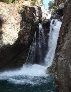
Crystal River (Marble)
| Rating: | |||||||||||||||||||||||||||||||
|---|---|---|---|---|---|---|---|---|---|---|---|---|---|---|---|---|---|---|---|---|---|---|---|---|---|---|---|---|---|---|---|
| | Raps:4, max ↨60ft
Red Tape:No permit required Shuttle:None Vehicle:Passenger Rock type:Limestone | ||||||||||||||||||||||||||||||
| Location: | |||||||||||||||||||||||||||||||
| Condition Reports: | 29 Sep 2020
"Ran this at about 57cfs. We both thought it could easily be done at about 70+cfs by the competent with no issues. Crossing the pool at the "guided rap |
||||||||||||||||||||||||||||||
| Best season: | Sep-Oct in drought years and NOT after rain
|
||||||||||||||||||||||||||||||
| Regions: | |||||||||||||||||||||||||||||||
Introduction[edit]
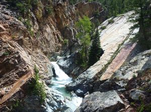
The Crystal River near Marble, Colorado cuts a very pretty short limestone gorge with more water than most canyoning adventures in the state. This has been a kayak descent of notable fame that few attempt.
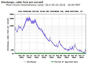
In normal years, the Crystal River can run at over 2000 cubic feet per second (cfs) during the spring melt.
In drought years, it can drop to as little as 50cfs. Due to hazards of potential siphons particularly in the upper gorge narrows, advanced techniques, and knowledge of the hydraulics within, it is advised not to attempt a descent unless the stream gauge of Crystal River above Avalanche Creek near Redstone, CO reads 50cfs or less.
http://waterdata.usgs.gov/co/nwis/uv/?site_no=09081600&PARAmeter_cd=00065,00060
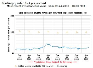
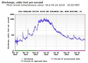
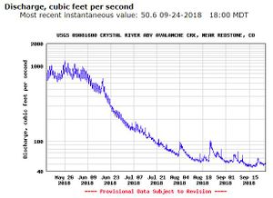
50CFS gauge data looks like this in 2018, a drought year with much below average snow pack:
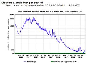
Compare 2018 drought year data with low snow pack over the 2017/2018 winter to the preceding non-drought years of 2017 and 2016 with more normal snow pack levels and rainfall. Note both the reduction in cfs over the whole season as the high country (14ers shared by the range with Aspen) and large catchment melts off through the season as well as the spikes from summer monsoon rainstorms.
Approach[edit]
Marble is a town with a 2016 population of only 136. Much of the area around the Crystal River is privately owned. Please be considerate of both locals, their private land, and especially during the autumn season during fall colors when the Crystal River will be lowest: photographers, hikers, and 4x4 jeeps hiking or driving to see the iconic Crystal Mill 3.5 miles from the parking lot at the bottom of Daniels Hill as well as hunters.
Following signs for the Crystal Mill, drive East through Marble, pass the recommended BBQ restaurant and Beaver Lake and park in one of many spaces if available before the road gets rougher, turns left and goes uphill. If these spaces are full, proceed up the hill and park in the first available roadside space.
The trail starts from the back of the emergency vehicle turnaround at the bottom of the hill.
Proceed through a field on a well-worn trail. Duck what remains of a barbed wire fence. Turn left at a sitting bench with a marble footrest. Descend left downhill to a crossing of a tributary stream on a makeshift bridge and then descend to the confluence of this tributary with the Crystal River on tributary stream left. Game trails will take you shortly to the river itself.
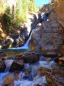
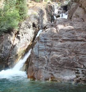
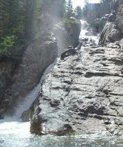
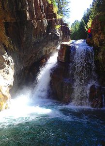
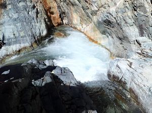
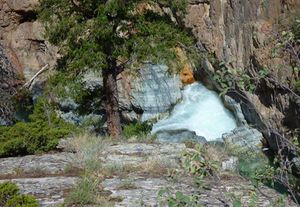
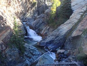
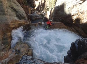
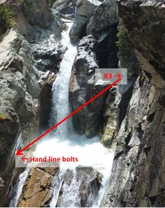
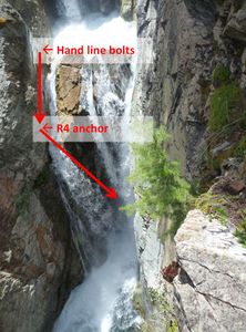
Check the final series of waterfalls by walking upstream a short distance from the confluence. Note the differences in the R3 and R4 pour overs at different cfs levels in the upper right of each photo.
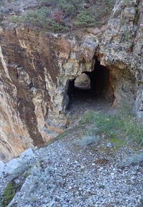
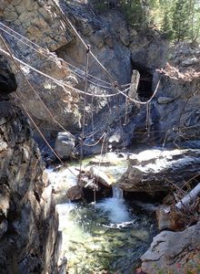
Hike to the start of the route by crossing the Crystal River and following worn game trails up Canyon Left (Right Upstream) until game trails lead to slabs which lead to an old mine cart trail paralleling the river. Walk through a mine tunnel. Enter the creek at a washed out gully. If you continue on the trail upstream a short distance the remnants of an old mining bridge still remain.
On the approach, peer into the river to gauge water level and obstacles.
Descent[edit]
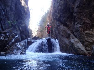
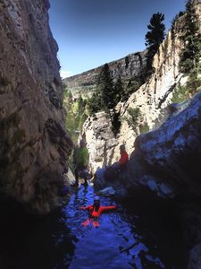
Entering at the washed out gully, R1 is almost immediate. The narrow steep gorge that follows is full of small siphons, walking, swimming and at least one jump (check depth first). At water flow higher than 50cfs, the siphons in this unassuming gorge could still present danger.
R1: 45ft bolts CL
R2: 35ft bolts CL
When the narrow straight gorge after R1 turns sharply to the left, avoid the eddies in that pool above R2 by staying on canyon left and climbing up to find R2 bolts not much higher on the slab Canyon Left.
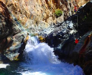
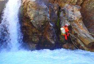
Rappel to the bottom of the falls and swim across the aerated swift flow to the rocks on the opposite side canyon right. At 50cfs the flow pushes, but is manageable. The pool at the bottom is deep, but check it first before considering jumping.
After R2, climb the large boulders on canyon left until you look down into a still water pothole below. Rappel into the pothole from natural anchors or down climb into the back of the pothole through a narrow squeeze starting more toward canyon center.
R3: 50ft guide rappel from bolts CL at the lip of the pothole. Rappel from the lip of the pothole into the pool below avoiding the chute on canyon left by swimming quickly across the flow to get to the next hand line bolts on CR. Know and understand the proper technique to accomplish this before practicing it in this location the first time.
Set a guide rappel from the pothole bolts CL to the hand line bolts CR for the rest of the team.
Handline bolts CR: Set a retrievable 20ft hand/safety line to access R4 on canyon right.
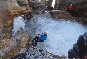
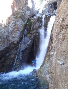
R4: 60ft bolts CR
Rappel to the bottom of the falls. Pull and restack the rope at this location to contain the cordage for the swim. Jump and swim hard through the current of the falls, ride the eddy line to the Canyon Left corner and climb out of the pool avoiding the narrow chute pour off on canyon right. The water flow on canyon right is still quite powerful at 50cfs in this narrow final chute. Down climb canyon left and walk the stream back to the confluence with the tributary.
Exit[edit]
Down climb the final ramp on canyon left avoiding the chute on canyon right. At the confluence with the tributary from the right (down canyon), return on the trails you entered on back to the car.
Red tape[edit]
Beta sites[edit]
This route is known to the swift water community as one of the most challenging in the State of Colorado. Kayakers run Crystal River from upstream of Lizard Lake to the take out at Beaver Lake. They also check the cfs with the same Crystal River above Avalanche Creek gauge and run it at 200cfs (low) to 400cfs (high) with 550cfs being survival mode. The hardest section to run is below R2 in this beta and kayakers may take out in the boulders above the pothole depending on conditions.
Trip reports and media[edit]
Sept 2018: Descended top to bottom by Clint Poole, Andrew Humphreys, Tyler Duffett, and Ira Lewis; originally scouted by Charly Oliver. Previously descended to R3.

