Cypress Creek
| Rating: | |||||||||||||||||||||||||||||||
|---|---|---|---|---|---|---|---|---|---|---|---|---|---|---|---|---|---|---|---|---|---|---|---|---|---|---|---|---|---|---|---|
| | Raps:4, max ↨98ft
Red Tape: Shuttle: Vehicle:Passenger | ||||||||||||||||||||||||||||||
| Location: | |||||||||||||||||||||||||||||||
| Condition Reports: | 28 Sep 2025
"Awesome time in the canyon with a little extra juice. Canyon has been cleaned out a bit so it looks lovely. Rap 2 entrance log has moved to DCR and th |
||||||||||||||||||||||||||||||
| Best season: | Aug-Oct
|
||||||||||||||||||||||||||||||
| Regions: | |||||||||||||||||||||||||||||||
Introduction[edit]
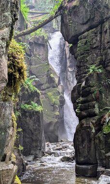
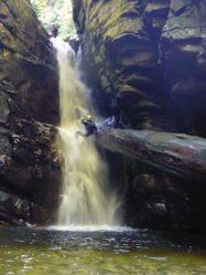
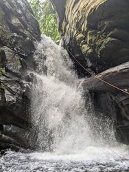
A short but spectacular canyon in the vicinity of Vancouver. The canyon is narrow and dark in most spots and all rappels are swimmers, so wetsuits are recommended even in summer. The water is also quite cold. The rappels are all bolted with chained dual bolts. This canyon is very good for beginners, but they must have dry rappelling experience because all rappels will be in the flow.
The first rappel is a good checkpoint for water flow. All the other rappels will be more difficult. <- For some. in 2024 we found that rap 1 was the most difficult by far.
Approach[edit]
Walk up the trail from the parking lot going upstream. You will pass a view of R4, and just upstream of that will cross a bridge over the drainage. Continue uphill on the other bank (DCL) and you will reach a chainlink fence followed shortly after by a paved road. Go left up the road passing a power substation, and as the road crests and starts to go back downhill, you will see on your right a heavily used path next to a power pole that goes into the woods. Go up this. If you reach the bridge on the road, you are standing over R2 and have gone too far. Up the footpath, in about 200m, a lesser used but still obvious trail will split off to the left, as the main trail starts a number of switchbacks up the steep hillside in front of you. Take the path to the left for another couple hundred meters, and you will reach a ridge with the final part of the trail dropping down to the right with a few rope handlines. Go down this to the watercourse and suit up at the top of R1.
Descent[edit]
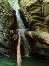
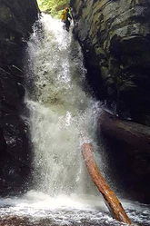
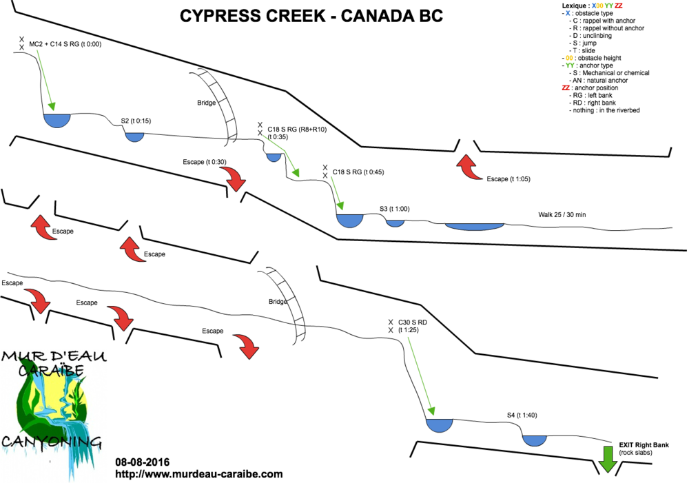
Four rappels of up to 100ft, all of them with swimmer pools at the bottom. Other minor drops can be jumped.
- R1: DCL 40ft. There is a bolt installed for an optional traverse line to access the rappel anchors. There was once a fixed webbing traverse line here. Setting a retrievable traverse line will keep the anchors looking cleaner.
- R2: DCL 70ft in two stages. There is a set of bolts at the top of stage 2 installed to rappel out of the flow at high levels. At moderate to low flows, these can be skipped and the rappel can easily be done in a single, 2-stage rappel, with a smooth pull.
- R3: DCL 60ft. Access to this rappel has been rigged with multiple traverse line bolts DCL. As of fall 2021, the traverse line bolts can be skipped by downclimbing the log jam DCR. At the anchor, there is a pair of unlinked bolts, with a chain anchor just around the corner. The chain anchor will keep you out of the flow. The unlinked bolts provide an in-flow rappel line.
- R4: DCR 95ft rappel. The bolted anchors are DCR on the far side of the trail overlook, and the approach is exposed. A single bolt allows for safe access using a retrievable traverse line.
Exit[edit]
After R4, the canyon walls remain high and steep for a couple hundred meters. You will find a well used exit on DCR at the top of another series of non-technical pools. You can exit here, or continue down through the pools, but note that when you encounter the first residence downstream, you will have to turn around and backtrack upstream to the previous exit.
Red tape[edit]
Beta sites[edit]
 CanyoneeringNorthwest.com (archive.org) : Cypress Creek
 CanyonCollective.com : Cypress Creek
 Super Amazing Map : Cypress Creek
